Iceland Destinations Directory
Discover 254 hand-curated places across Iceland. From majestic waterfalls and steaming hot springs to remote volcanic craters and hiking trails, explore detailed information to plan your perfect itinerary.
Jump to Region
Golden Circle
14 placesIceland's most famous sightseeing route, featuring geothermal geysers, the roaring Gullfoss waterfall, and Thingvellir National Park.
 💧Waterfall
Brúarfoss
The color of Brúarfoss stops people: the water runs a vivid, saturated blue that looks almost artificial. The shade comes from fine glacial silt suspended in the flow — the river traces back to Langjökull glacier, and the ground-up rock powder scatters light toward an intense turquoise. The effect is strongest on overcast days and in the narrower chutes above the main drop where depth concentrates the color. Getting here is simple since a purpose-built car park opened on Road 37 in spring 2023, between Laugarvatn and Geysir. From the car park it's a few minutes' walk to the falls. The old route crossed private farmland and is now closed to the public; use the official car park. There is a 750 ISK parking fee. The trail closes in winter; a 4x4 is advisable outside summer months. Brúarfoss is about 95 kilometers east of Reykjavík and roughly 15 kilometers from Geysir, making it an easy addition to a Golden Circle day. Keep well back from the river's edge — the current is fast, the banks can be slippery, and the water is dangerously cold.
Read details →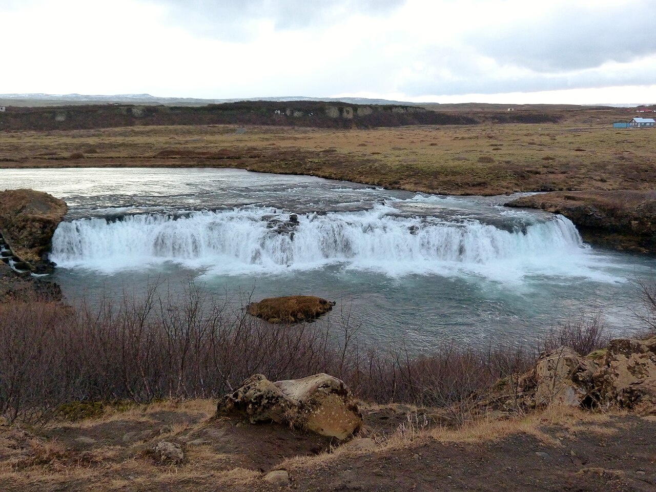 💧Waterfall
Faxifoss
Faxifoss — also called Faxi or Vatnsleysufoss — spreads about 80 meters across the Tungufljót river and drops roughly 7 meters over a single broad basalt ledge, producing a wide rolling curtain rather than the tall plunge falls most people associate with Iceland. It sits just off Route 35 about 12 km south of Geysir, with a short flat walk from the parking area to the riverbank. Most Golden Circle itineraries skip it entirely, which means you often have the place to yourself. The practical draw is the fish ladder built into the right bank. During summer, Atlantic salmon and sea trout working upstream are visible from the viewing area — one of the more accessible spots in Iceland to watch live salmon migration without permits or queues. The stop fits naturally into a Golden Circle day: drive south from Geysir, look for the signed turn off Route 35, and budget 20–30 minutes. There is a small parking area, no entry fee, and the ground is easy underfoot. The width of the falls is genuinely striking up close in a way that is hard to appreciate at distance.
Read details → 🏘️Town
Flúðir
Flúðir is a small farming village where geothermal energy is put to practical use at an unexpected scale. The Flúðasveppir mushroom farm here — the only commercial mushroom operation in Iceland — produces around 11 tonnes of button, chestnut, and portobello mushrooms per week using geothermal-heated greenhouses, and offers farm tours that show how Iceland harnesses underground heat for year-round food production. The village's main draw is the Secret Lagoon (Gamla Laugin), built in 1891 and considered Iceland's oldest swimming pool. It sits in the geothermal area of Hverahólmi just outside the village, where small geysers puff and hot springs bubble around the pool's edge. The setting feels far more natural and low-key than the larger spa complexes elsewhere on the Golden Circle. Flúðir sits just off the Golden Circle route, roughly 90 minutes from Reykjavík, and is quieter than Geysir or Gullfoss — a reasonable overnight base or lunch stop. Hrunalaug, a small natural hot spring on private farmland, is also a short detour from here.
Read details → 💨Geyser
Geysir
Every geyser in the world takes its name from this one. The Icelandic verb geysa — to rush forward — gave Geysir its name, and written records of eruptions here date to 1294. At its most active the Great Geysir reached 70 to 80 meters, and after earthquakes in 2000 it briefly shot to 122 meters before quieting again. Its last known eruption was in 2016, and it has been dormant since. The reason most visitors still come is Strokkur, which erupts every five to ten minutes to around 15–30 meters. Watching the distinctive blue bubble form and explode at the surface remains genuinely impressive. The wider Haukadalur geothermal field includes colourful hot springs, fumaroles, and bubbling mud pots worth a slow walk around. The Geysir area sits at the centre of the Golden Circle, roughly 100 kilometres east of Reykjavík on Route 35. Parking and access to the geothermal field are free, and the large visitor centre has a restaurant and gift shop. Budget 45 minutes to an hour to catch several Strokkur eruptions and walk the field — it is one of the busiest stops in Iceland, so arriving early or late in the day helps.
Read details →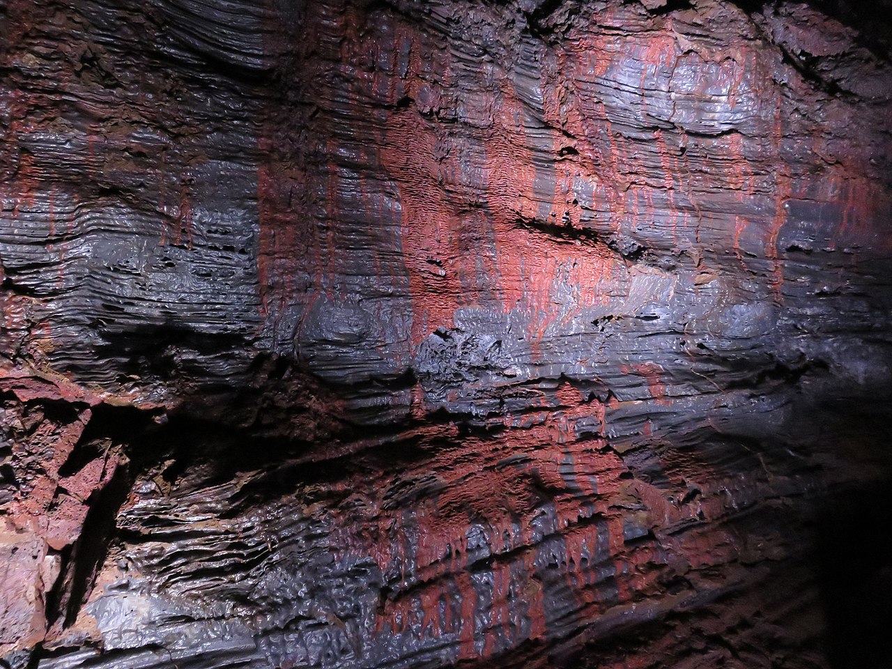 🕳️Cave
Gjábakkahellir Lava Tube
GjábakkahellirAbout 40 kilometers from Reykjavík near Þingvellir, Gjábakkahellir is a 360-meter lava tube formed around 9,000 years ago that you can explore without a guide — a rarity among Iceland's lava caves. Entry is free and self-paced. The tube has openings at both ends, so you walk straight through rather than doubling back. Inside you'll find shark-tooth lava stalactites, colored mineral deposits on the walls, and in winter, ice formations on the floor. The entrance requires a crawl through a narrow low opening; once inside, the passage opens up enough to walk upright in most sections. A good headlamp is essential — not just a phone torch — as is warm layering, since cave temperatures stay near freezing year-round. Wear sturdy waterproof boots because the floor can be slick with ice or moisture. The cave sits off a gravel road and makes a straightforward half-hour detour from Þingvellir or en route between Þingvellir and Geysir. There is no formal car park or signage, so the coordinates here are the practical way to find the pull-off. Budget around 45 minutes for a relaxed walk-through.
Read details → 💧Waterfall
Gullfoss
The Hvítá river drops at Gullfoss in two stages — 11 metres, then 21 metres — and the second plunges into a narrow crevice at a near-right angle to the first, making the river appear to vanish into the earth. The Hvítárgljúfur canyon around it reaches up to 70 metres deep. On sunny days spray carries a rainbow almost continuously; in winter ice formations build up around the still-flowing core. Gullfoss is fed by Langjökull, Iceland's second-largest glacier, with roughly 140 cubic metres passing over every second in summer. Two paths give different angles — the upper one offers the overview used in most photographs, the lower path descends toward the crevice rim and gets you wet. Sigríður Tómasdóttir, daughter of a local farmer, campaigned in the early 20th century against plans to sell the falls for hydroelectric development; her memorial stands at the site. Gullfoss became a conservation area in 1979. The car park has a café and gift shop. The falls are on Route 35 about 120 kilometres east of Reykjavík, roughly two hours by road, and are free and open year-round.
Read details → 💨Geyser
Haukadalur Valley
HaukadalurStrokkur is the real show here — every five to ten minutes it builds a blue dome of water, then throws a column roughly 20 meters into the air before collapsing back into the vent. The Great Geysir, which gave the world the word "geyser," sits nearby but is mostly dormant now. The whole valley entered the historical record in 1294 when earthquakes created new hot springs across the area. Beyond the two famous features, the valley has boardwalk paths linking bubbling mud pots, fumaroles, and colour-stained spring pools. The 3-square-kilometre geothermal field is free to enter and open year-round. Stay firmly on the marked paths; the crust around hot springs can be thin and the water beneath is boiling. Haukadalur sits about 90 minutes from Reykjavík on Route 36, and is almost always paired with Þingvellir and Gullfoss as the classic Golden Circle day trip. The on-site Geysir Center has a café, restaurant, hotel, and a geothermal exhibition. Strokkur erupts reliably day and night, so an early morning or evening visit beats the midday coach traffic.
Read details → ♨️Hot Spring
Hrunalaug
Hrunalaug is a small geothermal pool on private farmland a few kilometers north of Flúðir, comprising three separate pools fed by natural hot springs. The oldest section dates to around 1890, built for laundry and bathing; a second pool from 1935 once served for sheep washing. The current visitor pool was added in 2017 and renovated in 2023. Water temperature holds at around 37–38°C year-round, and the pools are small — the larger one fits roughly seven people comfortably — so come early or late in the day to avoid sharing with a crowd. Admission runs around 3,000 ISK per adult. Two small changing huts are on site, but there are no showers or lockers, and facilities are deliberately rustic. A service building near parking has toilets. The access road from Flúðir is short and manageable in a standard car — follow signs to the farm Ás. The pool is open year-round. Winter and early spring visits are particularly good, when steam rises off the water against cold air and the site is far less busy than in summer.
Read details → 🌋Volcano
Kerið Crater
KeriðKerið's walls drop sharply — about 55 meters from rim to water — and the contrast between the dark red volcanic rock and the opaque turquoise lake at the bottom is one of the more striking natural scenes on the Golden Circle. The crater measures roughly 270 meters long and 170 meters wide: large enough to impress, small enough to walk around in 20 minutes. A well-maintained path circles the rim, and a separate trail descends to the lakeshore. Unlike many crater lakes that fill from rainfall, Kerið's lake likely sits at the natural water table level. The crater is around 6,500 years old — geologically young by Icelandic standards. Björk once performed a concert on a floating platform on the lake, a detail that tells you something about both the acoustics and the Icelanders. Kerið sits on Route 35, about 15 km north of Selfoss, and fits neatly into a Golden Circle day without backtracking. There is a small entrance fee, free parking, and basic facilities on site. Afternoon light tends to bring out the red of the crater walls best.
Read details → ♨️Hot Spring
Laugarvatn Fontana
Rye bread baked underground in hot sand is the thing most visitors remember about Laugarvatn Fontana — bakers bury sealed pots of rye dough about 30 cm deep in 100°C volcanic sand, where it bakes for 24 hours, and the demo ends with warm slices beside the lake. The spa sits on the shore of Lake Laugarvatn, about an hour and a quarter from Reykjavík on the Golden Circle, and that lakeside position is what separates it from most Icelandic thermal pools. The contrast between hot baths and a quick swim in the cold lake is genuinely bracing. The facility has three steam rooms built over separate geothermal vents, three outdoor mineral pools, and a Finnish sauna. The steam rooms sit nearly at ground level and have a raw, damp quality that more polished spas have engineered away. Plan for at least two hours; advance booking in summer is strongly recommended. The original bathing facility dates to 1929 and the current building opened in 2011; the baths were then closed for a major renovation through late 2025 and reopened in mid-2026 with expanded pools and a new panoramic sauna. Bread-baking demos run daily year-round (typically 11:45 and 14:30, with an extra morning slot in summer). Check fontana.is for current hours before visiting.
Read details →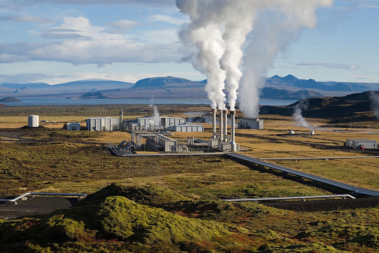 👀Viewpoint
Nesjavellir Geothermal Plant
NesjavellirNesjavellir sits on the Hengill volcanic system about an hour's drive from Reykjavík via Route 435 and produces around 120 MW of electricity plus enough hot water to supply a large share of the capital's heating. The plant went into operation in 1990 after exploratory drilling began in the 1960s, and the infrastructure — insulated pipes, steam columns, turbine halls — makes a dramatic impression against the raw geothermal landscape. The plant itself is not open for public tours, but the surrounding Hengill area has good hiking. A marked loop of around 8.5 kilometres passes mossy lava fields, active fumaroles, and steaming vents with views over Lake Þingvallavatn, plus close views of the plant's pipework from the hillside above. The Hellisheiði power station about 11 kilometres away operates a public visitor centre if you want an indoor geothermal exhibit. No admission is charged to walk the area. The road from Þingvellir along the lakeshore is scenic and paved. Access is best June through August — winter snow can close higher ground.
Read details → ♨️Hot Spring
Secret Lagoon
Gamla LauginGamla Laugin — Old Lagoon — has been a bathing spot since 1891, making it the oldest swimming pool location in Iceland. The country's first organized swimming lessons were held here in 1909 and continued annually until 1947, after which the site fell into disuse for decades. It reopened as the Secret Lagoon in 2014. The pool runs entirely on geothermal water from the surrounding hot spring field, holding a steady 38–40°C year-round. The atmosphere is noticeably less polished than places like Sky Lagoon — rough stone edges, wild grass, steam venting from the ground, and a small active geyser (Litli Geysir) that erupts every few minutes beside the pool. Facilities include changing rooms and a small bistro. It is particularly atmospheric on cold days when steam is dense. Flúðir sits just off Route 30, about 20 minutes from Geysir and Gullfoss, squarely on the Golden Circle route. It works well as a late-afternoon stop after the main sites. Advance booking is recommended in summer as capacity is limited.
Read details → 🏛️Historic Site
Þingvellir National Park
ÞingvellirIn 930 AD, Icelandic chieftains chose this rift valley, about 48 kilometers east of Reykjavík, as the seat of the Alþingi — one of the world's oldest parliaments. They gathered here annually for nearly nine centuries, reading laws aloud from Lögberg, the Law Rock. Iceland adopted Christianity here in the year 1000, and declared the republic at Þingvellir on June 17, 1944. The park sits where the North American and Eurasian tectonic plates diverge at roughly 2 centimeters per year. Walking through Almannagjá you move between continental plates along a crack that grows measurably wider each decade. The Silfra fissure, filled with glacial meltwater, offers visibility exceeding 100 meters and is a premier cold-water dive and snorkel site. Þingvallavatn, at 84 square kilometers, is Iceland's largest natural lake. Þingvellir is a UNESCO World Heritage Site and the busiest stop on the Golden Circle. Entry to the park is free, though parking fees apply. Come early morning or late evening to have the main sites to yourself.
Read details →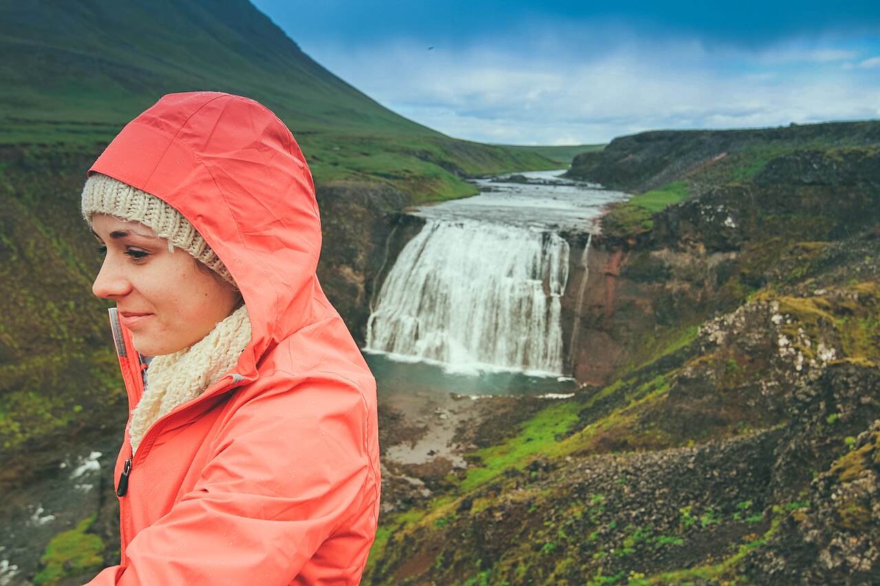 💧Waterfall
Þórufoss
Þórufoss drops about 18 meters on the Laxá í Kjós river, a salmon river in the hills west of Þingvellir — close enough to the Golden Circle to work as a quick detour, but off the radar enough that the small gravel pullout is rarely crowded. The falls are wide rather than tall, and in summer a fringe of green vegetation lines both banks. In cold winters the cascade can freeze entirely, which makes for a different kind of visit. The waterfall appeared in Game of Thrones: Season 4 used it as a location, and it also stood in for the home of the Children of the Forest in later episodes. That connection brings some visitors deliberately, but the site still sees far less traffic than anything on the main Golden Circle circuit. To reach it, leave Route 1 at Mosfellsbær onto Route 36, then turn onto Route 48 and continue about 5.6 km to a small roadside sign. The walk from the parking area to the viewpoint is five minutes across flat ground. There are no facilities on site. The road is paved to Route 36 and well-maintained gravel on Route 48; no 4x4 required.
Read details →South Coast
23 placesA breathtaking stretch of dramatic black sand beaches, iconic waterfalls like Seljalandsfoss, and massive volcanic glaciers.
 🏔️Canyon
Fjaðrárgljúfur Canyon
FjaðrárgljúfurFjaðrárgljúfur is a 2-kilometer canyon near Kirkjubæjarklaustur, cut up to 100 meters deep by the Fjaðrá river through layers of palagonite and basalt — volcanic rock formed when lava meets ice. The canyon winds rather than running straight, a rare shape for such a deep gorge, and the moss-covered walls give it a green-on-black quality that reads well in any season. From Route 1, turn onto Road 206 just west of Kirkjubæjarklaustur. A marked rim path runs the canyon's length with several viewing platforms; the full walk takes 45 to 60 minutes. A lower parking lot charges a small fee; the upper lot near the main viewpoint is free. The canyon saw a surge of visitors after appearing in Justin Bieber's 2015 video and later in Game of Thrones — the damage to the vegetation prompted formal paths and fencing. Respect any barriers. The road is paved and accessible in a standard car, about 275 kilometers from Reykjavík. It makes a natural midway stop on a Ring Road itinerary; go early in the morning in summer for the best chance of an uncrowded viewpoint.
Read details → 💧Waterfall
Gljúfrabúi
Gljúfrabúi — "canyon dweller" — hides inside a narrow slot in a basalt cliff roughly 150 meters north of Seljalandsfoss. Most people drive past without realizing it is there. To see the full 40-meter drop you wade a shallow stream into the canyon mouth, picking over wet uneven rocks until the walls close in and the falls appear ahead of you, crashing into a small pool ringed by moss. The roar fills the enclosed space. Morning light filtering through the canyon opening makes for better photography. Unlike Seljalandsfoss, fed by glacial meltwater, Gljúfrabúi flows from a spring, so its volume is fairly stable year-round. Waterproof shoes are not optional — your feet will get wet. Waterproof trousers are wise too, given the spray inside. A gap in the cliff at the canyon entrance lets you glimpse the falls from dry ground if you want to assess conditions first. The car park is shared with Seljalandsfoss off Route 1; parking costs a small fee, the falls are free. Budget 30 minutes and combine both waterfalls in the same stop.
Read details →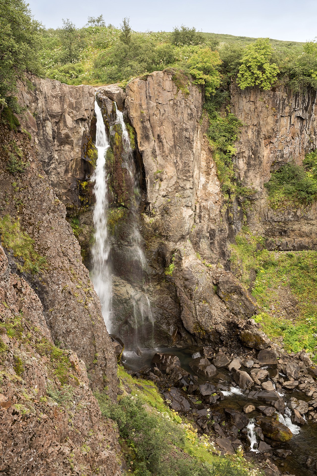 💧Waterfall
Hundafoss
Hundafoss sits roughly 3 to 4 kilometers up the Skógá river from Skógafoss, one of many cascades on the hike that climbs toward Fimmvörðuháls pass. The name means Dog Falls, reportedly from an old story of dogs swept away when the river ran high. The waterfall drops through a narrow gorge thick with moss and basalt; the enclosed canyon stays noticeably lush even in cooler months. The trail from Skógafoss is well-worn and signed, with wooden steps and bridges at key sections, but it gains elevation quickly — the steepest part comes early — and turns muddy in wet weather. Hundafoss makes a reasonable turnaround for hikers who want a moderate half-day rather than the full push to the pass. Allow at least two to three hours round trip from the Skógafoss car park. Best done June through September; outside summer, snow and ice above Skógafoss make the going significantly harder. In peak season the lower section near Skógafoss is one of South Iceland's busiest spots — start early and the crowds thin out quickly once you head upriver.
Read details → 🏘️Town
Hveragerði
Hot water comes up through the ground in Hveragerði — in the geothermal park at the edge of town, in some backyards, and beneath greenhouses that make the town a year-round producer of tomatoes, cucumbers, and flowers. The Agricultural University of Iceland is based here. A magnitude 6.3 earthquake in May 2008 reshaped the geothermal features, opening new vents; a small exhibition at the Sunnumörk shopping center documents the event. The main draw is the Reykjadalur hike, starting from a signed trailhead on the north side of town. The path climbs through steam vents and bubbling springs into a gentle valley, reaching a naturally heated river in about 40 minutes. Water temperature in the bathing area sits around 36–40°C year-round, and there is no fee to hike or bathe. Bring a dry bag and a change of clothes — there are no facilities at the river. The valley is best from May through early October. Hveragerði is about 45 km east of Reykjavík, 30–45 minutes on the Ring Road. It works as a lunch stop on a South Coast day-trip or a base for the Golden Circle. The town has cafés, a geothermal pool, and accommodation.
Read details → 🌋Volcano
Katla
Katla sits beneath the Mýrdalsjökull ice cap on Iceland's South Coast, its caldera roughly 10 kilometres across. Historically it has erupted every 40 to 80 years, yet the last major eruption was in 1918 — making the current dormancy one of the longest on record. A minor subglacial event occurred in 1999, and the Icelandic Met Office monitors the system continuously. When Katla does erupt, rapid ice melt produces enormous glacial floods capable of briefly exceeding the discharge of the Amazon, as happened in 1918. Visitors experience Katla through guided glacier walks and ice cave tours on Mýrdalsjökull. Ice caves are accessible roughly October through March when the ice is stable; glacier walks run year-round. Always check current volcanic status before going out and use only licensed guides — conditions on the glacier change quickly. The volcano's summit reaches about 1,512 metres, though the caldera is entirely buried under ice. The surrounding outwash plains bear the scars of past floods, and the black sand coast nearby gives some sense of the scale of what Katla can produce.
Read details → 🕳️Cave
Katla Ice Cave
KötluhellirKötluhellir sits inside the Kötlujökull outlet glacier, a lobe of Mýrdalsjökull (Iceland's fourth-largest ice cap) that overlies the active Katla volcano. What sets it apart from Iceland's other ice caves is its combination of colours: the walls and ceiling display deep blue glacial ice threaded with thick bands of black volcanic ash deposited by past Katla eruptions. The result is a layered geological record that looks unlike any other cave in the country. Unlike most natural ice caves in Iceland, which are only safe to enter from November to March, Kötluhellir is accessible throughout the year because geothermal heat from the volcano below moderates melting patterns and keeps the structure relatively stable. All visits require a guided super-jeep tour departing from Vík í Mýrdal. Tour operators pick up at the bus car park near the Icewear/Krónan building in Vík, then drive roughly 30–45 minutes north across black-sand plains and unbridged river crossings to the glacier edge — terrain that is impossible in a standard rental car. At the glacier, guides fit visitors with crampons, helmets, and headlamps for a 1–2 km walk across uneven ice to the cave entrance. The total excursion runs around three hours; one hour is typically spent inside the cave itself. Prices start from around 23,900 ISK per person for the standard Vík-based tour, with private and buggy options at higher cost. Minimum age is 8–12 years depending on the operator. Because this is an active volcanic zone, tours are monitored and can be cancelled on short notice due to volcanic or weather conditions. Booking in advance, especially in summer, is strongly advised. Photo: Moyan Brenn / Wikimedia Commons (CC BY 2.0)
Read details → 🕳️Cave
Loftsalahellir Cave
LoftsalahellirLoftsalahellir's real draw is the view looking back out: its wide triangular mouth frames the Dyrhólaey peninsula and Reynisfjara black sand beach, and on a clear day the lighthouse sits squarely in the opening. The cave itself is modest — a shallow chamber of soft volcanic tuff covered in moss, carved into the southwest slope of Geitafell mountain about 15 kilometers from Vík. The tuff is softer and more porous than the basalt of most Icelandic caves, giving the walls a grassy, organic texture quite different from a raw lava tube. Historically the cave served as a gathering place for farmers near Vík, and local legend holds it also sheltered outlaws. The name translates roughly as "Air Halls Cave." Getting there is a short hike of around five minutes from a small car park on Road 218, the secondary road toward Dyrhólaey off the Ring Road. The path can be muddy, so proper footwear matters. There is no charge to visit. It fits naturally into a South Coast day combining Dyrhólaey and Reynisfjara, adding no more than thirty to forty-five minutes to the itinerary.
Read details → ❄️Glacier
Mýrdalsjökull
Mýrdalsjökull covers roughly 600 square kilometers of the South Coast highlands directly above Katla, one of Iceland's most powerful volcanoes. Katla has erupted roughly every 40 to 80 years historically — last major eruption in 1918 — and when it does, meltwater surges from beneath the ice create catastrophic floods across the black sand plains below. The most accessible part is Sólheimajökull, an outlet tongue between Katla and Eyjafjallajökull that descends to the lowlands and is visibly streaked with dark ash bands from both volcanoes. Glacier walks and ice climbing tours run year-round from the Sólheimajökull parking area, reached via a short gravel road off Route 1. All glacier access requires a guided tour; solo walking on the ice is not permitted. Ice caves are accessible on guided tours typically from October through March. The glacier is about 30 km east of Vík and two and a half hours from Reykjavík. Budget around three hours for a glacier walk tour. Snowmobile and super-jeep tours on the upper icecap are also available through local operators.
Read details → ⛽Fuel Station
N1 - Vík
Vík í Mýrdal is the southernmost inhabited place on the Icelandic mainland, about 187 km southeast of Reykjavík, and the N1 here is the main service anchor for the village. Fuel pumps run around the clock via card; the attached shop is open daily with hot food and coffee, roughly morning to early evening. ATM and toilets are on-site. The station is right in the middle of the action. Reynisfjara black-sand beach — with its basalt columns and the Reynisdrangar sea stacks offshore — is a five-minute drive west. The sea there is known for unpredictable waves that have injured and killed visitors; the warning signs at the beach should be taken seriously. Mýrdalsjökull glacier sits about 20 km north with Katla volcano beneath it, an active system under ongoing monitoring. Westward from Vík, Skógafoss and Seljalandsfoss are within reasonable distance. Heading east the road grows remote quickly, with the next reliable fuel a long way off — fill up here before continuing in that direction.
Read details → 🏖️Beach
Reynisfjara Black Sand Beach
ReynisfjaraThe black sand comes from Katla's ancient lava meeting the Atlantic — basalt ground to dark, fine grains over centuries, stretching in a long arc below the sea cliffs south of Vík. The most-photographed section is Hálsanefshellir cave, formed by stacked hexagonal basalt columns rising like organ pipes. Offshore, the Reynisdrangar sea stacks break the surf — tradition says they are trolls turned to stone at dawn. The beach is about 180 km from Reykjavík, roughly a two-and-a-half-hour drive. The waves here are genuinely dangerous. Sneaker waves surge far up the beach without warning, and several tourists have been killed. A warning light at the car park entrance signals current conditions — respect it, and stay well back from the waterline. As of early 2026, storm erosion brought the cave entrance very close to the water; entering Hálsanefshellir is unreliable and potentially hazardous depending on tide and swell. Arrive early or in the evening to beat the tour buses. In summer, nearby Dyrhólaey pairs well for elevated views over the beach and nesting puffins. Parking is free; the access road is paved.
Read details → 🏘️Town
Selfoss
The largest town in South Iceland, Selfoss sits on the Ölfusá — Iceland's most voluminous river — about 50 kilometers southeast of Reykjavík. A working town first and a tourist stop second: full supermarkets (Krónan, Bónus), fuel stations, a hospital, a swimming pool with hot tubs and water slides, restaurants, and accommodation at prices lower than the capital. The town is at the junction of Route 1 and Route 35, the road north to the Golden Circle. The Bobby Fischer Center at Austurvegur 21 is a small museum dedicated to the chess champion who spent his final years in Iceland. Fischer died here in 2008 and is buried at the Laugardælir church just outside town. The center holds original scoresheets from the 1972 Fischer–Spassky match and opens daily May through October. Day trips from Selfoss reach Þingvellir, Geysir, Gullfoss, and the South Coast waterfalls within an hour. The Westman Islands ferry at Landeyjahöfn is about 45 minutes away. Everything is paved and accessible year-round, and the town is open every day of the year.
Read details → 💧Waterfall
Seljalandsfoss
Seljalandsfoss drops 60 meters from a former sea cliff — the old Icelandic coastline, now several kilometers inland. What makes it unusual is the cave carved behind the curtain of water by centuries of erosion; a narrow path circles around and behind the falls, putting you inside the bowl looking out through the cascade. The loop takes about ten to fifteen minutes and will soak anyone without good waterproofs. The rock path is often slippery, especially near the wetter sections. The path behind the falls closes in winter when ice builds up on the cliff face; the front viewing area stays accessible year-round. Flow is highest in summer, drawing more visitors — come before mid-morning or in the evening to avoid tour-bus traffic. There is a paid car park directly at the base (around 1,000 ISK); the waterfall itself has no entrance fee. A few hundred meters north, Gljúfrabúi hides inside a narrow gorge — you step through a shallow stream to enter. It adds about fifteen minutes and is easy to miss. Both falls sit just off Route 1, roughly two hours east of Reykjavík.
Read details → ♨️Hot Spring
Seljavallalaug
Built into a hillside in 1923 to teach locals to swim — most made their living from fishing, yet few could actually do it — Seljavallalaug is a 25-meter outdoor pool fed by a hot spring seeping through the rock wall on one side while a cold stream runs along the other. The temperature gradient is real: warmer near the mountain, cooler toward the open end, generally 20–30°C. Algae grows freely since the pool is cleaned just once a year by volunteers, giving the water a greenish tint. There are no showers, no running water, no toilets — only a basic changing hut. From the gravel parking area at the end of Route 242, the walk in takes 15–20 minutes each way through a narrow valley beneath Eyjafjallajökull. That volcano's 2010 eruption buried the pool in ash; volunteers cleaned it by hand the following year. The valley closes steeply on three sides, giving the place a remote feel no commercial pool can replicate. Entry is free with no official hours. Bring everything: towel, change of clothes, drinking water. Budget about two hours total.
Read details → 💧Waterfall
Skógafoss
Skógafoss drops 60 meters over a cliff that was Iceland's coastline thousands of years ago; the sea has since pulled back roughly five kilometers, leaving a line of old sea cliffs running inland along the South Coast. The Skógá river feeds it year-round, and the falls are wide enough (about 25 meters) and heavy enough that spray hangs in the air constantly — on a sunny afternoon there is almost always a rainbow, and often a double, arcing across the base. Flat gravel leads from the car park right up to the foot of the falls, close enough to soak you. A steep metal staircase climbs the cliff beside the water to a viewing platform at the lip, where you look straight down the drop and out over the farmland toward the sea. From there the path continues as the Fimmvörðuháls trail, passing a string of smaller waterfalls that most day-trippers never walk to. Skógafoss sits right beside Route 1 at the hamlet of Skógar, about two hours from Reykjavík, is free, and is open at any hour. It is also one of the South Coast's busiest stops — come before mid-morning or in the evening if you want it without tour-bus crowds. The Skógar folk museum next door is a decent backup if the weather turns.
Read details →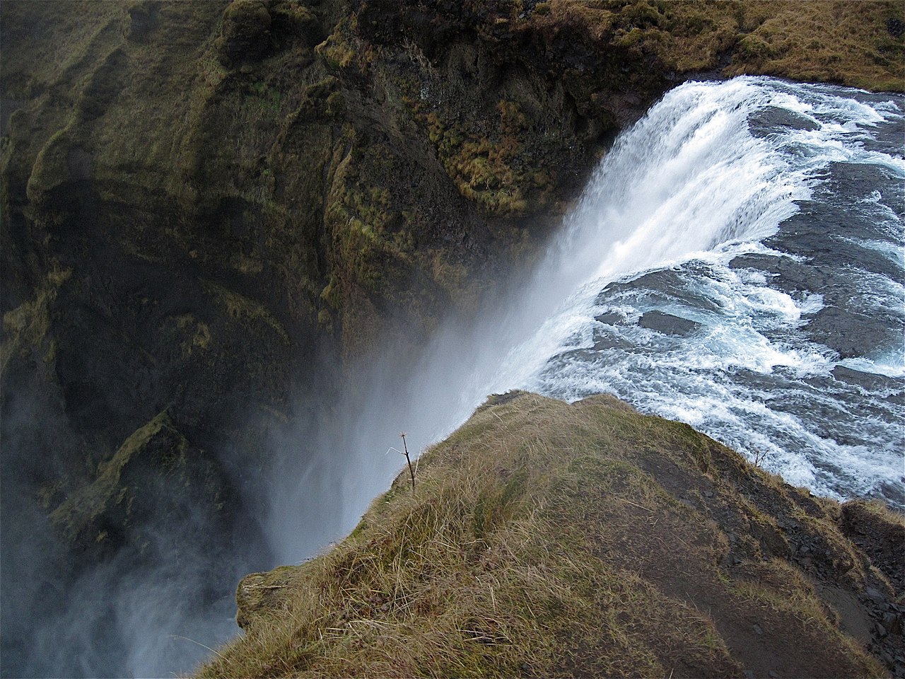 🥾Hiking Trail
Skógafoss Steps Trail
SkógafossThe staircase beside Skógafoss climbs the eastern cliff face to a platform level with the lip of the falls, where the Skógá river tips over a 60-meter drop. Over 500 metal steps, taking around 10–15 minutes at a steady pace; the top gives you a straight-down view of the waterfall and a long look toward the coast. In winter the stairs ice over significantly — check conditions first. From the top, a marked trail follows the Skógá river upstream, passing roughly 25 smaller waterfalls in the first 8 km before reaching a bridge — the standard turnaround for a day hike. The round trip is about 16 km and takes four to six hours at a moderate pace. Most visitors only climb to the first viewpoint and head back down, which is worth doing even if you skip the full trail. This is one of the South Coast's most visited spots. Skógafoss sits right off Route 1 near the village of Skógar, roughly two hours from Reykjavík, and the car park can fill completely by mid-morning in summer. The falls, the staircase, and the riverside trail are all free.
Read details →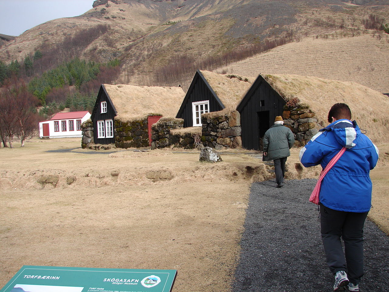 🏛️Museum
Skógar Folk Museum
SkógasafnThe Skógar Museum sits directly beside Skógafoss, making it easy to treat as an afterthought — but it's one of the most substantive regional museums in Iceland. Founded in 1949 by Þórður Tómasson, who spent over six decades gathering objects that would otherwise have been discarded, the collection has grown to more than 18,000 artifacts across three separate museums and several historic outdoor buildings. The Folk Museum covers three floors of fishing gear, farm tools, textile equipment, and natural history, with a centrepiece eight-oared fishing boat, Pétursey, built in 1855 and used until 1946. The Open Air Museum lets you walk through original turf farmhouses, a church, and a schoolhouse. A third wing, the Technical Museum, traces transport and industry from the 19th century onward. Skógar sits on Route 1, roughly two hours east of Reykjavík. Most visitors arrive after the waterfall — consider doing the museum first, while energy is high. Budget at least two hours; a café is on site.
Read details → 👀Viewpoint
Sólheimasandur DC-3 Plane Wreck
On November 21, 1973, a US Navy Douglas C-117D — a military transport in the DC-3 family — made an emergency landing on the black sand plain of Sólheimasandur after severe icing seized both engines. All seven crew members survived. The aircraft was abandoned in place, and the stripped white fuselage against the dark featureless sand has become one of Iceland's most photographed sights. Reaching the wreck requires a 4 km walk each way across flat, exposed terrain with almost no landmarks. The round trip takes about 1.5 to 2 hours. Private vehicles are banned from the beach, so the walk from the car park off Route 1 is mandatory; some operators run shuttle services. The terrain is flat, but wind and blown sand are a real factor — dress in layers and protect your eyes in gusty conditions. The wreck is photogenic in almost any weather; overcast skies with dramatic clouds suit the atmosphere particularly well. In winter, snow can obscure the path markers, so follow them carefully — the wreck stays hidden behind dunes until you are close.
Read details →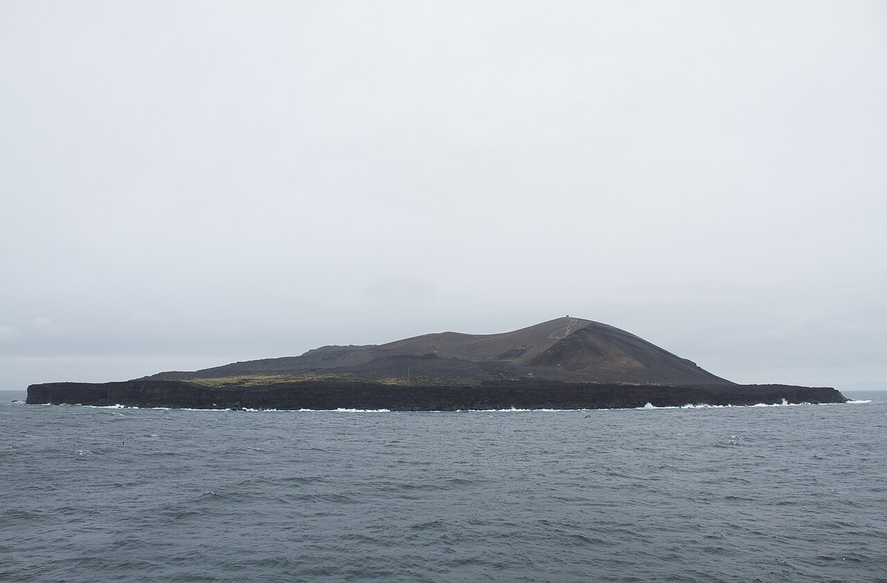 🌋Volcano
Surtsey
On 14 November 1963, a cook aboard a fishing vessel spotted what looked like a ship burning on the horizon. It was a new island pushing up from the ocean floor, fed by an eruption that began about 130 meters below the surface. The eruption continued until June 1967; at its peak the island reached around 155 meters. Named for Surtur, the Norse fire giant, Surtsey remains one of the youngest landmasses on Earth. UNESCO inscribed it in 2008. The island is closed to almost everyone except researchers. Its strict protection since formation has made it an uncontaminated laboratory for studying how life colonizes bare rock — from the first bacteria and mosses to insects, seabirds, and flowering plants. Wave erosion has roughly halved the surface area since 1967 and continues to shrink it. What visitors can do is take a boat tour from the Westman Islands, roughly 20 kilometers to the north. Tours typically run May through September. You see the island from the water — close enough to grasp its scale, but the research exclusion zone means no one lands.
Read details →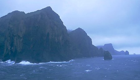 🐧Puffin Colony
Vestmannaeyjar Cliffs
VestmannaeyjarThe Westman Islands hold the world's largest Atlantic puffin colony — around 1.1 million breeding pairs nest here each summer, about 20 percent of the global population. The sea cliffs of Heimaey and the surrounding uninhabited islands provide ideal burrowing habitat, and at peak season the air is almost continuously busy with birds. Guillemots, fulmars, and other seabirds share the ledges. Recent decades have brought breeding failures linked to warming seas reducing the sand eel supply. Getting here requires a ferry from Landeyjahöfn (around 30–45 minutes) or a short flight. Boat tours circle the outer cliffs for close views. Heimaey town is small and charming, with a working harbour and a museum covering both the puffins and the 1973 Eldfell eruption that buried part of the town. Budget a full day. From late August through September, fledgling puffins disoriented by the town lights land in the streets. Locals and visitors collect them and release them at the water's edge the next morning — a quiet, memorable tradition. The main puffin-viewing season runs May through August.
Read details → 🏘️Town
Vík
Vík í MýrdalVík í Mýrdal is Iceland's southernmost settlement, about 180 km southeast of Reykjavík where the Ring Road runs between volcanic cliffs and the North Atlantic. The white church on the hilltop is the one building planners consider likely to survive a major Katla eruption — the volcano sits beneath Mýrdalsjökull nearby, and an eruption could send meltwater flooding across the lowland. Katla last erupted significantly in 1918, the longest quiet period on record. Evacuation drills are part of life here. Around 750 people live in Vík — the largest community for roughly 70 km — making it a natural stop for fuel, food, and a bed. Reynisfjara black sand beach, a short drive west, is one of the south coast's busiest spots. The basalt columns and Reynisdrangar sea stacks are dramatic, but the beach is genuinely dangerous. Waves arrive without warning from behind. In summer, puffins nest on the cliffs above town. Vík works well as an overnight base — Dyrhólaey, Skógafoss, and Reynisfjara are all within 30 minutes. Tour buses dominate at midday; evenings are much quieter.
Read details →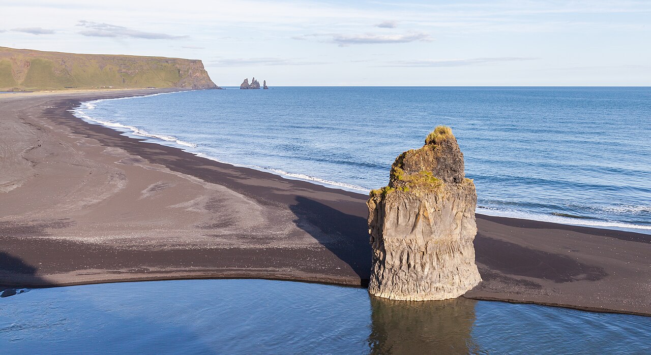 🏖️Beach
Ytri Vík Beach
Ytri VíkWest of Vík í Mýrdal, just behind the town's main road, lies a stretch of black sand that most visitors drive straight past on the way to Reynisfjara. Ytri Vík shares the same volcanic black sand and Atlantic drama as its famous neighbour, with views toward the Reynisdrangar sea stacks and Dyrhólaey headland, but without the tour buses. On a clear day the contrast between dark sand, white surf, and the green cliffs above town is striking. Access is easy: park near the village shops and walk through, or follow signs off Route 1 to the small beachfront car park. The beach is compact enough to walk end to end in fifteen minutes; most people spend time watching waves, photographing the stacks, or scanning cliff ledges for puffins and fulmars in summer. Do not mistake the lighter crowds for a calmer sea. The waves here are the same Atlantic swell that makes Reynisfjara notorious — powerful, irregular, capable of reaching well up the beach without warning. Stay well back from the waterline, especially in rough weather. Swimming is not safe. Open at all hours, free year-round.
Read details → ⛺Camping
Þakgil Canyon
ÞakgilAbout 20 kilometers northeast of Vík, a rough gravel road climbs for roughly 40 minutes before dropping into Þakgil — a compact, moss-covered canyon carved into the flanks of Mýrdalsjökull. The canyon walls close in around a flat grassy floor, which is where the campsite sits. It is genuinely sheltered from the coastal wind, and the green moss against dark lava makes the place feel remote in a way that doesn't match how close it is to the Ring Road. Open from around June 1 to mid-September, the campsite has heated bathrooms, showers, an outdoor kitchen area, and a large natural cave fitted with tables and a grill that serves as a communal dining shelter. Small wooden cabins with private facilities are also available. Hiking trails range from a short easy canyon walk to a full-day 18-kilometer route with glacier views. The access road is passable in a 2WD car with decent clearance in dry conditions, but a high-clearance vehicle is more comfortable. The site can also be visited as a day trip from Vík. It fills quickly on summer weekends, so book ahead or aim for early in the week.
Read details →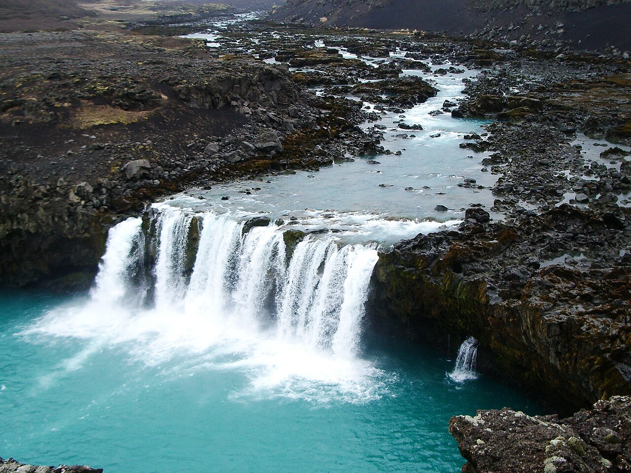 💧Waterfall
Þjófafoss
Þjófafoss spreads wide and low across the Þjórsá — Iceland's longest river — forming a horseshoe shape rather than plunging straight down. The drop is modest, around 10 to 15 meters, but the width during high flow can reach 50 meters or more, and the plateau bulk of Búrfell rising directly behind makes it one of the most photogenic waterfall compositions in the country. The name means "Thieves' Waterfall," referring to the medieval practice of executing thieves by drowning in the pool below. The falls are significantly shaped by modern infrastructure: the Búrfell hydroelectric station diverts much of the river's flow, so the volume varies considerably by season. Flow tends to be strongest in late summer when the reservoir spills. Access is via Route 26 through Þjórsárdalur; a signed gravel track branches left roughly 70 kilometers from the Ring Road junction and runs about 4 kilometers to a small parking area. The walk from the car is short. The road is paved to the junction, gravel after, and manageable in a regular car in summer. Allow about 30 minutes for the visit.
Read details →Southeast
17 placesHome of the crown jewel Vatnajökull glacier, breathtaking floating ice lagoons, and the famous Diamond Beach.
 ❄️Glacier
Breiðamerkurjökull Glacier
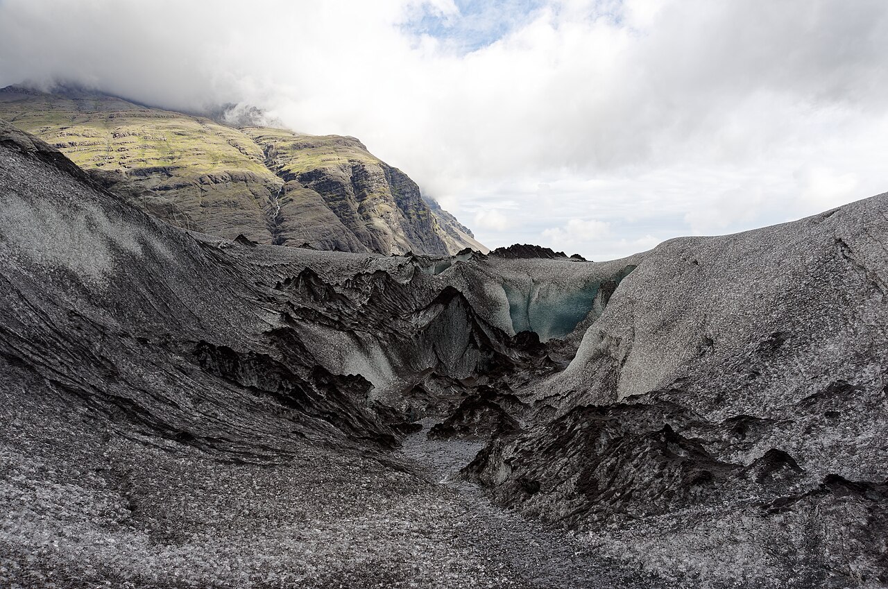
BreiðamerkurjökullBreiðamerkurjökull is the outlet glacier of Vatnajökull that calves icebergs into Jökulsárlón lagoon. The lagoon didn't exist until around 1933, when warming temperatures caused the glacier to retreat far enough to let meltwater pool behind it. Since then it has grown to Iceland's deepest glacial lake, covering around 15 square kilometers, and the glacier front has pulled back roughly six kilometers from the old shoreline. All access onto the ice requires a guided tour. In summer, four-wheel-drive vehicles ferry visitors from Jökulsárlón to the glacier's edge, where crampons go on and a guide leads you across textured blue and grey ice. From November through early March, the approach reveals natural ice caves formed by meltwater; caves typically run 30 to 70 meters long and glow a deep electric blue when light filters through the compressed ice overhead. Tours depart from the Jökulsárlón car park on Route 1, about five hours from Reykjavík. Book well ahead for winter ice cave slots — they sell out months in advance.
Read details → 🕳️Cave
Crystal Ice Cave (Vatnajökull)
Íshellar í BreiðamerkurjökliThe Crystal Ice Cave sits inside Breiðamerkurjökull, the outlet glacier responsible for Jökulsárlón glacier lagoon, roughly 380 km east of Reykjavík along Route 1. Entry is by guided tour only — it is illegal and unsafe to enter independently. Tours depart from the Jökulsárlón meeting point in super jeeps with oversized tires that carry visitors across the glacier margin to the cave entrance, a 15–20 minute ride over uneven terrain. Guides supply helmets and crampons; the total outing runs about 2–3 hours. Inside, compressed glacier ice absorbs longer red wavelengths and transmits blue light, producing walls that range from pale aquamarine to a deep saturated blue depending on ice thickness and the angle of natural light. The ice at the terminus is approximately 1,200 years old. Because the cave is carved by meltwater each summer and refreezes each winter, its exact shape, size, and location shift from year to year, and operators select which cave to visit based on daily safety assessments. Minimum age is typically 6–10 years depending on the operator. Prices start around 19,990 ISK per adult with operators such as Glacier Guides, Arctic Adventures, and Blue Iceland. Visitors drive paved Route 1 to Jökulsárlón and do not need a 4x4 of their own, as the glacier transport is provided. Dress in warm, windproof layers and sturdy footwear; interior temperatures hover around −2 to −5°C. Photo: Jakub Hałun / Wikimedia Commons (CC BY 4.0)
Read details → 🏖️Beach
Diamond Beach
FellsfjaraIce breaks off the Breiðamerkurjökull glacier, drifts through the Jökulsárlón lagoon, and washes out through the channel onto a stretch of black volcanic sand directly across Route 1. What ends up on Diamond Beach (Fellsfjara) ranges from fist-sized chunks to blocks the size of a small car; deep compression inside the glacier gives some pieces an electric blue tint. The beach rearranges itself every tide, so what you find in the morning is gone or shifted by afternoon. Ice concentrations tend to be greatest from late autumn through early spring, though ice appears year-round. Two car parks serve the site and fill quickly in peak season — arriving before mid-morning or after dinner helps. Toilets are in the main lot. Sneaker waves are a documented hazard: multiple visitors have been knocked down by waves reaching farther up the sand than expected. Stay well back from the waterline, never turn your back on the sea for long, and don't climb on the ice — even large grounded pieces can roll without warning. Jökulsárlón lagoon is a short walk away and most people pair both in a single stop.
Read details →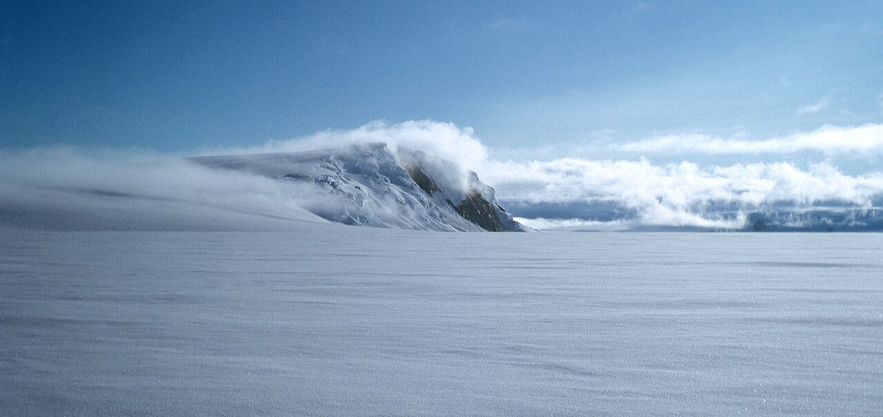 🌋Volcano
Grímsvötn
Iceland's most frequently erupting volcano is entirely out of sight, buried under the Vatnajökull ice cap. Grímsvötn is a subglacial caldera roughly 8 kilometers across that has erupted around 70 times in recorded history, with eruptions typically separated by only a few years. The most recent major event was 2011, when an ash column reached roughly 20 kilometers up and disrupted European air travel. Beneath the ice, a geothermally heated lake periodically drains in sudden glacial outburst floods — jökulhlaups — sending enormous volumes of water across the southern sandur plains. The volcano is inaccessible to regular visitors. What you can appreciate from nearby is what it has shaped: the flat, black outwash plains south of Vatnajökull were largely built by Grímsvötn floods over centuries. Skaftafell, about an hour to the southwest, offers good perspective on this scale. Checking the Iceland Met Office (en.vedur.is) on any southeast Iceland trip is sensible — Grímsvötn can give little warning before erupting, and the sandur plains south of the glacier are dangerous during events.
Read details → 🏘️Town
Höfn
Höfn í HornafirðiHöfn's identity revolves around langoustine. Restaurants call them lobster, menus in every price range feature them, and at the end of June the town throws Humarhátíð — the Lobster Festival — drawing food enthusiasts and live music to a town of around 2,200 people. The catch lands fresh at the harbour, so the langoustine here is genuinely good. Sitting 450 km from Reykjavík, Höfn is the natural base for the region: Jökulsárlón glacier lagoon and Diamond Beach lie about 80 km west, Vestrahorn and Stokksnes beach are a short drive east, and glacier tongues are visible from the road in both directions. The town has petrol, supermarkets, hotels and guesthouses, a swimming pool, and the Gamlabúð visitor centre with exhibits on Vatnajökull glacier. Allow a couple of hours to walk the harbour and eat well. Most travellers spend at least one night before continuing the Ring Road. The drive between Höfn and Vík is one of Iceland's best, with glacier tongues descending close to the road for long stretches — budget time to stop.
Read details →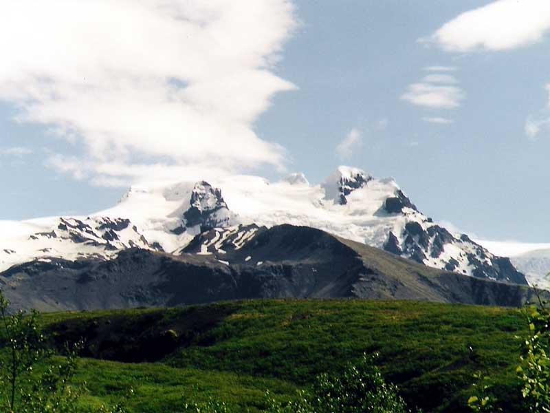 🥾Hiking Trail
Hvannadalshnjúkur Summit
HvannadalshnjúkurAt 2,109.6 meters, Hvannadalshnjúkur is the highest point in Iceland — a summit on the crater rim of the Öræfajökull stratovolcano in the extreme southeast, within Vatnajökull National Park near Skaftafell. The standard route, Sandfellsleið, starts from a parking area south of Skaftafell and climbs via the Svínafellsjökull glacier, gaining around 2,000 meters of elevation. Expect a full day: roughly 8 hours up and 4 hours down, so most groups start before dawn. This is serious mountaineering. The route crosses crevassed glacier and steep ice, and there is no responsible way to attempt it without a certified guide, crampons, ice axe, harness, and rope. Guided expeditions run mainly in spring and early summer when snow bridges over crevasses are sound. The adult price reflects a guided tour — this is not a self-guided hike. Weather on Öræfajökull can shift abruptly, so any operator will have a cancellation-and-rebook policy. Build two or three spare days into your schedule. On a clear day the view takes in most of Vatnajökull and the southern coastal plain to the sea.
Read details →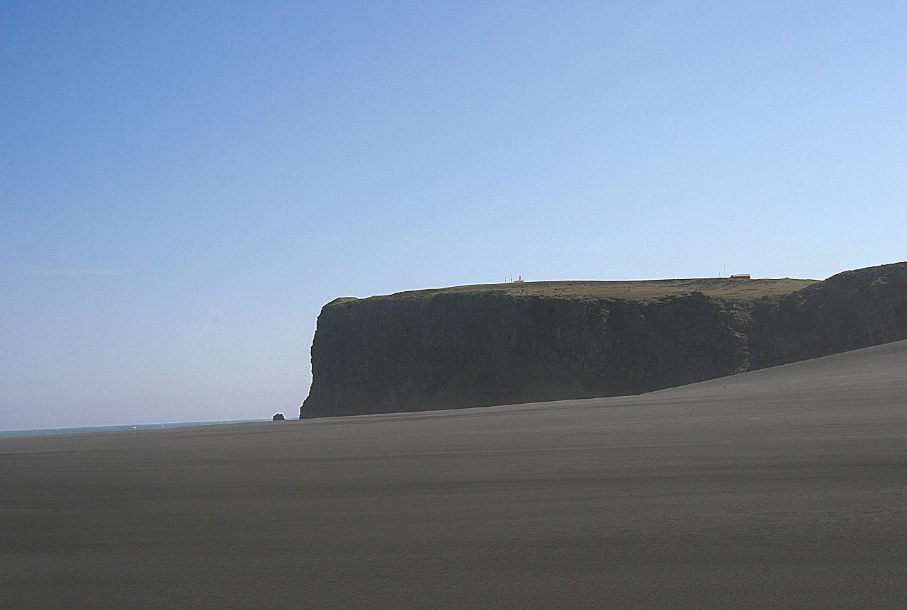 🐧Puffin Colony
Ingólfshöfði Puffin Colony
IngólfshöfðiRising 76 meters from the black sand flats of Iceland's South Coast, Ingólfshöfði is a flat-topped promontory where Iceland's first Norse settler, Ingólfur Arnarson, reportedly spent his initial winter around 874 CE before founding Reykjavík. Today it's a protected nature reserve with one of the country's best seabird concentrations: puffins, great skuas, fulmars, razorbills, and common murres all nest on the clifftops each summer. Getting there is half the experience. You can't drive to the headland — a local family hauls visitors across roughly 6 km of wetlands and black sand on a tractor-drawn hay cart, about 25 minutes each way. A guided hike of around 1.5 hours then loops around the cape, with Vatnajökull visible to the north and an unbroken sweep of black coast in both directions. Tours run May through August when the puffins are present. Budget around 3 hours total. Advance booking is advised as group sizes are limited.
Read details → ❄️Glacier
Jökulsárlón Glacier Lagoon
JökulsárlónIcebergs calved from Breiðamerkurjökull — an outlet glacier of Vatnajökull — drift through Jökulsárlón before passing to the sea through a short channel beside Route 1. The lagoon formed around 1934 as the glacier retreated and has grown roughly fourfold since the 1970s; it now covers about 25 square kilometres and reaches 284 metres at its deepest point, making it Iceland's deepest lake. The bergs show blue-white and ash-black (from volcanic layers in the ice), and seals are year-round residents, often draped over floating ice. Boat tours — amphibious vehicles or smaller zodiacs — run in summer among the bergs. Across the road, Diamond Beach is a short walk where wave-tumbled ice catches the light on black sand. The lagoon appeared in two James Bond films and Lara Croft: Tomb Raider. Free to visit from the shore, open at any hour. Morning and evening light is better and the crowds thinner. It's roughly five hours from Reykjavík; most Ring Road drivers stop here.
Read details →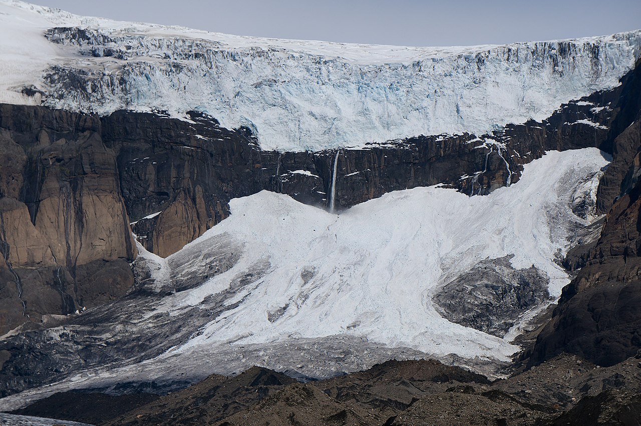 💧Waterfall
Morsárfoss
Morsárfoss became visible around 2007 when retreating Morsárjökull, an outlet of the Vatnajökull ice cap, uncovered a cliff face and exposed Iceland's tallest waterfall. The confirmed drop is at least 228 meters — exact measurement has always been difficult because the glacier above continues to calve unpredictably. Reaching a viewpoint requires a roughly 12 km round-trip hike from the Skaftafell Visitor Center along the Kristínartindar trail. The route takes four to five hours and is rated expert: strenuous and remote terrain. From the ridgeline you look across the Morsá valley to the falls dropping down dark basalt below the glacier snout. Binoculars or a telephoto lens are worth bringing. Reaching the actual base involves crossing active glacier with crampons and an ice axe — an undertaking only for experienced mountaineers with a guide. The waterfall is within Vatnajökull National Park and free to visit. Snow lingers on the upper trail into early June, making late June through August the practical window. Skaftafell has a campsite, café, and national park ranger station at the trailhead.
Read details → 🥾Hiking Trail
Múlagljúfur Hidden
Múlagljúfur is a compact canyon in southeast Iceland where glacial meltwater has carved a narrow gorge into the hillside, its walls covered in vivid green moss and fed by multiple waterfalls. A double waterfall at the canyon's head is the main payoff, with the Öræfajökull ice cap filling the skyline behind it. The trailhead is reached via a rough 2 km gravel track off Route 1, manageable by a regular 2WD car in summer with careful driving. The hike is around 3 to 4 km round trip with meaningful elevation gain — expect an hour to an hour and a half on trail. The final section is steep and slippery when wet, so proper footwear matters. There are no facilities at the trailhead; the nearest toilets are at Skaftafell or roadside fuel stations. The canyon sits between Skaftafell and Höfn, roughly 330 km from Reykjavík. June through September gives the best conditions: the moss is greenest and the access track reliably passable. Visitor numbers have grown, but the canyon still draws far fewer people than Skaftafell or Jökulsárlón, and the short approach keeps it manageable as a roadside stop.
Read details → ⛽Fuel Station
N1 - Höfn
Höfn's N1, on Vesturbraut in the centre of town, is one of the more strategically placed fuel stops on the Ring Road. The town sits at the southeast edge of Vatnajökull — Europe's largest glacier — and marks the end of a long, thinly serviced stretch from Vík. The station is open daily, roughly 8:00–22:00 on weekdays, with adjusted weekend hours, and offers fuel, a grill, snacks, a car wash, and Wi-Fi. Höfn is known for its langoustine — what locals call "lobster" — and several restaurants a short walk from the N1 specialize in it. Jökulsárlón glacier lagoon is about 80 km west, roughly an hour's drive; Diamond Beach is just across the bridge from it. Before continuing east from Höfn, fill the tank regardless of your current level. The road into the Eastfjords is scenic but services are sparse, and the stretch between Höfn and Djúpivogur is one of the longest gaps without a reliable fuel stop on the entire southeastern route.
Read details →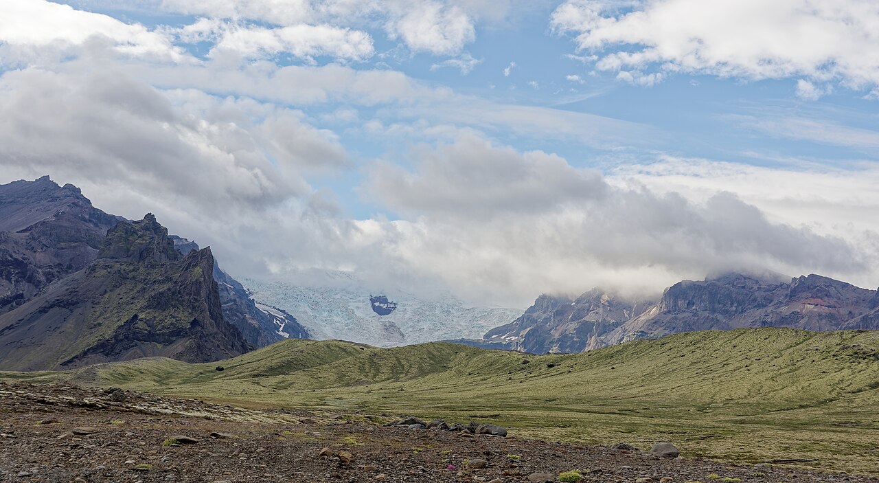 🌋Volcano
Öræfajökull
Öræfajökull is Iceland's highest point and largest active volcano by volume. The summit ridge, Hvannadalshnúkur, reaches 2,109.6 meters on the caldera rim of a stratovolcano buried under Vatnajökull's southern edge. Both historical eruptions were destructive: the 1362 event produced more tephra than any other in Iceland's recorded history, wiped out a prosperous farming district, and left the land uninhabited for over 40 years — the area was renamed Öræfi, or wasteland. The smaller 1727 eruption sent meltwater floods across farmland, killing three people. Climbing Hvannadalshnjúkur is a serious undertaking. The round trip from Skaftafell takes 12 to 15 hours, involves glacier travel with crevasse risk, and requires a guide and mountaineering equipment. Most guided ascents run April through June. The Skaftafell visitor centre inside Vatnajökull National Park is the starting point, with guides and a campsite on site. Shorter guided glacier walks on the tongue glaciers are available year-round. The Ring Road runs past the base of the massif around 330 km east of Reykjavík.
Read details → 🥾Hiking Trail
Skaftafell
Skaftafell sits where a sheltered valley meets the edge of Vatnajökull, Iceland's largest glacier. Established as its own national park in 1967 and folded into the larger Vatnajökull National Park in 2008, the area is greener than you'd expect at this latitude — the glacier mass to the north acts as a windbreak and creates an unusually mild local climate. The trail network covers everything from a gentle hour-long glacier viewpoint walk to full-day ridge climbs. The S2 circuit (around 5.8 km, roughly two hours) reaches Svartifoss, a 20-meter waterfall framed by hanging columns of dark hexagonal basalt — the same geological formation that inspired the design of Reykjavík's Hallgrímskirkja church. Guided glacier hikes on Svínafellsjökull depart from the area for those wanting to get onto the ice. The visitor center (Skaftafellsstofa) is open year-round and has solid exhibits on the park's geology, plus a souvenir shop. Skaftafell is right off the Ring Road, roughly five hours from Reykjavík. The car park fills fast on summer afternoons — an early start makes a real difference.
Read details →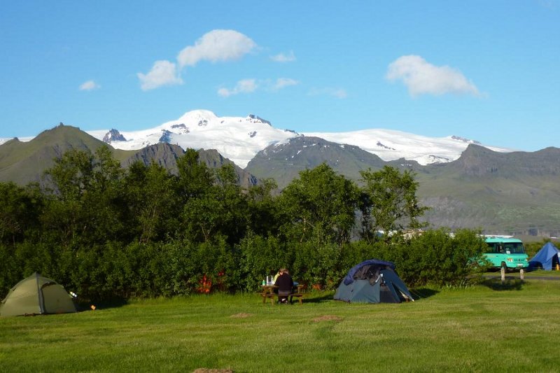 ⛺Camping
Skaftafell Campsite
Tjaldsvæði SkaftafellsThe campground at Skaftafell is one of Iceland's largest, spread across eight pitch zones inside Vatnajökull National Park with room for around 400 tents and direct views toward the glacier tongues. Open year-round, though only zones A and C run in winter; outdoor water taps come on in mid-May. Facilities are solid for a national park campground: flush toilets, hot showers, laundry machines, electrical hookups (around 100 outlets), dish-washing stations, and WiFi across the site. There is no indoor kitchen or dining hall for campers, though a privately operated restaurant operates on-site seasonally. Walk-in campers cannot pre-book; you register and pay at the reception on arrival. Groups can reserve in advance. Peak summer fills the site quickly. The location is the real draw. Trails to Svartifoss waterfall and the glacier viewpoints begin steps from the pitches, and Jökulsárlón glacier lagoon is around 50 km east along the Ring Road. The campsite sits off the Ring Road; the access road is paved and no four-wheel drive is needed.
Read details →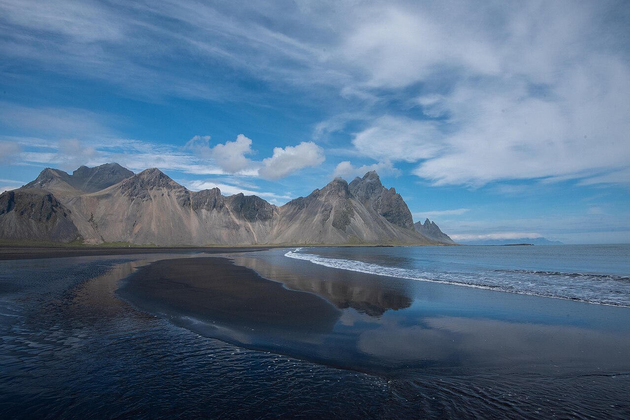 🏖️Beach
Stokksnes Beach
StokksnesBlack sand, wild marram grass, and Vestrahorn rising 454 meters from the shoreline make Stokksnes one of the most photographed spots on Iceland's southeast coast. Tidal pools form at low tide and mirror the mountain cleanly; the light at either end of the day turns the dark peaks dramatic shades of orange and pink. Access runs through a private gate where you pay a small entry fee at the Viking Café. A cluster of turf-roofed structures — built as a film set that was abandoned before production began — sits on the property and adds an atmospheric detour. The beach stretches far enough that spreading out is easy even when others are present. Stokksnes is just off Route 1 near Höfn, about five to six hours east of Reykjavík. The gravel access road is straightforward in dry conditions; a standard car is fine outside of winter. Come at low tide for the reflections, and at sunrise or sunset for the best light on Vestrahorn.
Read details → 💧Waterfall
Svartifoss
Dark hexagonal basalt columns hang from the lip of Svartifoss like a chandelier of stone, framing a 20-meter drop into a pool below. The columns formed when ancient lava cooled slowly and cracked into geometric shapes; erosion undercut them over time to create the dramatic overhang seen today. Architect Guðjón Samúelsson drew on these formations when designing both Hallgrímskirkja, Reykjavík's landmark church, and the National Theatre — the geology here has quietly shaped Iceland's built landscape. The trail from Skaftafell visitor centre is 1.5 kilometers each way with about 140 meters of elevation gain through birch and rowan woodland. On the way up you pass two smaller falls — Hundafoss and Magnúsarfoss. The return trip takes around 90 minutes. The path can be slippery in wet conditions; waterproof boots are worth bringing year-round. The Skaftafell area of Vatnajökull National Park has a visitor centre, café, and campsite near the trailhead. The trail continues past Svartifoss to the Sjónarsker viewpoint for broader views over the glacier and surrounding ridges.
Read details → ❄️Glacier
Vatnajökull Glacier
VatnajökullVatnajökull is Europe's largest glacier by volume — roughly 3,000 cubic kilometers of ice across about 7,700 square kilometers, covering around 8% of Iceland. The ice averages 380 meters thick, reaching close to 950 meters at its deepest. Beneath it sit active volcanoes including Grímsvötn and Bárðarbunga; when geothermal heat melts ice from below, the result is a jökulhlaup, a glacial outburst flood that can reshape river valleys in hours. Iceland's highest point, Hvannadalshnjúkur at 2,110 meters, rises from the glacier's southern rim. Vatnajökull National Park, established in 2008 and a UNESCO World Heritage site, is Europe's second-largest national park. Most visitors enter via Skaftafell, about 4–5 hours from Reykjavík on the Ring Road, or at Jökulsárlón lagoon. Around 30 outlet glaciers flow from the ice cap; guided hikes run year-round, and ice caves form each winter — guided access only. The glacier has lost roughly a meter of thickness per year for several decades. Guided glacier walks from Skaftafell need no prior experience; traversing the full ice cap does.
Read details →Highlands
16 placesAn untouched volcanic wilderness accessible only in summer via rough F-roads, boasting colorful mountains and hot springs.
 💧Waterfall
Aldeyjarfoss
Aldeyjarfoss drops roughly 20 meters on the Skjálfandafljót river into a wide pool, but the drop is almost secondary to what surrounds it: a tight ring of hexagonal basalt columns set against churning white water in a way that looks almost constructed. The columns formed as thick lava from the Bárðarbunga volcanic system cooled and cracked. Because it sits well into the highlands, visitor numbers stay modest even in peak season. Getting here requires a 4WD. The standard approach follows Route 842 south through Bárðardalur valley, then turns onto the F26 Sprengisandur highland road for a few kilometers to a parking area with toilets. A short track leads down to the falls. An alternative northern-bank viewpoint is accessible off Route 842 near the farm Stóratunga, avoiding the F-road entirely. The season is June through September; F26 closes in winter, though walking in from Road 842 is possible in calm conditions. The site is free with no facilities beyond car park toilets. The long, low-angle light during midnight sun hours brings out the basalt column texture particularly well.
Read details → 🌋Volcano
Askja
Askja is a caldera system in Iceland's central highlands so remote and otherworldly that NASA brought Apollo astronauts here in the 1960s to practice geological fieldwork before the moon landings. Inside the main caldera, Öskjuvatn lake occupies a nested depression that collapsed during the catastrophic 1875 eruption and is more than 200 meters deep — Iceland's deepest lake. Beside it, Víti crater holds a small pool of milky-blue geothermal water at around 20–30°C. Swimming is sometimes permitted; check with rangers on arrival. Reaching Askja requires a 4x4 on F-roads through black sand desert. The route may include river crossings, and roads typically open only from late June to early August. From the Vikraborgir parking area a marked trail of around 2.5 km leads to the calderas; budget three hours comfortably. First-time visitors often join a super-jeep tour from Akureyri or Mývatn, which removes the navigation uncertainty. Those driving independently should check road conditions at safetravel.is beforehand and carry extra fuel, water, and warm layers regardless of the forecast.
Read details →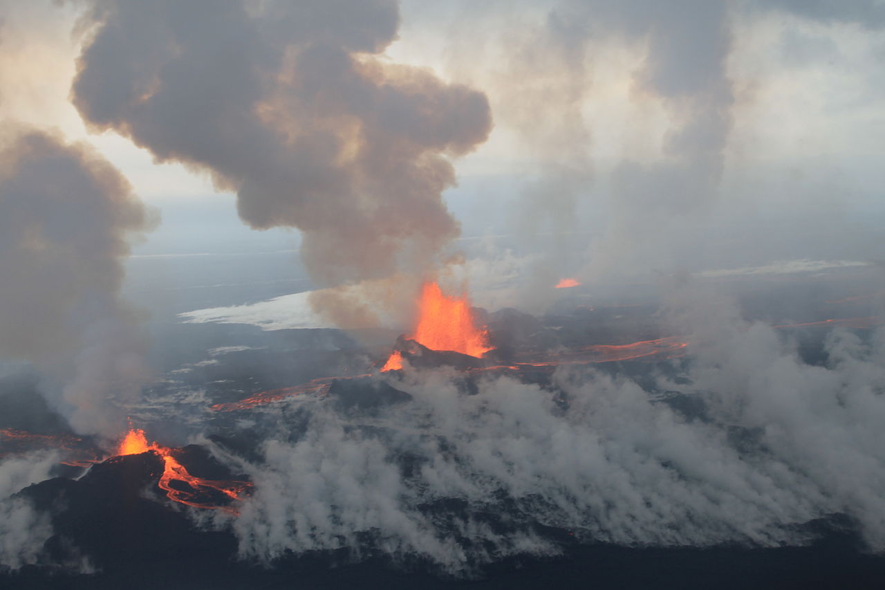 🌋Volcano
Bárðarbunga
The Holuhraun lava field — created by Bárðarbunga's 2014–2015 eruption — is the largest lava flow Iceland has seen since Laki erupted in 1783. Over six months, roughly 85 square kilometers of fresh black rock formed north of Vatnajökull, reshaping terrain that had been empty highland tundra. The caldera itself sits buried under the northwestern portion of Vatnajökull, beneath around 850 meters of ice, with its floor roughly 700 meters deep and its diameter spanning about 11 kilometers. During the eruption, the caldera floor dropped more than 50 meters as magma drained northward through a subterranean dike. Getting to Holuhraun requires a serious commitment. The access route runs across the F-roads of the central Highlands — loose gravel, river crossings, no services — and is only reliably passable between July and September. Organized super jeep tours from Reykjavík or Akureyri are the practical choice for most visitors; independent travel demands a high-clearance 4x4, experience with river fords, and careful planning. The reward is an otherworldly landscape of cracked, ochre-tinged lava with fumaroles still venting steam and sulfur. This remains one of Iceland's most geologically raw destinations, and it doesn't reward the unprepared. Check road conditions at vegagerdin.is before setting out, carry extra fuel, and treat the surface gently — it fractures under careless footfall.
Read details →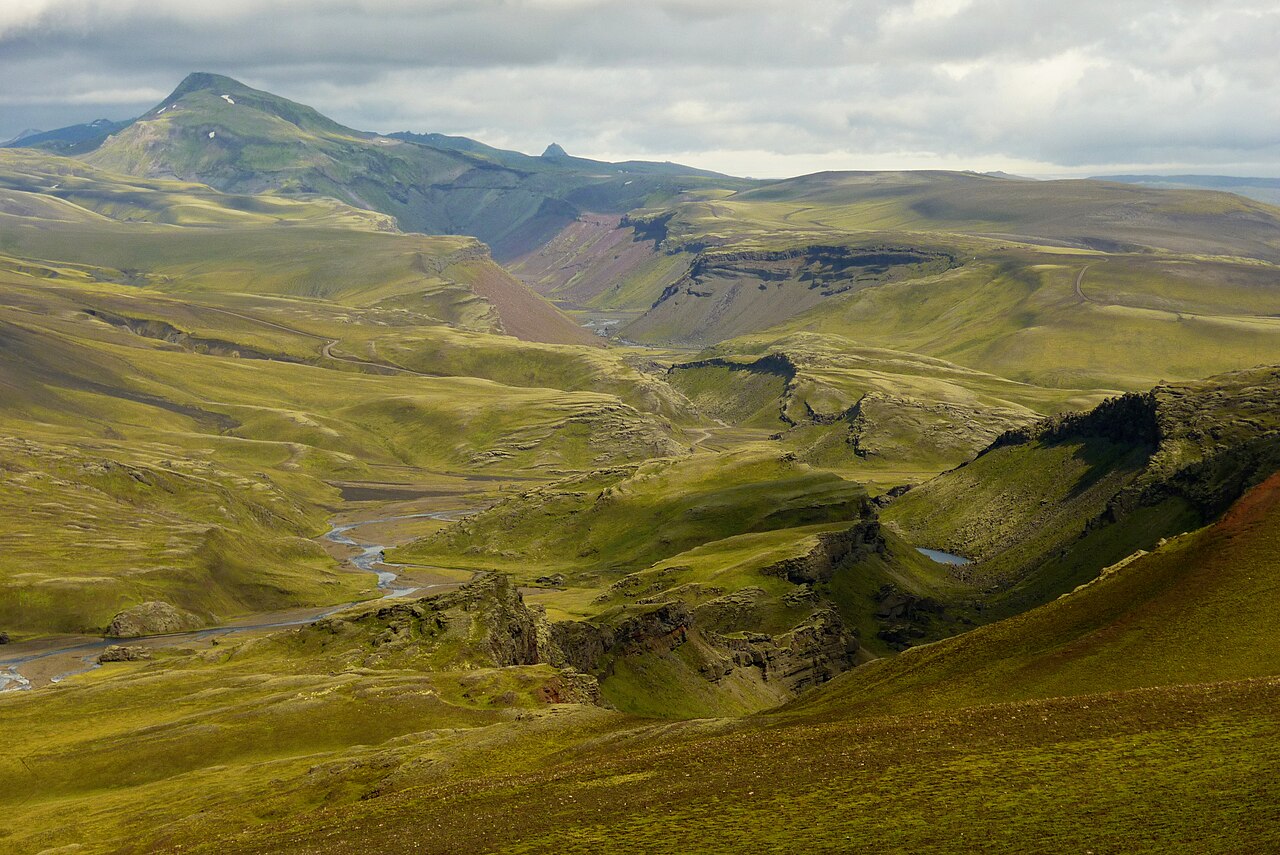 🏔️Canyon
Eldgjá Fissure
EldgjáThe canyon at Eldgjá opened during an eruption around 939 CE that researchers consider the largest effusive volcanic event in recorded history — roughly 18 cubic kilometers of lava spread across the Highlands, and the sulfur released cooled temperatures across the Northern Hemisphere for years after. The canyon runs about 8.5 kilometers, reaching around 600 meters across and 150 meters deep, part of a much longer fissure chain tied to the Katla volcanic system. Inside the canyon, the Ófærufoss waterfall drops in two streams onto the gorge floor — the main destination for most visitors, a roughly one-hour walk from the parking area. The landscape is raw and sparsely vegetated: dark basalt walls, patches of moss, very few other people. Reaching Eldgjá requires the F208 highland road, open roughly July through September and requiring a 4x4 with river-crossing clearance. Budget at least two hours on site. The canyon sits between Landmannalaugar and Kirkjubæjarklaustur, making it a natural stop on a highland traverse. There are no services here, so arrive with food, water, and layers.
Read details →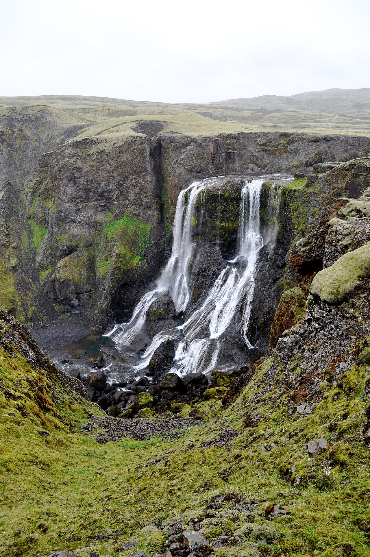 💧Waterfall
Fagrifoss
Fagrifoss drops around 80 meters through a basalt column canyon on the Geirlandsá river in the South Iceland highlands near the Lakagígar craters. Getting there requires road F206 north from Kirkjubæjarklaustur — an F-road with river fords that are impassable without a proper 4x4. The falls sit about 24 km from Kirkjubæjarklaustur along this track. The road is only reliably open in July and August. The payoff is a falls that sees a fraction of the visitors that South Coast stops attract. The basalt columns flanking the drop are well-formed, and the canyon gives the water a confined energy before it spills below. The name means simply Beautiful Waterfall — understated even by Icelandic standards. Check road conditions at road.is before setting out, carry sufficient fuel, and do not attempt the river crossings if water looks high. Most visitors combine the stop with the Lakagígar craters further up the same road, which makes for a full highland day trip.
Read details → 🌋Volcano
Herðubreið
Herðubreið rises 1,682 meters from the flat black Ódáðahraun lava field in a near-perfect cylinder that looks too geometric to be natural. It's a tuya — formed when a subglacial volcano erupted beneath thick ice, the surrounding glacier confining the lava into a steep tower rather than letting it spread. Icelanders call it the Queen of Icelandic Mountains, and the shape earns the title. Access requires a 4x4 and the F88 road, which typically opens in late June and closes in early September. The route involves unbridged river crossings and rough highland terrain. Just below the mountain, the Herðubreiðarlindir oasis is a startling contrast to the surrounding desert — springs push through the lava feeding patches of moss and wildflowers, with a mountain hut, campground, and short walking trails. The summit requires technical climbing skills and is not a casual day hike. Most visitors reach the oasis, walk the springs, and photograph the mountain from below — an experience that stands on its own against the backdrop of black lava extending in every direction.
Read details →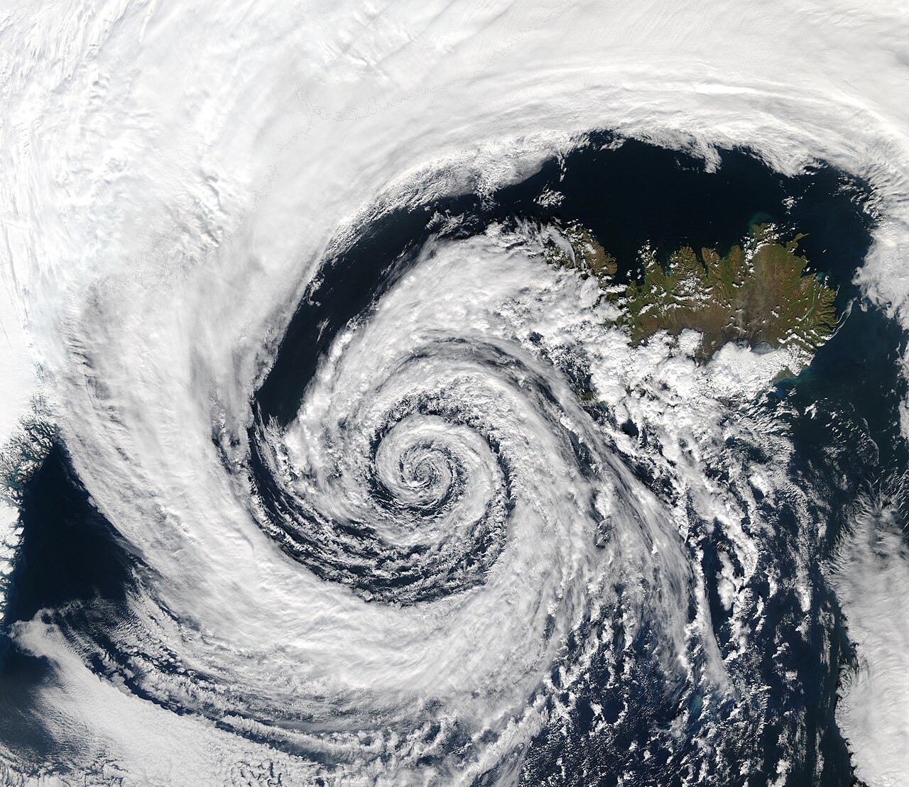 ❄️Glacier
Hofsjökull
Iceland's third-largest ice cap, Hofsjökull covers around 830 square kilometers of the central highlands and rises to 1,782 meters at its highest point. Beneath the ice sits the country's largest active central volcano — a caldera the glacier conceals entirely. The combination makes Hofsjökull both geologically significant and almost entirely unvisited: there are no tourist facilities on the ice, and reaching it requires expedition-level planning. The practical way to see it is from the Kjölur route (Route 35), which crosses the highlands between Geysir and Akureyri and passes close enough for a clear view of the white dome above the plateau. The route is open in summer, typically from late June, and passable without a 4x4 in reasonable conditions. Hofsjökull feeds several major rivers, including Þjórsá, Iceland's longest. Most drivers cover the Kjölur route in a long single day (around 200 km end to end), stopping at Kerlingarfjöll and the Hveravellir hot spring oasis along the way. The glacier is visible for much of the southern half of that drive.
Read details →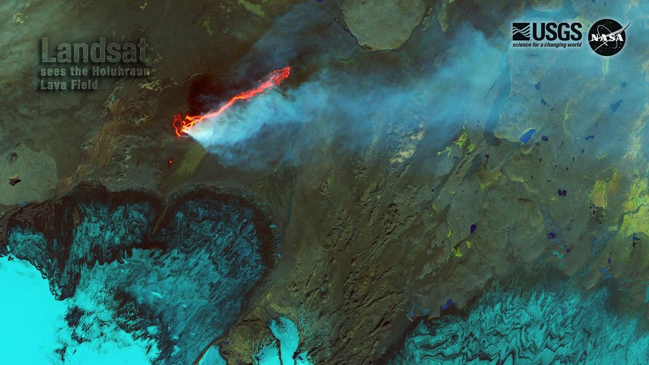 🌋Volcano
Holuhraun Lava Field
HoluhraunBetween late August 2014 and February 2015, a fissure eruption north of Vatnajökull produced around 85 square kilometers of fresh lava — the largest flow-field Iceland had seen since Laki in 1783. Magma traveled roughly 50 kilometers beneath the ice cap before breaking the surface at Holuhraun. The result is one of the rawest landscapes in the country: a vast black field in the highland interior, still venting steam where heat persists below. Reaching Holuhraun requires a highland-capable vehicle for F-roads and river crossings. Most visitors join organized super jeep day tours from the Lake Mývatn area, typically combined with Askja caldera and Víti crater. These run 12 to 13 hours and operate roughly mid-June to mid-September. Walking the field, the scale is hard to grasp: the surface stretches to the horizon and shifts between smooth ropy flows and broken, ankle-twisting rubble. Bring warm layers and solid footwear regardless of the forecast; highland weather changes fast and there is no shelter anywhere near the site.
Read details →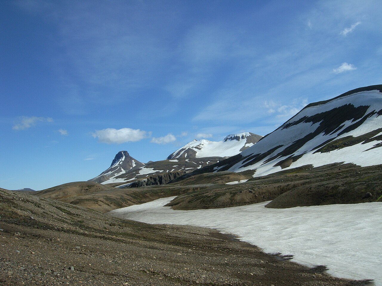 🥾Hiking Trail
Kerlingarfjöll Mountains
KerlingarfjöllKerlingarfjöll is a rhyolite mountain range in the central Highlands whose peaks reach around 1,477 meters at the highest summit. The rock's vivid spectrum — deep reds, burnt oranges, sulfur yellows — comes from active geothermal forces still bubbling across the valleys. The Hveradalir valley at the range's core is laced with steam vents, boiling mud pots, and hot springs, and a loop trail of roughly 7–11 km (depending on the branches you take) winds through it close enough to feel heat rising from the ground. Getting here requires a 4x4. Access is via the F35 Kjölur route — manageable by highland standards, with bridges over major rivers, but still unpaved and rough; the base is about 170 km from Reykjavík. The road typically opens in late June and closes in early September. The Kerlingarfjöll Highland Base offers chalets, dorm rooms, and camping at the range's edge, and super-jeep day tours from Reykjavík are possible though they make for a very long day. Budget at least half a day for Hveradalir. The hills' colors shift through the day as the light changes, and early summer often brings snow on upper slopes while steam rises from below. Highland weather can change fast even in July — bring layers whatever the forecast says.
Read details → ♨️Hot Spring
Landmannalaugar
A geothermal stream pushes up at the edge of the Laugahraun lava field and mixes with cold snowmelt, creating a natural pool sitting between 36 and 40°C. The hot spring is free; you wade in from the rocks and look up at rhyolite mountains striped in yellow, green, and deep red. The lava field formed after an eruption in 1477 and is worth an hour of wandering. Landmannalaugar marks the northern start of the 54-kilometre Laugavegur trail south to Þórsmörk. Day hikers can tackle Bláhnúkur (943 metres, around 2–3 hours) or a circuit of Brennisteinsalda. A full day is the minimum; many people stay two or three nights at the campsite or mountain hut run by the Iceland Touring Association, which books up fast in July and August. Access requires a 4x4 on mountain roads F208 or F225, open roughly mid-June to mid-September; driving from Reykjavík takes four to five hours. Highland buses run from Reykjavík and Hella during summer. Parking now uses a reservation system with limited daily slots — check requirements before setting out.
Read details → ♨️Hot Spring
Laugafell Hot Springs
LaugafellLaugafell sits on the high plateau of Iceland's northern interior, about 15 kilometers northeast of Hofsjökull glacier and roughly 85 kilometers south of Akureyri by F-road. The draw is a man-made hot spring pool fed by the geothermal area here, maintained at around 38°C in summer, with a wooden walkway down to the water and changing facilities alongside. Soaking out here, with highland desert in every direction and Hofsjökull on the horizon, is nothing like the polished pools near Reykjavík. Access requires a high-clearance 4x4. From Akureyri take F821 (Eyjafjarðarleið) south, then connect via F752; from the Sprengisandur direction, turn west off F26. Roads are typically passable early July through mid-September — check road.is before going. The Akureyri Touring Club hut sleeps around 32 guests across two geothermally heated buildings; camping is also available. A warden is on-site through summer. Reservations at ffa.is. Hiking trails and several waterfalls surround the mountain, and an overnight stay lets you explore the plateau properly. Budget at least three hours for a day visit.
Read details → 🥾Hiking Trail
Laugavegur Trail
LaugavegurThe Laugavegur runs 55 kilometers from Landmannalaugar south to Þórsmörk through terrain that changes so completely it barely feels like the same country. The first day climbs through rhyolite mountains striped in ochre and rust before leveling off near Hrafntinnusker, where obsidian litters the ground and fumaroles vent steam. From there the trail descends toward Álftavatn and eventually reaches Þórsmörk's birch valleys — volcanic desert giving way to something almost pastoral. Four mountain huts — Hrafntinnusker, Álftavatn, Hvanngil, and Emstrur — punctuate the route; beds must be booked well in advance. Most hikers walk north to south, as the trail trends downhill that way and the prevailing wind follows. Several rivers require fording; water levels vary with recent rain, and midsummer snow squalls in the highlands are not unusual. The trail is accessible from late June to early September, and most hikers allow four days. From Þórsmörk, the Fimmvörðuháls trail extends 25 kilometers south to Skógar, crossing between two glaciers — two more days for those wanting the full traverse.
Read details →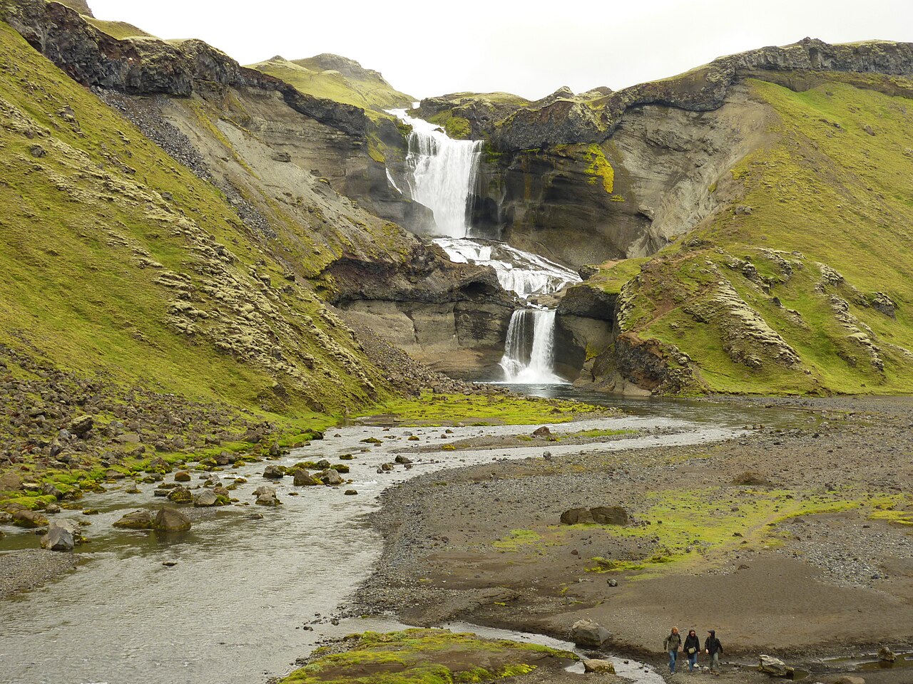 💧Waterfall
Ófærufoss
Ófærufoss drops roughly 40 meters in two tiers inside Eldgjá, a volcanic fissure canyon cut into the Highlands south of Mýrdalsjökull. What makes the site notable is partly an absence: until the early 1990s a stone arch spanned the canyon between the two falls. The arch collapsed through frost-shattering and erosion, and the open gorge it left is dramatic in its own right. Eldgjá was formed by a massive eruption dated to around 939 CE, one of the most voluminous lava-producing events of the last two thousand years. The canyon runs roughly 40 kilometers and reaches around 270 meters deep. The walk from the roadside parking area to the viewpoint at the base of the falls takes 30 to 40 minutes each way on a marked trail across mossy lava. The only practical access is via F-road F208 through the Highlands, requiring a 4x4 and passable only from roughly July through September. Check road conditions at road.is before setting out — snow closes the route early and late in the season. Budget around 90 minutes on site to walk in, view the canyon, and return.
Read details →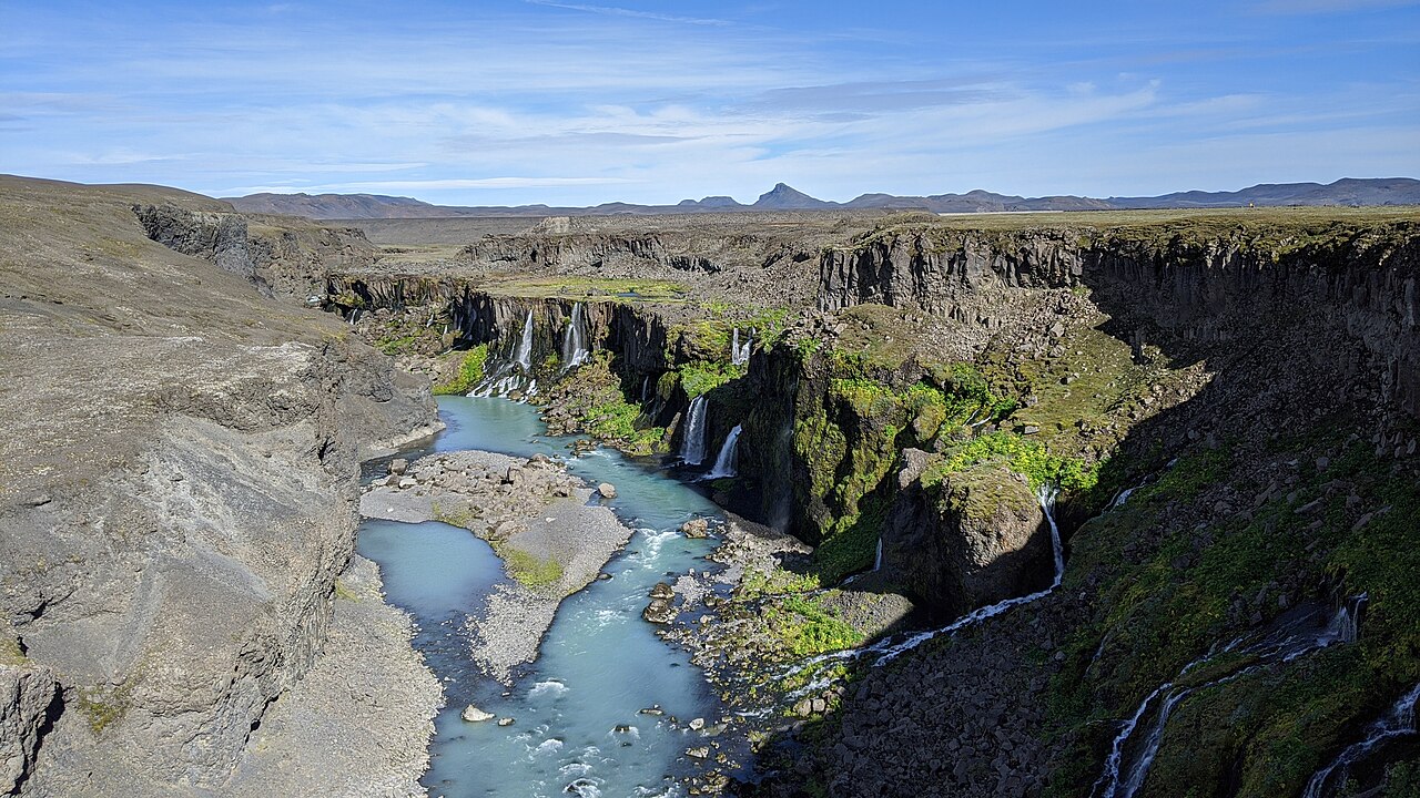 🏔️Canyon
Sigöldugljúfur
Sigöldugljúfur exists because of a dam. Before the Sigalda hydroelectric plant was built in the late 1970s, this stretch of valley was submerged. Lowering the water level exposed a canyon roughly two kilometres long and up to 30 metres deep, its basalt walls riddled with springs. Those springs now feed dozens of waterfalls pouring simultaneously from both sides into the turquoise Tungnaá river below — hence the name Valley of Tears. The moss on the walls is intensely green and the colour contrast with the blue-green water is striking on any clear day. A flat walk of about one kilometre from the parking area near the Sigalda dam reaches the rim viewpoint. Allow 15–20 minutes each way. There is no marked route down into the canyon. The site sits in the Highlands on Route F26, southeast of Hrauneyjar. A 4x4 vehicle is required to reach it — the F-roads close from around October through May. The structured listing shows gravel road and no 4x4, but actual access demands a 4x4. July and August are the most reliable months. Reykjavík is roughly 2.5 to 3 hours away.
Read details → ♨️Hot Spring
Strútslaug
Strútslaug is a natural geothermal pool in the southern highlands between the Torfajökull and Mýrdalsjökull ice caps — roughly 8.5 by 5 metres, holding at 37 to 43 degrees Celsius, warmest near the geothermal source. There are no changing facilities, no signs, no infrastructure. It is just a warm pool in a remote moss valley, and getting there is the point as much as arriving. The standard approach uses Road 209 north off the Ring Road east of Vík, then F232 toward Mælifellssandur. After a river crossing of the Brennivínskvísl, the route reaches the Strutur hut, where you park and walk roughly 5 kilometres to the pool — about 90 minutes each way over gentle terrain. A super jeep or well-equipped high-clearance 4WD is genuinely required; the F-road section involves significant river crossings that standard rental SUVs should not attempt. The window is short: F-roads here typically open late June and close in early September. Check vegagerdin.is before setting out. Budget a full day for the round trip from the Ring Road.
Read details →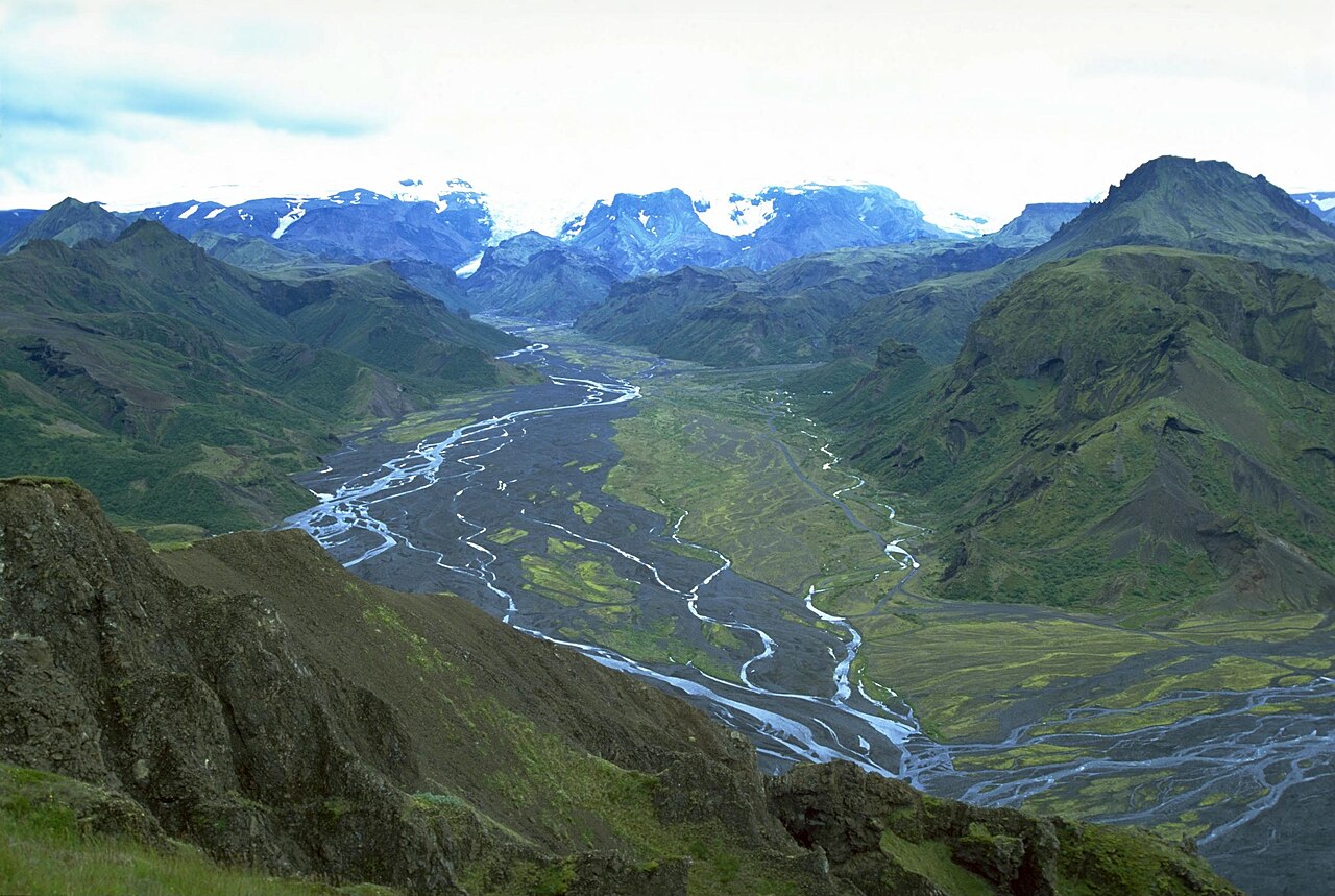 🏨Accommodation
Þórsmörk Volcano Huts
ÞórsmörkRun by Volcano Trails, the Húsadalur camp in Þórsmörk sits at the junction of two of Iceland's most popular long-distance routes: the Laugavegur trail from Landmannalaugar and the Fimmvörðuháls trail from Skógar. Both pass right through the site, so the huts see a steady flow of trail-finishers, day-hikers, and people using the valley as a base. Eyjafjallajökull glacier rises above the valley to the south. Accommodation ranges from shared dorm bunks to private rooms, shepherds' cottages, and glamping tents. The LavaGrill restaurant serves hot meals, and there is a sauna and a shallow natural pool on site — welcome after a long day on trail. Camping is also available. Getting here without a high-clearance 4x4 means taking one of the scheduled bus services that ford the glacial rivers on the approach road. Roads are generally open June through September. Book well in advance — July and August weekends fill fast with Laugavegur finishers.
Read details →Snæfellsnes
6 placesOften called "Iceland in miniature" because it packs active volcanoes, glaciers, black beaches, and steep mountains into one peninsula.
 👀Viewpoint
Kirkjufell
Kirkjufell is a 463-meter peak on the north coast of the Snæfellsnes Peninsula whose steeply curved profile makes it one of Iceland's most recognizable mountains. Formed as a nunatak — a summit that protruded above the ice sheet during glaciation — it became internationally famous as "Arrowhead Mountain" after featuring in Game of Thrones seasons 6 and 7. Its name means "Church Mountain," a nod to the steeple-like silhouette. The classic vantage point is across the road at Kirkjufellsfoss waterfall, where the small cascade frames the mountain behind it. The car park sits a few minutes west of Grundarfjörður on Route 54; the walk to the viewpoint takes only minutes. Come before mid-morning or in the evening to avoid tour buses. Climbing Kirkjufell is possible but genuinely dangerous: the upper sections are steep, loose, and exposed, and fatal accidents have occurred. Without a guide and solid hillwalking experience, don't attempt it. Most visitors spend around an hour photographing from the base, which is a completely satisfying way to experience the mountain.
Read details →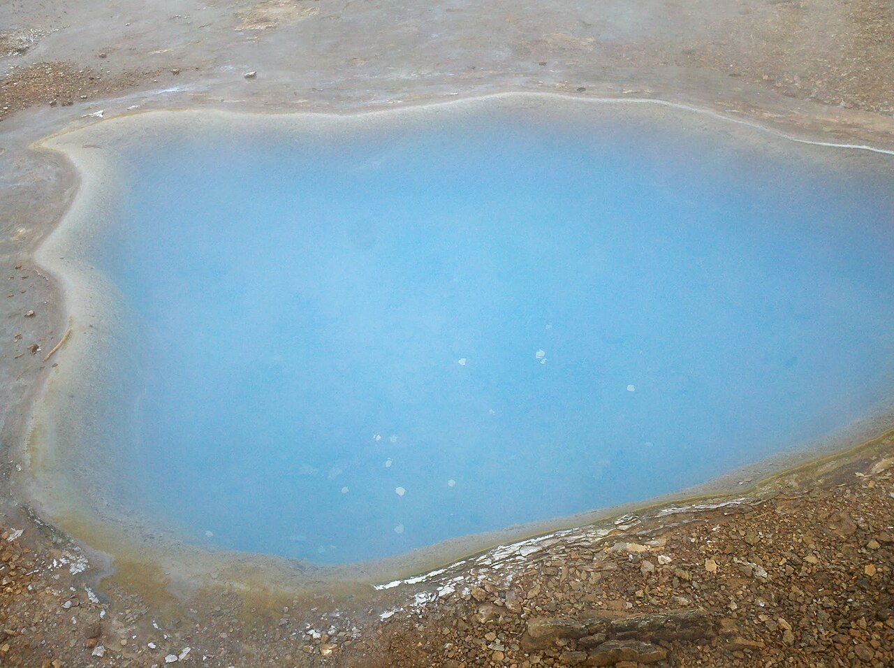 ♨️Hot Spring
Lýsuhólslaug
The pool at Lýsuhólslaug gets its colour from Chlorella algae in the mineral-rich spring water, giving it a murky green tint unlike any other swimming pool in Iceland. No chlorine is added; the water is drained and refilled regularly. The spring is naturally heated to around 37–39°C and contains calcium, magnesium, and carbonates. The pool sits on a working farm on the southern Snæfellsnes coast, with views toward the interior mountains. The facility is simple: changing rooms, showers, a main pool, and hot tubs. It dates to the 1940s when the farm owner built a pool around the spring. The rural setting and unusual water colour make it a quieter alternative to the region's busier tourist pools. The pool is seasonal — typically open June through mid-August, 11:00 to 21:00 daily. Dates can vary by year, so confirm before making the drive. The farm is reached via a gravel side road off Route 54, roughly halfway along the southern coast of the peninsula from Borgarnes. A small admission fee is charged at the gate.
Read details → ❄️Glacier
Snæfellsjökull National Park
SnæfellsjökullJules Verne sent his characters into the Earth through Snæfellsjökull's crater, and the volcano earns its mystique independently. The glacier-capped stratovolcano rises to 1,446 meters at the western tip of the Snæfellsnes peninsula and is visible from Reykjavík on clear days — about 120 kilometers across Faxaflói bay. Its last eruption was around 200 CE. The national park established in 2001 covers roughly 170 square kilometers. Within the park you'll find more than the glacier: the black pebble beach at Djúpalónssandur with historic lifting stones and shipwreck remains, the Saxhóll scoria crater with a staircase to panoramic views, and the twin sea-stack pillars of Lóndrangar rising from the shoreline. The visitor center at Malarrif has free entry. Roads inside the park are mostly gravel, manageable in summer with a standard car. Glacier summit hikes require a guide and proper equipment — the ice is crevassed. The park's other highlights are reached from roadside parking areas and most can be covered in a half-day loop from the Ring Road.
Read details →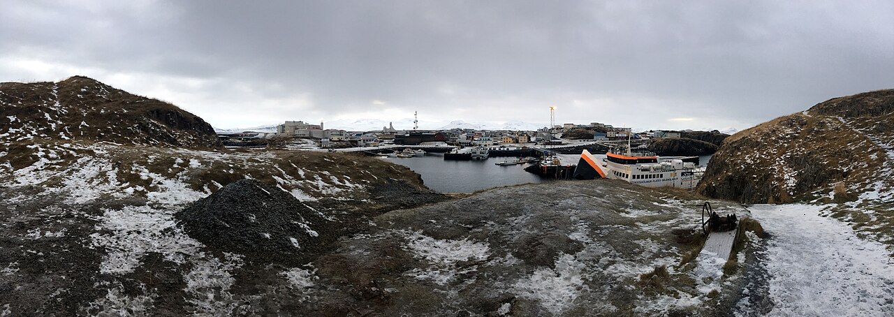 👀Viewpoint
Súgandisey Island
SúgandiseyA short causeway from Stykkishólmur's harbour connects the town to Súgandisey, a small basalt island topped by an orange cylindrical lighthouse relocated here from Grótta in Seltjarnarnes. From the top you get a full panorama: the colourful houses and distinctive church of Stykkishólmur below, and beyond them Breiðafjörður scattered with its many islands stretching toward the Westfjords. The island also shelters the harbour from northerly winds. The walk from the causeway car park to the lighthouse takes under ten minutes, with stone stairs climbing the cliff and benches at the higher levels for watching the light change over the water. The path can be slippery in winter. Nesting seabirds occupy the rock ledges in summer. Súgandisey is free, open at any hour, and takes around 30–45 minutes. It pairs well with a walk around Stykkishólmur itself or a meal before the Baldur ferry crossing to the Westfjords.
Read details →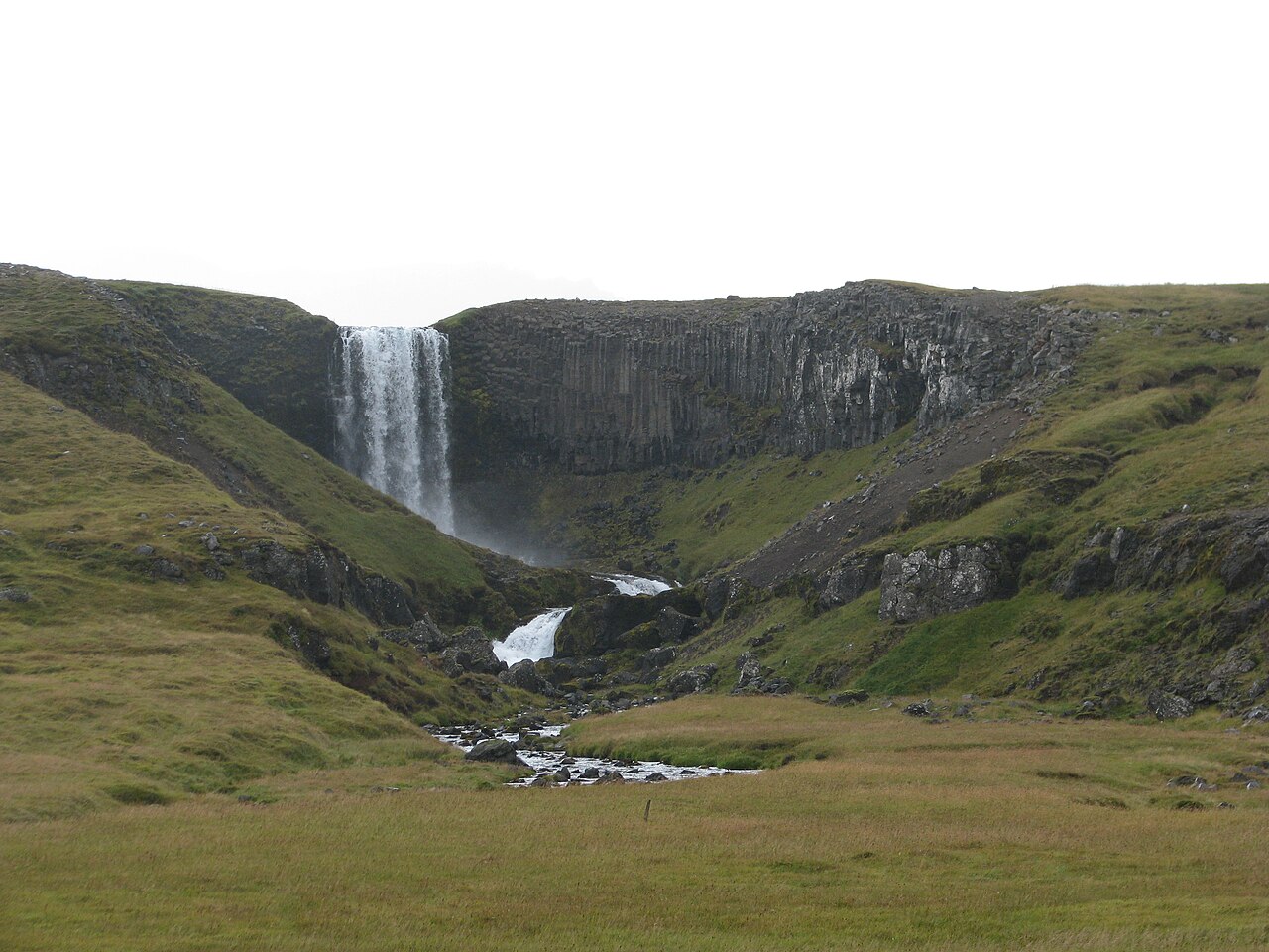 💧Waterfall
Svöðufoss
Svöðufoss drops over a basalt column cliff into the Hólmkelsá river on the northern edge of the Snæfellsnes Peninsula, with Snæfellsjökull glacier filling the skyline behind it on clear days. The combination of dark volcanic rock, white water, and the ice cap in the distance makes this one of the more photogenic small waterfalls on the peninsula. Access is via a dirt road branching off Route 574 between Ólafsvík and Rif, near a farm called Foss — not near Hellnar as some sources suggest. A small parking area sits at the trailhead, and the walk to the falls is about one kilometre, taking 15 to 30 minutes. The path is uneven in places with lava rock underfoot; sturdy footwear is worthwhile. A short path also lets you reach the top of the falls. Svöðufoss sees far fewer visitors than the famous glacier and coast stops on Route 574, so it rewards an early or late-day visit when the light hits the glacier backdrop well. The nearby waterfall Kerlingarfoss lies roughly two kilometres west if you want to pair the two.
Read details →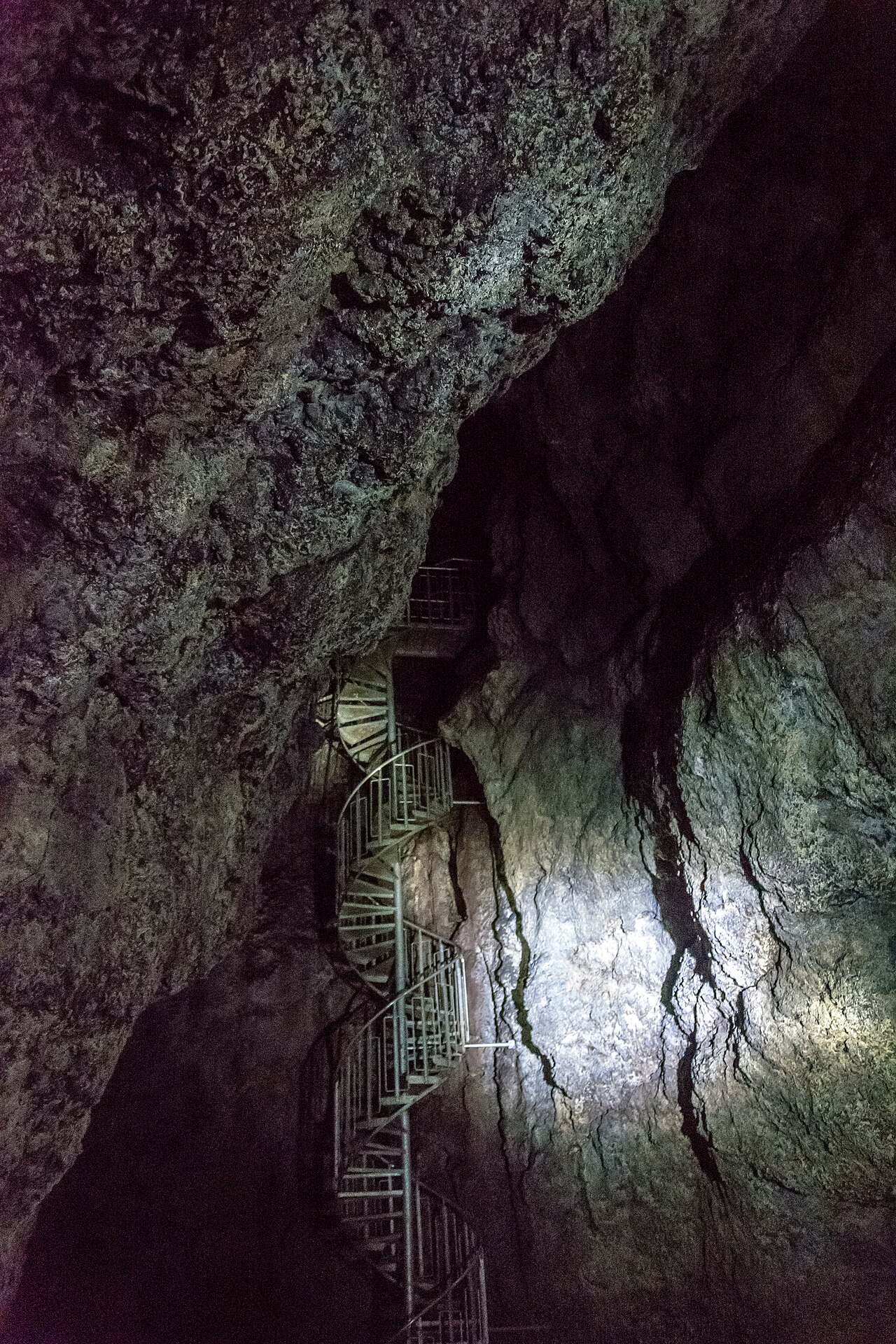 🕳️Cave
Vatnshellir Lava Cave
VatnshellirVatnshellir is an 8,000-year-old lava tube on the Snæfellsnes Peninsula, formed when lava from the Purkhólar crater family cooled on the surface while molten rock drained away below, leaving a hollow tube about 200 meters long. It descends 35 meters underground via a spiral staircase through three chambers; the 45-minute guided tour ends at the deepest point in near-total darkness. The cave holds just above freezing year-round — a warm layer is essential. Snæfellsjökull National Park requires approved guides for all visits; helmets and torches are provided. Tours run year-round, roughly hourly in summer and three times daily in winter. The cave is reached by a gravel road off the peninsula's main circuit. What to expect inside: this is a lava cave, so you get rough basalt surfaces, mineral color variations, and lava formations — not the dripping limestone formations of other cave systems. Book ahead in July and August when tours fill fast. The terrain is easy walking with staircase sections; most people with reasonable mobility handle it without trouble, though children must be able to walk independently.
Read details →Westfjords
15 placesA remote, mountainous region of dramatic fjords, nesting bird cliffs, thermal pools, and the multi-tiered Dynjandi waterfall.
 🏛️Museum
Arctic Fox Center
Iceland's only native land mammal has its own dedicated research centre in the village of Súðavík in the Westfjords. The Arctic Fox Centre opened in 2010 as a non-profit focused on the Arctic fox — its biology, population dynamics, and complicated history with humans, who hunted it heavily for fur before protections arrived. An outdoor enclosure gives visitors a close look at a live fox, typically a rescued animal that cannot be released. Súðavík was hit by an avalanche in January 1995 that killed 14 people including eight children — one of two deadly Westfjords avalanches that winter, a disaster that changed Iceland's approach to avalanche risk. The centre acknowledges this history, adding weight to what might otherwise feel purely nature-focused. Súðavík sits about 30 km south of Ísafjörður on paved road, a natural stop on any Westfjords loop. Open May through September (hours vary by month), with access by arrangement in winter — confirm before visiting. For wild fox encounters, Hornstrandir Nature Reserve is the best option; foxes there are unhunted and unusually approachable.
Read details →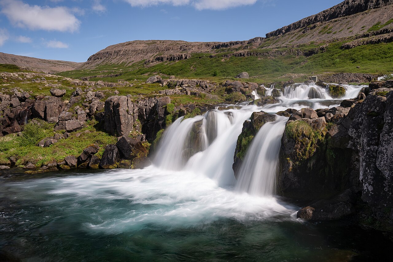 💧Waterfall
Bæjarfoss
Bæjarfoss tumbles down the steep mountainside directly above Ísafjörður, close enough that you can see it from the town's older streets. It's one of the most accessible waterfalls in the Westfjords — no drive required, no trail fee, just a walk from the town center. The falls carry snowmelt and mountain stream water, so flow is strongest in late spring and early summer; by late August it has often thinned considerably. In winter the cascade can partially freeze into dramatic ice formations. The walk up to a viewpoint near the base takes around 20 to 30 minutes each way on a path that gains elevation quickly. Wear footwear with grip — the trail becomes muddy or icy depending on season — and expect some scrambling on the upper section. The views back down over the fjord, the colorful corrugated-iron rooftops of Ísafjörður, and the mountains closing in on either side are a fair reward in themselves. This is an easy half-day add-on for anyone spending a night or two in Ísafjörður. The town has a small but functional tourist information center that can point you toward the current trailhead and advise on conditions. No facilities at the waterfall itself, but Ísafjörður has cafes and services a short walk away.
Read details → 🏖️Beach
Breiðavík Beach
Most of Iceland's beaches are black. Breiðavík is a sweep of golden sand over five kilometers long that faces west across the Atlantic, backed by green hills and framed by low headlands. On a bright afternoon the color contrast is genuinely jarring. The bay sits in the far southwest of the Westfjords, roughly 12 kilometers from the Látrabjarg bird cliffs — home to large puffin and razorbill colonies from May through August. Most visitors combine the two in a single day. Getting here takes commitment: Reykjavík is over 400 kilometers away and the drive runs at least six hours, with the final stretch on gravel roads that can be rough in wet conditions. A high-clearance vehicle is a good idea. There is a small hotel and restaurant at Breiðavík, making it a practical overnight base for catching the late-evening light or reaching Látrabjarg early. The beach is open coastline with no lifeguards, and the Atlantic stays cold year-round despite the inviting color. Budget an hour to walk end to end at a relaxed pace.
Read details →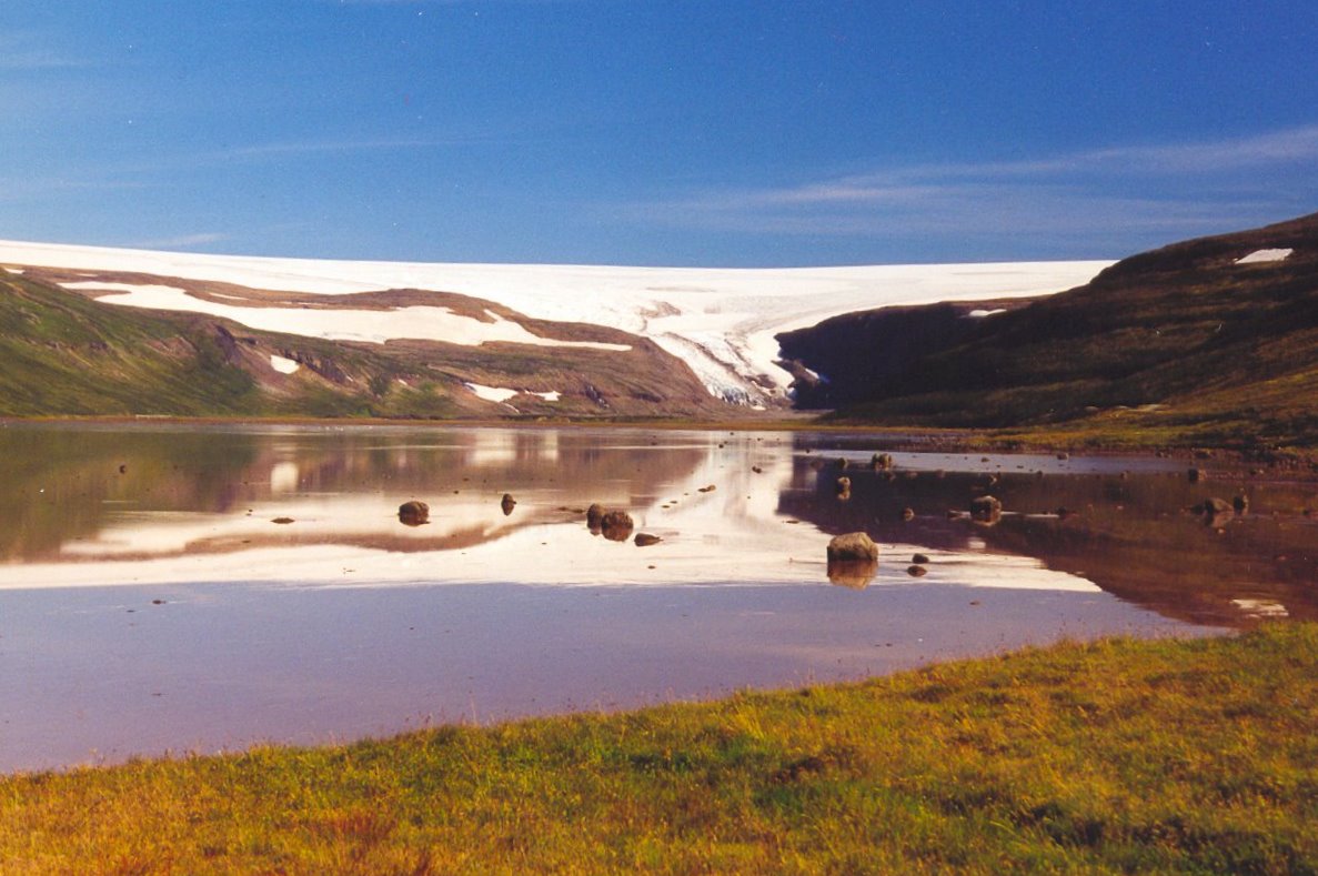 ❄️Glacier
Drangajökull
The northernmost glacier in Iceland, Drangajökull covers around 160 square kilometers in the remote Westfjords and tops out at 925 meters — the lowest-altitude ice cap in the country. While nearly every other Icelandic glacier retreated during the late twentieth century, Drangajökull held steady and even expanded during parts of that period. Researchers attribute this to the Westfjords' heavy snowfall and the cold sea currents around Hornstrandir to the north. Whether that stability continues as temperatures rise is uncertain. The most accessible approach is via Kaldalón fjord, where a glacier tongue descends toward the lagoon. Getting to the ice edge on foot is a serious undertaking — go with a guide or glacier-travel experience, as crevasse risk is real. The surrounding valley is spectacular and almost entirely empty of visitors. The Westfjords are genuinely remote; closest services are in Ísafjörður. Gravel roads to Kaldalón can be rough or impassable after heavy rain. Plan four hours at the site plus significant drive time. June through August gives the most reliable access.
Read details →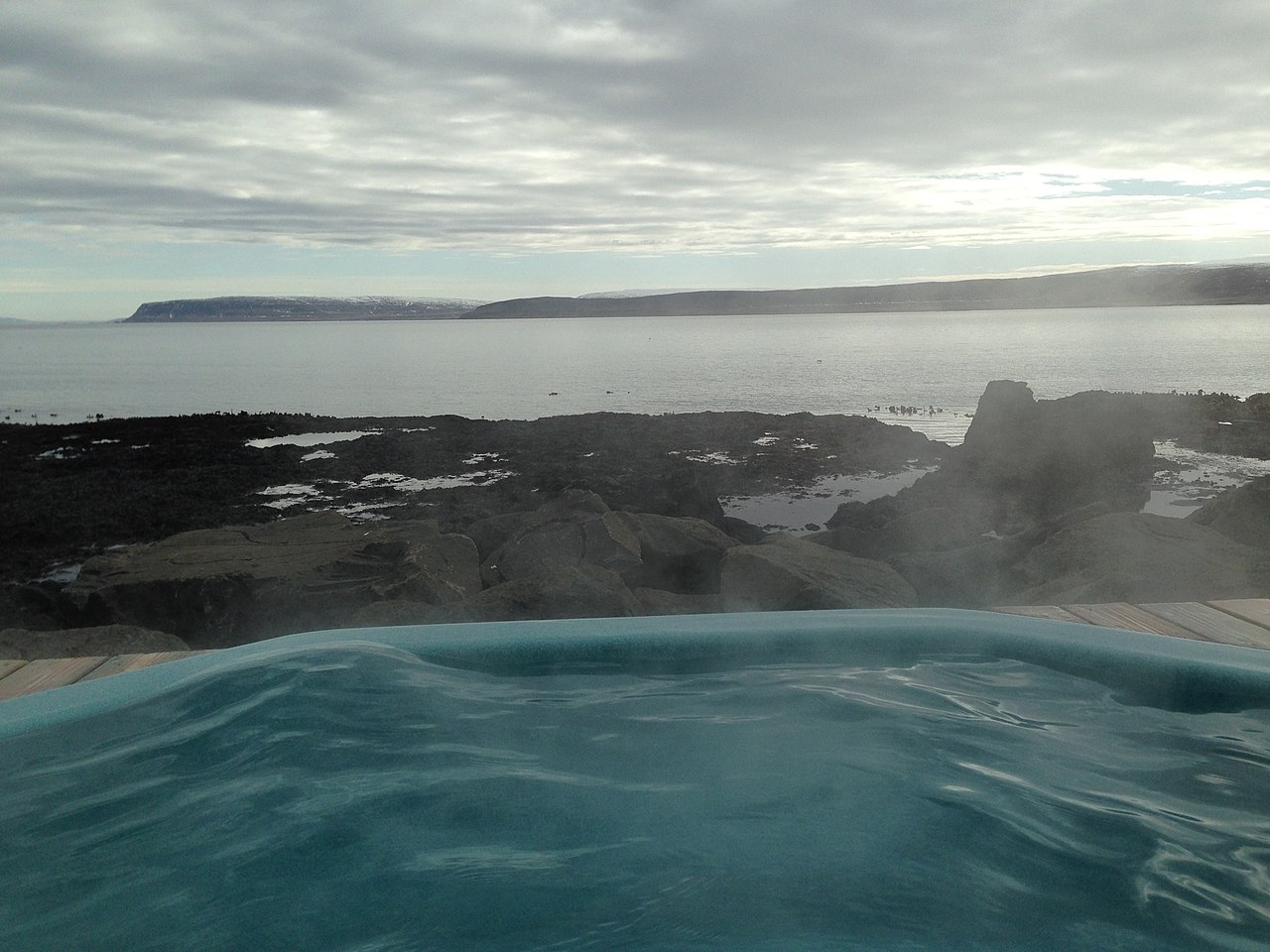 ♨️Hot Spring
Drangsnes Hot Pots
DrangsnesThree concrete geothermal pools sit right at the water's edge in Drangsnes village, looking out across Steingrímsfjörður toward the mountains on the far shore. They came about almost by accident: a drilling project in 1997 struck geothermal water, and the village built the pools shortly after. Each tub runs at a different temperature — cool, warm, and hot — so you can move between them. Admission is free. Drangsnes is a fishing village of fewer than a hundred people on the eastern edge of the Westfjords, and the pools double as the community social hub. On a weekday morning you are as likely to share the water with a local as with another tourist, which is rarer than it sounds in Iceland. Changing rooms and showers are across the street. The pools are open around the clock, year-round. Getting here requires some commitment: Road 645 runs through remote fjord country on a winding single-track. Budget at least 45 minutes from the Ring Road junction at Hólmavík. The remoteness is part of the appeal — the Westfjords do not reward rushing.
Read details → 💧Waterfall
Dynjandi
Dynjandi — also called Fjallfoss — drops around 100 metres in a wide bridal-veil shape that fans from roughly 30 metres across at the top to about 60 metres at the base. The name means "thunderous," and from close up the sound earns it. Protected as a natural monument since 1981, the trapezoidal spread gives it a look unlike anything else in Iceland. The path from the parking area climbs through five smaller cascades — Bæjarfoss, Hrísvaðsfoss, Göngumannafoss, Strompgljúfrafoss, and Hæstahjallafoss — before reaching the base of the main falls. The walk takes 15 to 30 minutes; budget extra time at each lower fall. Camping near Dynjandi is not permitted — nearest sites are in Flókalundur or Þingeyri. Reaching Dynjandi means gravel roads through the Westfjords, around 85 kilometres from Ísafjörður. Mountain passes in the area can close in winter with little warning, making this realistically a summer destination despite the open year-round listing. June through August gives the most reliable access.
Read details → 🏛️Historic Site
Garðar BA 64 Shipwreck
Garðar BA 64The Garðar BA 64 is Iceland's oldest steel ship, a 1912-built Norwegian whaling vessel that was run aground in the Skápadalur valley along the shore of Patreksfjörður in 1981 after being declared unfit for service. Now resting at a steep angle on the tidal flats, the rusted hulk stretches roughly 73 metres and is one of the most photographed shipwrecks in the country. Originally named Globe IV, the ship later served as a fishing and whaling vessel under Icelandic registration before ending its working life. Entry and parking are completely free, with a large gravel parking area right off Road 612. To reach the wreck, drive west on Route 62 from Patreksfjörður, then turn onto Road 612 and continue about 3 kilometres south along the fjord shore. Road 612 is an unpaved gravel road, not an F-road, so a standard car can manage in dry summer conditions, though a 4x4 is advisable in wet weather or winter. The shipwreck sits at beach level and can be approached on foot from the parking area in just a few minutes. For safety reasons, do not climb inside the hull — structural integrity has deteriorated significantly over the decades. The wreck is accessible around the clock and makes a striking subject at any light, but the window between May and September brings the most reliable weather and longest days. During storms the wreck takes on a particularly dramatic character, though conditions on this exposed fjord can shift quickly. Photo: Eric Kilby / Wikimedia Commons (CC BY-SA 2.0)
Read details →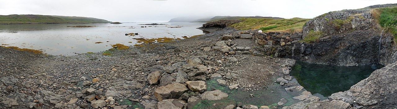 ♨️Hot Spring
Hellulaug
Hellulaug sits right beside Route 60 in the Vatnsfjörður Nature Reserve — a small stone-walled pool at the rocky shore with the fjord stretching out just meters away. The water hovers around 38–40°C year-round and holds maybe eight to ten people. There are no facilities: no changing rooms, no café, no staff. Just a short path from a roadside parking area and a view across the water to dark mountains. The spring is about 1.5 km west of Flókalundur. Dynjandi waterfall is roughly 36 km north, about 30 minutes up Route 60, so the two fit naturally into the same day. Because the Westfjords see far fewer visitors than the south or north of Iceland, this pool stays quiet even in July — a genuine contrast to the crowded commercial pools elsewhere. Getting here from Reykjavík takes roughly four to five hours of driving, so most visitors are staying overnight in the Westfjords or treating this as part of a longer regional loop. Bring a towel and swimsuit; no other preparation is needed.
Read details →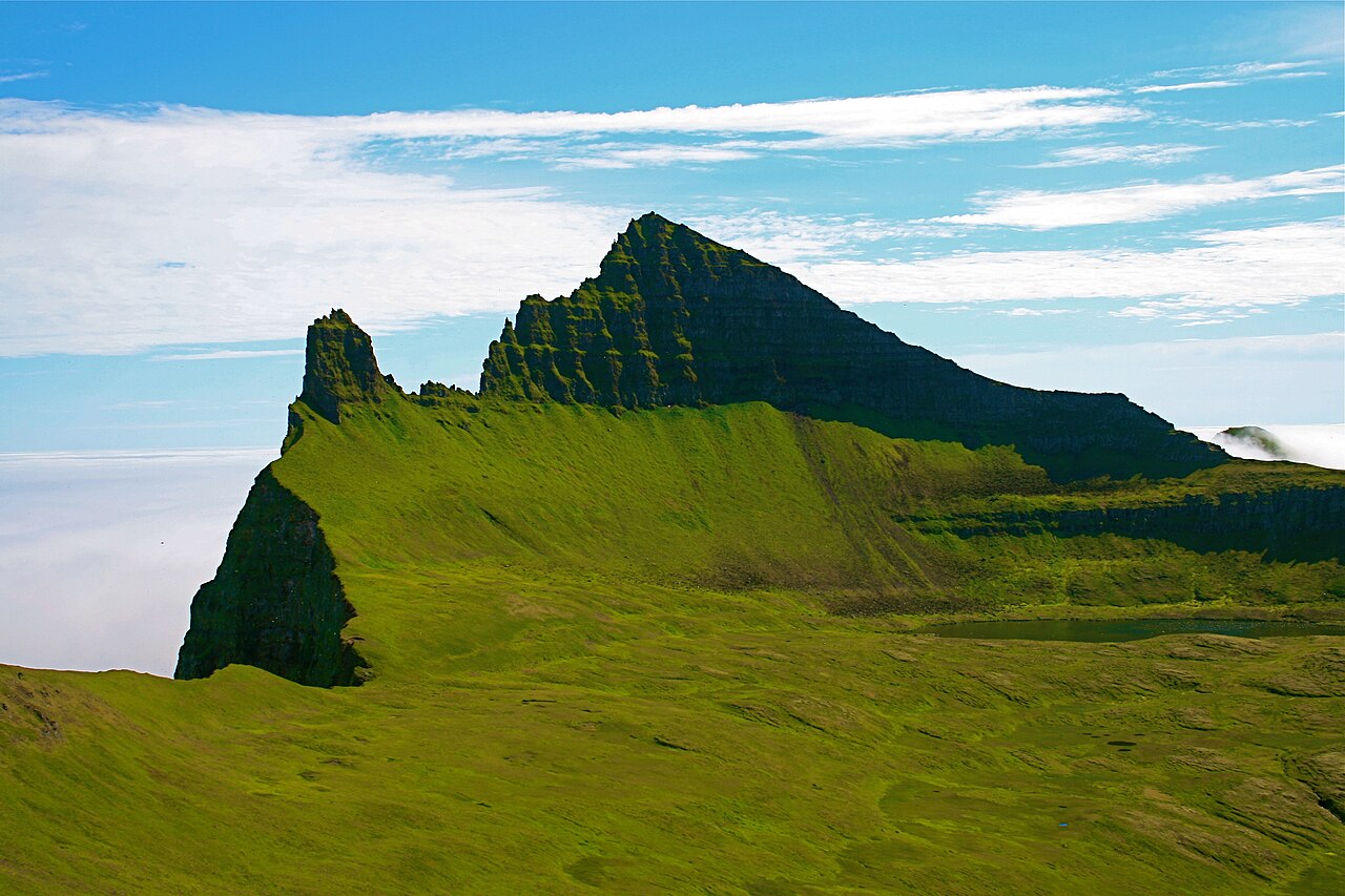 🐧Puffin Colony
Hornbjarg Cliffs
HornbjargHornbjarg rises from the Arctic Ocean at the northern tip of Hornstrandir, its highest point reaching around 535 meters. The cliff face drops almost sheer to the water, and from late May through July the ledges hold hundreds of thousands of breeding seabirds: common and Brünnich's guillemots, razorbills, kittiwakes, fulmars, and puffins. The noise and smell reach you before the birds come into view. There are no roads into Hornstrandir. The standard approach is a boat from Ísafjörður to Hornvík bay, followed by a hike of several hours to the cliff viewpoints. The terrain is steep and not uniformly marked, and coastal weather in the far northwest closes in without warning. Some boat-based tours also circle the cliffs from the sea. Either way, the price in the structured data reflects the boat transfer cost — the cliffs themselves are within an open nature reserve. June through early August is the only realistic window: boats run, birds are present, and daylight is near-continuous. Outside that window there is no regular boat service and the seabirds are gone.
Read details → 🥾Hiking Trail
Hornstrandir Nature Reserve
HornstrandirHornstrandir covers roughly 580 square kilometers at the far northwest tip of Iceland's Westfjords — no roads, no permanent residents since the 1950s, and no infrastructure beyond basic huts and designated campsites. Arctic foxes have been protected here since 1994 and show it: they'll walk within meters of people. The sea cliffs along the north coast rank among Europe's tallest bird cliffs. The only way in is by boat from Ísafjörður or Bolungarvík, one to two hours depending on destination. Schedules are weather-dependent and July seats fill fast — book weeks ahead. The season runs roughly mid-June to mid-August. Day trips to Hesteyri work, but multi-day stays reveal far more. Popular routes include the Hornvík day loop (around six to seven hours) and the Royal Horn, a four to five-day traverse. Self-sufficiency is not optional. There are no shops, emergency response is slow, and mobile coverage is mostly absent. Bring all food, a weatherproof tent, and navigation tools. The reward is a wilderness with no real equivalent elsewhere in western Europe.
Read details → 🏘️Town
Ísafjörður
Perched on a narrow sand spit jutting into Skutulsfjörður, Ísafjörður is the hub of the Westfjords — a region accounting for roughly half of Iceland's coastline yet holding barely a thousand people outside the town itself. Around 2,700 residents support a hospital, university centre, airport, and a restaurant scene livelier than the population suggests. The old quarter, Neðstikaupstaður, holds some of Iceland's oldest surviving timber-frame houses, dating to the eighteenth century, now used as museums and eateries. Summer ferries leave from here for Hornstrandir Nature Reserve, an uninhabited peninsula to the north favored by hikers wanting days without a road. Every Easter the town hosts Aldrei fór ég suður — "I never went south" — a free community music festival running since 2004. Getting here from Reykjavík takes around five to six hours by road (roughly 450 km), the final stretch winding through fjords and mountain tunnels. Flights take 35 minutes and are practical, though the drive through increasingly dramatic scenery is half the reason to come.
Read details → 🐧Puffin Colony
Látrabjarg Cliffs
LátrabjargAt the far western tip of Iceland, a wall of cliffs stretches 14 kilometres along the coast and rises up to 440 metres above the Atlantic — the largest seabird cliff in Europe. Látrabjarg hosts puffins, razorbills, guillemots, kittiwakes, and fulmars in extraordinary concentrations. The razorbill colony here holds a substantial share of the global breeding population. What sets the cliffs apart is the birds' unusual tolerance: puffins nesting in burrows at the edge let you sit quietly within a few metres. The season runs from around mid-May through August. Getting here requires a long drive into the Westfjords on gravel through remote terrain. The lighthouse at Bjargtangar, at the cliff's tip, is the westernmost lighthouse in Europe. Walking the cliff top is easy underfoot, but stay well back from the edge — it is undercut in places and crumbles. Never approach in strong wind. Breiðavík beach nearby has accommodation for those splitting the drive. The red-sand beach at Rauðasandur and Patreksfjörður village are useful on the return. No visitor facilities at the cliffs themselves.
Read details → 🏘️Town
Patreksfjörður Birds
Patreksfjörður, population around 700, is the main service hub for the southwestern Westfjords — the place to refuel, stock groceries, and sleep before tackling the roads to Látrabjarg and Rauðisandur. Látrabjarg, Iceland's largest seabird cliff at over 440 meters high and 14 kilometers long, lies about 60 kilometers west on a mixed paved-and-gravel route. Rauðisandur's red-sand beach is a similar distance south. Two nights here is sensible. The town sits on the southern shore of its namesake fjord, with steep hillsides behind it. There's a swimming pool, supermarket, fuel, and varied accommodation. A small museum covers local history, and the harbor keeps a working fishing character. The Baldur car ferry departs from Brjánslækur — about 45 minutes northeast — and crosses Breiðafjörður bay to Stykkishólmur on the Snæfellsnes peninsula, stopping at Flatey island. The crossing takes roughly 2.5 hours and carries vehicles, offering a practical exit without retracing the long drive in. Seabird season at Látrabjarg runs May through August.
Read details →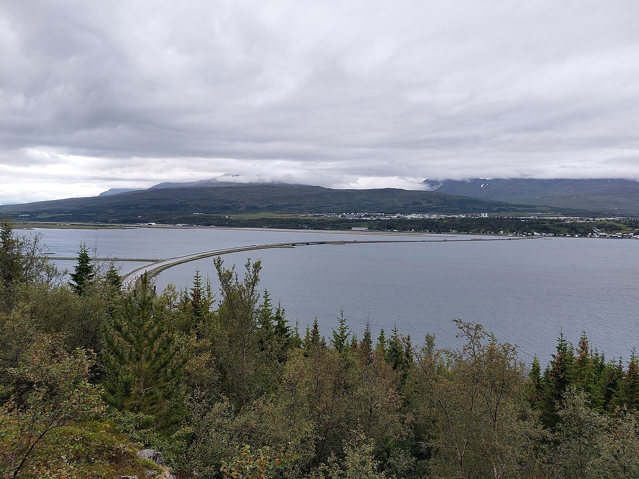 ♨️Hot Spring
Pollurinn
About four kilometres outside the small village of Tálknafjörður, tucked against a hillside with a view down the fjord, Pollurinn is a set of four concrete pools fed by the same geothermal source that heats the village's homes. Temperatures range from around 36 to 46 degrees Celsius across the pools. There is no dedicated cooler swimming pool — just the four hot pots at varying intensities, with a hose available to dial things back when needed. The setup is simple: a small changing cabin, an outdoor shower, no toilets, no café, no fee, no booking. Bring your own towel and swimwear. There is no formal signage from the road, so use GPS (65.6491, -23.8945) or ask locally. In winter, soaking here while northern lights move over the fjord is one of the better arguments for visiting the Westfjords. Tálknafjörður is roughly five hours from Reykjavík, so this fits naturally into a multi-day loop through the region rather than a standalone day trip.
Read details → 🏖️Beach
Rauðisandur Beach
RauðisandurThe sand at Rauðisandur is genuinely red — copper and amber and pink, the result of scallop shells ground to powder and mixed with coastal sediment over centuries. The 10-kilometer beach faces Breiðafjörður bay, and the color shifts noticeably with weather: sunny afternoons push it toward deep rust and gold, overcast days flatten it toward grey. Seals haul out along the shoreline. Getting there is a commitment. The final descent is Road 614, a steep, guardrail-free mountain track with sharp switchbacks — slow and careful in a regular car, and check conditions outside summer. At the beach you'll find the small black church Saurbæjarkirkja, a cafe serving waffles with sea views, and a campsite at Melanes. The abandoned farm at Sjöundá nearby was the scene of a notorious 19th-century murder case. No facilities at the beach itself; bring water and layers, as the wind off the bay can be sharp. Budget around 90 minutes for the sand, but the drive through the Westfjords is much of the experience.
Read details →North
25 placesA diverse volcanic wonderland around Lake Mývatn, filled with bubbling mud pots, geothermal baths, and whale-watching ports.
 🏘️Town
Akureyri
The heart-shaped red traffic lights at Akureyri's intersections arrived after Iceland's 2008 financial crisis as part of a community campaign to lift spirits, and they've become one of the country's most photographed oddities. Akureyri sits at the head of Eyjafjörður, Iceland's longest fjord, about 100 km south of the Arctic Circle, and with roughly 20,000 residents it is Iceland's second-largest urban area. The town has an unusually warm microclimate that supports a botanical garden and a ski resort (Hlíðarfjall, just west of town). The Akureyrarkirkja church dominates the skyline from its hillside above the compact harbor center. Flights from Reykjavík take around 45 minutes, and the town serves as the main hub for the north, with Mývatn, Húsavík, and Goðafoss all within a day's reach. Plan a full day here before or after heading into the wider region. The geothermal pool is worth a stop, the restaurant scene punches above the town's size, and in summer the festival calendar fills quickly. In winter the northern lights draw visitors and the ski slopes see steady local use.
Read details →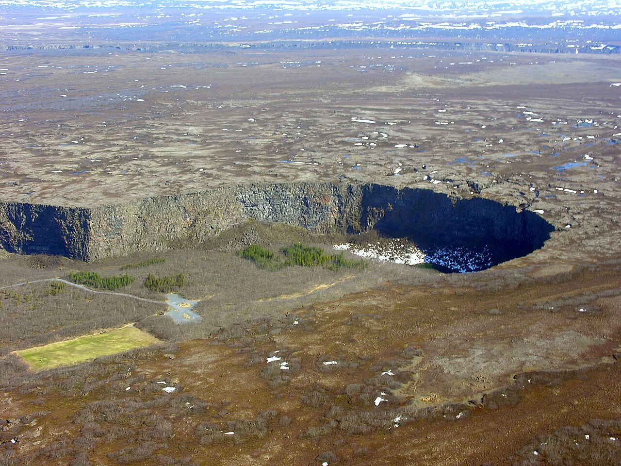 🥾Hiking Trail
Ásbyrgi Odin
Ásbyrgi is a horseshoe-shaped canyon in northeast Iceland, about 3.5 km long and over a kilometre wide, with cliffs rising up to 100 metres on three sides. The floor surprises: enclosed birch and willow woodland that feels nothing like the open tundra outside. Geologists credit catastrophic glacial floods from the Jökulsá á Fjöllum river — two events, roughly 8,000–10,000 years ago and again around 3,000 years ago. A 25-metre rock outcrop called Eyjan divides the canyon's middle; Botnstjörn pond at its head draws waterfowl. Norse legend reads it as Sleipnir's hoofprint, the eight-legged horse of Odin. Trails leave the parking area: the Botnstjörn walk is about 1 km and flat; the Eyjan loop adds wooden steps and a rim-level view into the canyon. The Gljúfrastofa Visitor Centre runs June through September, and a campground is open mid-May to mid-September. Ásbyrgi is in Vatnajökull National Park, 38 km east of Húsavík. Pair it with Dettifoss and Hljóðaklettar for a day in the Jökulsárgljúfur canyon system. From Reykjavík it is over 500 km — overnight in the north.
Read details → 🏘️Town
Dalvík
Whale watching, a ferry to the Arctic Circle, and some of Iceland's best skiing in a town of around 1,400 people — Dalvík delivers more than its size suggests. About 45 km north of Akureyri (roughly 35 minutes on paved road), it runs whale watching tours from the harbor where humpbacks, minke whales, white-beaked dolphins, and harbor porpoises are regularly spotted. Fewer boats than Akureyri means the tours tend to be quieter and more personal. The ferry Sæfari runs year-round to Grímsey, Iceland's northernmost inhabited island on the Arctic Circle. The Böggvisstaðafjall ski area draws competitive skiers from across the country in winter; summer brings hiking into the Tröllaskagi mountains with fjord views below. Every August, Fiskidagurinn mikli — the Great Fish Day — offers a free outdoor seafood buffet, live music, and fireworks. The Hvoll Folk Museum covers local history including the 1934 earthquake (magnitude 6.3), which damaged much of the settlement and displaced around 200 residents. The town pool and hot tubs make a good end to the day.
Read details → 👀Viewpoint
Dimmuborgir
About two kilometers east of Lake Mývatn, a lava field that erupted around 2,300 years ago cooled into one of Iceland's strangest landscapes. Dimmuborgir — "Dark Castles" — formed when molten lava overran a wet marsh; steam shattered and sculpted the cooling rock from within, leaving columns up to 20 meters tall and a cave system you can walk through. The standout is Kirkjan, a lava tube open at both ends whose vaulted interior resembles a Gothic cathedral nave. In Icelandic Christmas tradition, Grýla and her 13 Yule Lads are said to live here. Several marked trails loop through the field. The Church Route (Kirkjuhringurinn) is roughly 2.4 kilometers and takes about an hour, passing the main named formations. Wheelchair-accessible paths run alongside the more rugged options. Ravens, ptarmigan, and raptors are regularly spotted. Dimmuborgir is just off Route 848, about 5 minutes from the Mývatn Nature Baths, with a car park and small café on site. Entry is free and the area is open at all hours; trails become icy from October through April.
Read details → 👀Viewpoint
Drangey
A flat-topped volcanic island rising around 180 metres out of Skagafjörður, Drangey is the remnant of a volcano that solidified roughly 700,000 years ago. Its sheer palagonite cliffs look essentially unclimbable — which is precisely why Grettir the Strong, the outlaw hero of Grettis saga, used it as a refuge. He and his brother held out here for three years before enemies finally reached them in 1031 AD. The only way up is a single steep path fitted with ropes and ladders. Guided boat tours run daily from Sauðárkrókur marina from June through mid-August, each trip lasting around four hours. The climb is manageable for most people but involves real exposure — if heights bother you, the boat ride and cliff views are still worth the trip. The clifftops support large seabird colonies: puffins, guillemots, kittiwakes, and fulmars all nest here, and in summer the noise around the cliffs is relentless. Book through Drangey Tours (drangey.net) well in advance in summer. Sauðárkrókur is roughly two hours from Akureyri. Tours also run in May by prior arrangement.
Read details → ♨️Hot Spring
Forest Lagoon
SkógarböðinForest Lagoon (Skógarböðin) is a geothermal spa that opened in May 2022 in Vaðlaskógur, a birch and pine forest on the eastern shore of Eyjafjörður fjord, 3.6 km from central Akureyri. The hot spring source was discovered accidentally in 2015 when workers drilling the Vaðlaheiðargöng road tunnel struck a naturally hot geothermal spring. The spa is designed by Basalt Architects, the same firm behind the Blue Lagoon expansion, and features two outdoor infinity pools held at around 38–40°C, a sauna, a cold plunge pool, and swim-up bars. The larger pool covers 530 m² and the smaller 330 m², together accommodating up to 200 guests at a time. Getting there is straightforward: the facility is just off Route 1 (the Ring Road) with a free car park on site. Tickets are not tied to a time slot. The base adult entry (the Warm tier) costs 7,490 ISK and covers pool access only; packages that include a towel and a drink start at 10,150 ISK. Towel rental alone is 1,400 ISK. Children aged 6–15 pay 3,790 ISK; under-5s are free. Payment is accepted in Icelandic currency on-site, so bring a card — only ISK is accepted at the facility. The setting distinguishes the spa from Iceland's other commercial geothermal pools: the tree canopy provides wind shelter and a forested backdrop, and on clear days the view stretches across Eyjafjörður, Iceland's longest fjord. The Forest Bistro serves food from roughly 11am to 8pm. Winter visits are popular, with snow-covered trees surrounding the warm water, though the pools operate identically year-round. Image: Forest Lagoon / forestlagoon.is
Read details → ♨️Hot Spring
GeoSea
Three infinity pools of heated seawater sit on the Húsavíkurhöfði cape, 49 meters above Skjálfandi Bay — the same bay where whale-watching boats operate out of Húsavík below. GeoSea fills its pools from geothermal boreholes rather than the usual Icelandic freshwater springs, so the water carries a mild saltiness and mineral content said to benefit the skin. Temperature holds steady at 38–39°C year-round with constant fresh flow and no chemicals added. The site is built from local lava rock and slate, with three pools stepping down the cliff at different levels and temperatures. The largest catches the widest panorama; the smallest and warmest sits tucked to one side. A swim-up bar and bistro are on site. On clear winter nights, the northern lights are visible from the pools without moving. GeoSea is a paid attraction — adult admission runs around 7,490 ISK, with lower rates for children and seniors. Booking ahead is strongly recommended from June through August, when capacity fills quickly. Winter hours are shorter (roughly 17:00–22:00); summer stretches to 23:00. The facility sits a short walk from Húsavík's harbour.
Read details → 🏛️Museum
Glaumbær Farm
A farm has stood on this mound in Skagafjörður since Iceland's settlement era, and the thirteen interconnected turf buildings now open at Glaumbær date from the mid-18th to late 19th centuries. All are under turf roofs and furnished to reflect daily life from the period: the communal baðstofa where the entire household slept and worked sits at the far end, past the kitchen, pantries, and workrooms. A reconstructed 1849 wooden sitting room called Gilsstofa shows what modest prosperity looked like by that era. The museum is open daily from late May through mid-September, with weekday-only hours in April and late October; outside those dates, visits are by appointment only. Admission is around 2,200 ISK for adults; children under 18 enter free. The Áskaffi café next door, housed in a timber building from the same era, serves coffee and traditional cakes. Glaumbær is a 7-minute drive from Varmahlíð on the Ring Road — a logical stop if you're driving the north of Iceland. It pairs well with Víðimýri Turf Church a few kilometers away. Budget an hour for the farmhouse itself.
Read details → 💧Waterfall
Goðafoss
The Skjálfandafljót river drops 12 meters over a horseshoe-shaped ledge about 30 meters wide — one of northern Iceland's most accessible waterfalls, right beside the Ring Road between Akureyri and Mývatn, roughly 45 minutes from either. No hiking required, no entrance fee, paved paths on both banks. The west bank gives you the classic frontal view of the full width. The east bank is worth the short drive over the bridge: a path drops closer to the waterline, basalt columns appear across the river, and the spray is heavier. A loop trail of around 3 km connects both sides if you want to walk the full circuit rather than drive. The name means "Waterfall of the Gods," tied to the story of lawspeaker Þorgeir Ljósvetningagoði throwing his Norse idol statues into the falls when Iceland converted to Christianity around 1000 AD. Historians note this detail doesn't appear in the earliest sources and was likely added centuries later, but the name stuck. The falls look particularly dramatic in winter when ice builds along the edges, and they are open and free at any hour year-round.
Read details → 👀Viewpoint
Goðafoss East Bank
Most visitors to Goðafoss stop on the west bank and call it done, but the east bank gives you a different and often better experience. A separate parking area sits on the east side of the Ring Road bridge, and a short path leads down toward the water, getting you closer to the falls than anything on the west side allows. From here you see the basalt columns on the opposite bank framed behind the cascade, and the horseshoe shape of the falls wraps around you rather than sitting flat ahead. Morning light works well on this side — afternoon sun comes from the west and can backlight the falls. In high flow, spray reaches the path, so expect to get damp if you go close. The east bank parking area is smaller and fills up less quickly than the main west-side lot, which coaches tend to occupy. Both banks are open year-round, free to visit, and linked by a short loop trail if you prefer to walk between them rather than drive. A full visit to both sides takes around an hour at an easy pace.
Read details → ♨️Hot Spring
Grettislaug Saga
Two small stone-lined pools sit on the shore of Skagafjörður, looking out at Drangey — the flat-topped island where the outlaw Grettir the Strong made his final stand. According to the Saga of Grettir, he swam roughly six kilometers from the island to shore and warmed himself in these springs. The pools bear his name and that of a local figure. The originals were lost to storms in the early 20th century and rebuilt in 1992, but the setting is unchanged: cold sea air, black stones, and Drangey's silhouette on the horizon. Water temperature runs around 39°C — comfortable for a long soak. Basic changing facilities are on site but there are no showers; bring your own towel. There is a small entrance fee. The pools hold only a handful of people at once, so early morning or evening visits give you a better chance of having them to yourself. Route 748 runs north from Sauðárkrókur along the coast on gravel for much of the way, ending at the pools. Plan around an hour for the soak plus the drive. Verify current road conditions locally before setting out.
Read details → 🐧Puffin Colony
Grímsey Arctic Circle
Grímsey is the only part of Iceland that sits inside the Arctic Circle — a small island of around 5 square kilometers, 41 kilometers off the north coast. Fewer than 100 people live here, and from May through September the cliffs host large seabird colonies — puffins, razorbills, guillemots, kittiwakes, and fulmars. The east cliffs rise over 100 meters from the water, and Arctic terns defend their nests aggressively enough in summer that the cliff path requires keeping your head down. Getting here takes a 20-minute flight from Akureyri or the Sæfari ferry from Dalvík, about three hours each way. The ferry runs several times weekly, arriving around noon and departing around 4pm — day-trippers get about four hours, enough to walk the perimeter path and find the concrete sphere marking the Arctic Circle. Around the solstice, the sun stays above the horizon around the clock. Mid-June is generally the best time: puffins are actively nesting and the daylight is continuous. The island has a small guesthouse, and the ferry north passes waters where whale sightings are common.
Read details → 🕳️Cave
Grjótagjá Cave
GrjótagjáA narrow crack in a lava ridge north of Lake Mývatn opens into Grjótagjá, a small cave containing one of the most striking geothermal pools in Iceland — electric blue water glowing in near-darkness, framed by rough volcanic rock. The cave formed along a fissure in the rift system pulling the North American and Eurasian plates apart. For generations, locals bathed here, but Krafla eruptions between 1975 and 1984 drove the water above 50°C. It has cooled somewhat since, but bathing remains prohibited. The cave sits on private land — respect any posted signs. You can still walk inside and descend to the water's edge. The entrance is a small opening in the lava ridge near a parking area off Route 848, about 3 km east of Reykjahlíð. Hverfjall crater is close by, and most visitors combine the two stops. Grjótagjá appeared in Season 3 of Game of Thrones, though the scene was recreated in a studio; the actual cave is smaller and more intimate than it looked on screen. Budget about 20 to 30 minutes. Free to enter year-round.
Read details → ♨️Hot Spring
Hofsós Infinity
Hofsós opened its geothermal pool on the edge of Skagafjörður fjord in 2010, and the design is quietly clever: the infinity edge aligns the water's surface with the fjord, so when you're floating in the 30°C water your eye line meets the open sea directly and Drangey island rises from it like a sentinel. The main pool is 25 by 10.5 meters with a hotter tub alongside. This is a municipal pool, not a spa — modest facilities, honest prices — and that's exactly what makes it work. Getting here requires a car; public transport to Hofsós is sparse. From Akureyri it's roughly 1.5 to 2 hours along the Tröllaskagi peninsula on Road 76. Summer hours run from early morning until 9 PM, with shorter windows in winter. Crowds are lighter than the famous Blue Lagoon, but the pool gets busy on sunny summer afternoons — early morning is quietest. The village itself is small and genuinely historic, with the Icelandic Emigration Center documenting the thousands who left for North America in the 19th century. Budget an hour in the pool and another for the village if that history interests you.
Read details → 🏘️Town
Húsavík
Skjálfandi Bay's cold, nutrient-rich waters draw humpbacks, minkes, and occasionally blue whales close enough that tours routinely deliver sightings within an hour of leaving the pier. Húsavík has run whale watching since the 1990s — multiple operators, oak sailing vessels and RIBs, tours from April through October, up to 23 species recorded in the bay. The town is worth exploring beyond the harbour. The wooden 1907 church with a red roof overlooking the water is one of North Iceland's most photographed. The Whale Museum holds 13 real skeletons including a blue whale. GeoSea, an infinity-pool geothermal bath on the cliffs north of the harbour, has direct views over the bay. The 2020 Will Ferrell film Eurovision Song Contest: The Story of Fire Saga was filmed here, and the harbour district is recognisable from it. Húsavík is on Route 85 about an hour north of Akureyri, on the Diamond Circle route that takes in Ásbyrgi and Dettifoss. Whale watching, the museum, and GeoSea fill a full day. Accommodation ranges from hotels to guesthouses, with good seafood restaurants throughout.
Read details → 🏛️Museum
Húsavík Whale Museum
Thirteen real whale skeletons hang inside the Húsavík Whale Museum, including a complete blue whale — one of only a handful on public display anywhere in the world. The museum occupies a former harbourside slaughterhouse, and the building's scale suits the subject: the blue whale skeleton alone fills much of the main hall. Other species include sperm whale, narwhal, and several rarely seen beaked whales. More than eight rooms cover whale biology, migration, acoustics, and Iceland's history of whaling. A cinema runs documentaries; audio guides are free. Founded in 1997, it is among the most respected cetacean museums in Europe. It works well as a primer before a whale watching tour, or as a way to identify what you saw afterwards. Admission is around 2,650 ISK for adults; children 16 and under enter free. Summer hours are roughly 9am–6pm, winter 10am–4pm. The museum is steps from the whale watching piers in Húsavík harbour. An hour is a minimum — the depth of the exhibits rewards more time if you have it.
Read details → 🌋Volcano
Hverfjall
Hverfjall is a near-perfect circle of black tephra rising about 420 metres above sea level on the eastern edge of Lake Mývatn, its rim so symmetrical it looks almost engineered. The crater formed around 2,500 years ago when rising magma hit groundwater and detonated, flinging volcanic fragments outward. The result is a roughly one-kilometre-wide bowl dropping around 140 metres to a flat floor of grey cinder. Two marked paths reach the rim: a steeper southern route (around 20 to 30 minutes) and a gentler northern trail. Once on top, a trail circles the crater in about 3.5 km, alternating views of the Mývatn lake district to the west and open volcanic terrain to the east. The tephra surface erodes easily — stay on marked paths; shortcuts have left visible scarring. Hverfjall sits just off Road 848 near Mývatn, close to Dimmuborgir's lava formations, so most visitors combine both in a half-day loop. The site is free and draws sizeable crowds in July and August; summer mornings are the quietest. Winter access is possible but the path can be icy.
Read details → 🌋Volcano
Krafla
The Krafla Fires of 1975 to 1984 produced nine eruptions and left a lava field that still steams in places today. At Leirhnjúkur, a marked boardwalk winds through the most recent flows — the ground is warm underfoot in spots and fumaroles vent sulphurous gas between the black and rust-coloured rock. It's one of the few places in Iceland where you can feel the volcano's heat directly. The second focal point is Víti, an explosion crater on the caldera rim with a milky blue-green lake inside. It formed during the Mývatn Fires of 1724 to 1729 — the name means "hell" in Icelandic. A short path circles the rim with views down into the crater; swimming is prohibited, as the water is geothermally active. The Krafla geothermal power station is nearby, with displays on how volcanic heat becomes electricity. Both sites are reached via paved road off Route 1 near Mývatn, with small car parks at each. Budget two hours to walk both properly. Open year-round and free to visit.
Read details → 🏛️Museum
Laufás Historic
Laufás sits on the western shore of Eyjafjörður in North Iceland, with farm records going back to the 11th century. The turf buildings you walk through today date mostly from the latter 19th century, built as a prosperous priest's residence: gable-end construction, thick sod walls, interconnected timber-framed rooms. Period furnishings and tools fill the interior, giving a credible sense of how a large household lived here. The small church, built in 1865, contains a carved pulpit dated 1698 — one of the finer surviving pieces of ecclesiastical woodwork in Iceland. The National Museum acquired Laufás in 1948 and has carried out conservation work since. A carved eider drake on one gable references the nesting areas that once brought the farm considerable income. The site is about 30 kilometers from Akureyri along Eyjafjörður on paved roads. Opening hours run daily 11am–5pm, June through August. Visits outside that window can sometimes be arranged through the Akureyri Museum. Admission is modest; the relatively light visitor traffic makes it easy to move at your own pace.
Read details → 👀Viewpoint
Mývatn
Lake Mývatn formed around 2,300 years ago from a large basaltic eruption, creating a shallow lake — rarely deeper than 4.5 meters — covering 37 square kilometers. It supports 15 breeding duck species, more than anywhere else in Europe. The name means "Midge Lake," and summer midges live up to it; a head net from June through August is genuinely useful. The lake anchors a cluster of volcanic features within easy driving range. Dimmuborgir is a lava field of pillars and arches. Hverfjall is a near-perfect tephra ring crater climbable in under 30 minutes for views across the lake. Námaskarð has steaming sulfur vents right beside Route 1. Grjótagjá is a lava cave with a geothermal pool — water entry is currently restricted. The Krafla volcanic system last erupted in 1984. The Mývatn Nature Baths offer geothermal soaking without the Blue Lagoon crowds. Mývatn is roughly 100 km east of Akureyri on Route 1, about 90 minutes by car. The villages of Reykjahlíð and Skútustaðir have hotels, a supermarket, and restaurants. Two full days covers the main sites comfortably.
Read details → ♨️Hot Spring
Mývatn Nature Baths
Jarðböðin við MývatnThe facility now called Earth Lagoon — rebranded from Mývatn Nature Baths in late 2025 — draws geothermal water from around 2,500 meters underground and holds it in a large open-air lagoon at 36–40°C year-round. The water is alkaline and mineral-rich, producing a milky blue-grey tint, but the backdrop is genuinely volcanic: the Námafjall ridge and Mývatn lava fields stretch out on all sides, and crowds are a fraction of what you find in the south. Geothermal steam baths complement the main lagoon. The baths sit in North Iceland's most active geological corridor — Dimmuborgir, Námakarð, and the Krafla crater are all within 20 minutes by car — making them a natural anchor for a full day. An on-site bistro serves food with views over the lava field. Advance booking is recommended in July and August; walk-ins are usually fine the rest of the year. The site closed in early 2026 for renovation and expansion under the Earth Lagoon rebrand, with a planned reopening in summer 2026. Check the official website for current status and pricing before visiting, as both will change with the reopening.
Read details → 💨Geyser
Námaskarð
The ground at Námaskarð is actively cooking: grey mud pools churn and splatter, fumaroles hiss jets of steam, and the flat terrain is stained vivid shades of yellow, orange, and ochre from sulfur deposits. The smell of hydrogen sulfide hits before you reach the car park. This is the Hverarönd geothermal field on the eastern flank of Mount Námafjall, right beside the Ring Road roughly 4 miles east of Lake Mývatn — no detour needed. Marked gravel paths guide visitors through the active area and should be followed carefully. The surface looks firm in places where it is not — ground near mud pools and fumaroles can be unstable. No café or visitor centre here; facilities are limited to paid toilets and a car park. Entry is free. In winter, steam columns rising against snow make the place feel particularly surreal. In summer, the colour contrasts photograph well in early morning or evening light. Budget around 30–45 minutes for a thorough walk of the marked paths.
Read details → 🏛️Museum
Siglufjörður Herring Era
Three restored harbour buildings house Iceland's largest maritime museum, each dedicated to a different chapter of the herring industry that made Siglufjörður briefly one of the country's wealthiest towns. Róaldsbrakki, a Norwegian salting station from 1907, covers processing methods and the seasonal workers who flooded the docks each summer. Grána documents the rendering of herring into fishmeal and oil. The Boathouse, opened in 2004, recreates the harbour with old fishing vessels and period equipment. Herring represented a striking share of Iceland's total export income at the industry's peak in the 1950s. The boom collapsed in the late 1960s when stocks failed. Original machinery, reconstructed workspaces, and audiovisual material carry the story directly. The museum won the Micheletti Prize in 2004 for Europe's best new museum of industry and technology. Allow at least an hour; the buildings are spread along the waterfront. Opening hours vary by season, so check ahead in winter. Siglufjörður is roughly 90 minutes from Akureyri via the Héðinsfjörður tunnel.
Read details → 🏘️Town
Siglufjörður History
Siglufjörður carried extraordinary economic weight for much of the 20th century. Herring from the waters off the Tröllaskagi peninsula generated a large share of Iceland's total export income, and at the peak in the 1950s this settlement at 66 degrees north swelled to over 3,000 residents. Seasonal workers arrived from across Iceland and Scandinavia. In the late 1960s the stocks disappeared and the town never recovered its former scale. What remained was a well-preserved historic core. The Herring Era Museum, spread across three harbour buildings, is the main draw and won a European museum prize in 2004. The Folk Music Centre hosts a folk festival each July. The harbour itself — colourful boats, mountains falling almost to the water — gives the place a character difficult to find elsewhere in the north. Until 2010, reaching Siglufjörður meant a difficult drive prone to closures. The Héðinsfjörðargöng tunnel now links the town through to Akureyri, roughly 90 minutes away on paved road year-round. The town centre is compact and walkable; parking is easy.
Read details →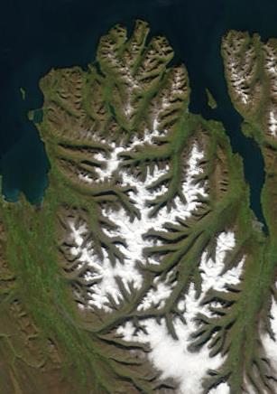 👀Viewpoint
Tröllaskagi Scenic
Tröllaskagi sits between Skagafjörður and Eyjafjörður in North Iceland, and Route 76 circling the peninsula ranks among the country's most rewarding drives. The mountains rise abruptly from sea level to over 1,400 meters, with fishing villages like Siglufjörður and Hofsós clinging to narrow strips at the water's edge. The road links Varmalið on the Ring Road to Akureyri and adds roughly 90 minutes over the direct route, but delivers fjord scenery at nearly every bend. Two one-way tunnels — shorter near Siglufjörður, longer near Ólafsfjörður — use traffic lights and are free. Roads are paved and need no 4x4, though some stretches are narrow with limited guardrails. In winter the same terrain makes Tröllaskagi home to Iceland's best downhill skiing. Siglufjörður, the northernmost town, has a well-regarded herring-era museum and good restaurants. The full loop from Akureyri fits comfortably in a day; staying overnight lets you see the low light on the fjords at its best.
Read details →East
12 placesA peaceful land of narrow fjords, charming fishing villages, dense forests, wild reindeer, and scenic mountain passes.
 👀Viewpoint
Borgarfjörður Eystri
Borgarfjörður eystriAt Hafnarhólmi, the small harbor islet at the end of Route 94, around 10,000 pairs of Atlantic puffins nest from mid-April through mid-August. Boardwalks and viewing platforms bring you within a couple of meters of the colony — close enough to watch birds land, stand around, and carry sand eels back to their burrows. Access is free. A small harbor building serves refreshments. No boat trip, no clifftop scramble: this is the most straightforward puffin access in Iceland. Getting here takes about 75 minutes from Egilsstaðir. The road is paved all the way but crosses a mountain pass with tight hairpins. The village has a guesthouse, a café, and a small shop. It also anchors the Víknaslóðir multi-day hiking trail network through the coastal mountains. A hike of two to three hours from the village leads to Stórurð, a high valley of enormous glacier-deposited boulders with clear turquoise pools between them. Snow lingers there well into summer, so mid-July through September is the safer window. Combining puffins with Stórurð makes the detour worth a full day or overnight stay.
Read details → 🏘️Town
Djúpivogur
Along the harbor breakwater at Djúpivogur, 34 oversized granite eggs sit on stone pedestals facing the sea — one for each bird species that breeds locally. The installation, Eggin í Gleðivík (The Eggs of Merry Bay), was created by artist Sigurður Guðmundsson and placed here in 2009. The 900-meter coastal walk to see them is free and open at any hour. The harbor's red-painted Langabúð warehouse dates to 1790 and is one of Iceland's oldest commercial buildings, now housing a cultural center with local history exhibitions and sculpture. From June through August, boat tours run to Papey island — about 15 km offshore, uninhabited since 1966, with a puffin colony and a wooden church from 1807. Búlandstindur, a near-perfect pyramid peak rising to 1,069 meters, dominates the view behind the village. Djúpivogur is on the Ring Road between Höfn and the Eastfjords, with fuel, accommodation, and a restaurant. An hour covers the egg walk and harbor area.
Read details → 🏘️Town
Egilsstaðir Gateway
Egilsstaðir is East Iceland's main service town — the place you stop to fuel up, buy groceries, pick up a rental car, or catch a domestic flight before heading into the fjords or the highlands. With a population of around 2,600, it's the largest settlement in the east, and while it isn't a destination in itself, its practical role is hard to overstate on a long trip around the Ring Road. The town sits on the banks of the Lagarfljót river, just upstream from where the river broadens into the long, glacially fed lake of the same name. The lake has its own resident legend — the Lagarfljótsormurinn, a serpent said to have been spotted there since at least 1345. On the lakeside, the Hallormsstaðaskógur forest stretches along the eastern shore and is Iceland's largest forest, a genuinely pleasant surprise in a country known for treelessness. From Egilsstaðir it's a short drive to Hengifoss waterfall, and Seyðisfjörður — one of the most scenic fjord towns in the country — is about 30 minutes east over the mountains. The domestic airport connects to Reykjavík in around 50 minutes and sits less than two kilometres from the town centre, making the east one of the more reachable regions for visitors short on driving time. The Vök Baths, a geothermal spa on nearby Lake Urriðavatn with floating pools, opened in 2019 and has become a good reason to linger an evening. Plan at least one overnight here to use Egilsstaðir as the base it's designed to be.
Read details → 💧Waterfall
Hengifoss
The cliff face behind Hengifoss is what makes it unlike any other waterfall in Iceland. Alternating bands of dark basalt and deep rust-red clay run horizontally across the rock — ancient soil horizons from ground exposed between volcanic eruptions, slowly oxidizing over millions of years. The falls themselves drop 128 meters, making Hengifoss one of the tallest in the country, but the striped geology is the thing people remember. The trail starts from a parking area on the south shore of Lake Lagarfljót, about 30 minutes from Egilsstaðir via Route 931. It's 2.5 km each way with roughly 300 meters of elevation gain. About halfway up you pass Litlanesfoss, whose entire bowl is lined with tall geometric basalt columns. Budget two to three hours round trip; proper footwear matters as the upper trail turns muddy. The red clay layers read most vividly in soft overcast light, which East Iceland provides reliably. An early-morning start beats the afternoon tour groups that fill the trail in summer.
Read details → 💧Waterfall
Litlanesfoss
The basalt columns at Litlanesfoss are the tallest feature in the frame when you arrive — they flank the 30-meter waterfall on both sides like a colonnade, each hexagonal pillar reaching around 20 meters high. The falls are also called Stuðlabergsfoss, or Basalt Column Falls, and that name is arguably more accurate: the columns, not the cascade, are what sets this apart from dozens of other Icelandic waterfalls. The falls sit about 1.2 kilometers along the hiking trail from the car park off Route 931 in the Fljótsdalur valley, east of Egilsstaðir. The trail gains elevation and has steeper sections, but nothing technically difficult. Continuing roughly another 1.5 kilometers brings you to Hengifoss, one of Iceland's tallest waterfalls at 128 meters — the two are almost always visited together, so budget two to three hours for the full return trip. The trail is open year-round but safest from late spring through early autumn. Entry and parking are both free. Being well east of the main tourist corridor, it sees far fewer visitors than comparable waterfalls on the South Coast.
Read details → 💧Waterfall
Rjukandafoss
Right beside the Ring Road in East Iceland's Jökuldalur valley, Rjúkandafoss drops about 93 metres in two main tiers. The name comes from the Icelandic rjúka — to steam or smoke — and the mist thrown up by the cascade earns it: on cold mornings the spray hangs like a low cloud over the valley floor. The falls are visible directly from the road, making this one of the easiest significant waterfalls in Iceland to stop at without detours. A short, mostly flat walk from the parking area leads to the base for a closer look, though some sections are rocky underfoot. In winter the outer edges freeze into ice columns while the central flow keeps moving. The falls sit roughly 50 km southwest of Egilsstaðir — far fewer visitors than South Coast waterfalls, with no entry fee and rarely a crowd. Studlagil Canyon, one of Iceland's most dramatic basalt gorges, is about 22 km away and pairs naturally on the same stretch of road. This part of the east rewards slower travel: the valley is quiet even at the height of summer.
Read details → 🏘️Town
Seyðisfjörður
Route 93 climbs the Fjarðarheiði mountain pass at around 600 meters, then descends through hairpin turns with waterfalls dropping down both valley walls before Seyðisfjörður appears below — colorful Norwegian timber houses at the end of a long, narrow fjord. Norwegian herring fishermen settled here in the mid-19th century, and many of those original buildings survive. In 1906, the town became the landward terminal of Iceland's first undersea telegraph cable to Europe. The most photographed spot is the rainbow-painted street leading to the blue church (Bláa Kirkjan, built 1922). The Skaftfell Center for Visual Art anchors the town's creative scene. Seyðisfjörður is the Icelandic terminal for the Smyril Line ferry from Denmark and the Faroe Islands — the only car-ferry link between Iceland and Europe. The mountain road closes regularly in winter storms; check road.is between October and April. Egilsstaðir is 26 km away. Allow at least two hours; an overnight stay is worth it for the quiet that settles over the fjord once the day-trippers leave.
Read details → 🥾Hiking Trail
Stórurð Paradise
Stórurð sits at over 400 meters elevation in the Dyrfjöll mountains above Borgarfjörður Eystri, and getting there takes genuine effort — the hike from the Vatnsskarð trailhead on Road 94 covers around 13 kilometers round trip with roughly 680 meters of total elevation change, and the terrain is rocky and uneven for stretches. Most hikers budget three and a half to four and a half hours for the full outing. The reward is a landscape that looks almost accidental: enormous boulders, some the size of houses, left behind when glaciers retreated at the end of the last Ice Age, now scattered around small turquoise-green pools edged with vivid moss. The color contrast between the dark rock, the moss, and the water is striking under any light. The trailhead at Vatnsskarð pass sits about 20 minutes from Borgarfjörður Eystri village along Route 94, which itself is about an hour north of Egilsstaðir. Free parking is available at the trailhead. There is no public transport — a rental car is required. Several marked trails approach from different directions; the Vatnsskarð route is the most commonly used. Snow can linger into July at this elevation, and some sources note it can appear even in August. Mid-July through early September is the most reliable window. The village of Borgarfjörður Eystri is also known for accessible puffin-watching in summer, so combining the two makes a strong day in the East Fjords.
Read details → 🏔️Canyon
Stuðlagil Canyon
StuðlagilThe turquoise color of Stuðlagil is not a filter trick — it's the result of the Kárahnjúkar hydroelectric dam, completed in 2009, which reduced the flow of the Jökulsá á Dal river and replaced glacial-brown meltwater with clear spring-fed water. That same drop in water level exposed towering walls of hexagonal basalt columns that had been submerged for decades, and when photographer Einar Páll Svavarsson documented the canyon in 2016, it quickly became one of Iceland's most talked-about natural sites. There are two ways in. The west bank has a viewing platform above the canyon, reached by a 240-step staircase — the view is fine but distant. The east bank, starting from a parking area near Klaustursel farm off Road 923, gives you the far better experience: roughly 2 kilometers of walking brings you down to the riverbed, where you can stand among the columns with the water running at your feet. The round trip from the east-side car park takes about two to three hours at a relaxed pace. Road 923 is gravel but manageable in a standard car. Visit between June and early August for the clearest, most vivid water. By mid-August, glacial runoff can temporarily cloud the river back toward brown. The canyon sits in the Jökuldalur valley in East Iceland, well off the Ring Road, so it attracts far fewer day-trippers than comparable sites on the South Coast — the remote location is genuinely part of the appeal.
Read details → 👀Viewpoint
Vestrahorn
Vestrahorn rises 454 meters from the black sand dunes of the Stokksnes peninsula, its serrated gabbro peaks dark enough to look like storm cloud even on a clear day. The rock is unusual for Iceland — gabbro rather than basalt, slow-cooled and rich in iron and magnesium, giving the mountain its near-black colour. When the tide pulls back and leaves shallow pools across the sand, the peaks reflect cleanly in them; this is why the location appears on so many photography shortlists. Access runs through a private gate on Route 1, about 18 km east of Höfn, where the Viking Café charges around 1,100 ISK per adult — children under 16 enter free, and a self-service kiosk handles tickets at any hour if the café is closed. Wooden turf-roofed structures scattered across the beach were built as a film set for a Viking movie that was never made; they are off-limits but make effective foreground for photographs. Low tide and the hours around sunrise or sunset give the best light. The dunes extend for a worthwhile walk, and the peninsula feels genuinely remote despite paved road access — far enough east (about five to six hours from Reykjavík) that crowds stay lighter than at comparable South Coast spots. Allow 90 minutes to walk the beach properly rather than just photograph from the car park.
Read details → 🥾Hiking Trail
Víknaslóðir Trek
Víknaslóðir — the Trails of the Inlets — is a network of marked routes in the Borgarfjörður Eystri area of East Iceland, threading along sea cliffs, over mountain passes, and between deserted inlets with old farm ruins. The system runs southward from the village of Bakkagerði toward Loðmundarfjörður, with hiking lodges at Breiðavík and Húsavík where you can break a multi-day traverse. Day hikes from the village are also feasible without committing to an overnight. The drive from Egilsstaðir to Bakkagerði is about 70–75 km on Route 94, taking roughly 90 minutes. Right at the village, Hafnarhólmi harbour has a boardwalk platform with close-up views of a large puffin colony during summer. The rhyolite ridges here run in reds and golds that look distinct from the grey basalt found elsewhere in Iceland. Trails are best from late June through early September, when the high passes are clear of snow and the lodges are staffed. Locally published trail maps are available in the village. Footwear and layers matter — the terrain is rugged in places despite moderate overall grades.
Read details → ♨️Hot Spring
Vök Floating Pools
Hexagonal pools float directly on Lake Urriðavatn, fed by geothermal springs rising from one to two kilometers underground. The word "vök" means a hole in the ice over warm water — exactly what locals noticed here for centuries before the baths opened in 2019. Water is heated naturally underground then cooled to about 38–41°C before entering the pools; it is certified drinkable, unusual even by Icelandic standards. The facility sits five kilometers from Egilsstaðir on the Ring Road. The floating pools connect to shore via a wooden walkway and have an infinity edge across the lake toward forested hills — noticeably greener than Iceland's treeless southern plains. On shore: additional hot pools, a sauna, a cold plunge, a spray tunnel, a pool bar, and Vök Bistro. East Iceland sees far fewer tour buses than the Golden Circle or South Coast, so the atmosphere stays calm even in peak summer. Budget at least an hour; most people stay longer. Book ahead in July and August.
Read details →Reykjanes
12 placesA raw, volcanic peninsula home to the famous Blue Lagoon, dramatic coastal cliffs, and active geothermal fields.
 ♨️Hot Spring
Blue Lagoon
Bláa LóniðThe Blue Lagoon sits in a lava field on the Reykjanes Peninsula, about 50 km from Reykjavík and 20 km from Keflavík Airport — a location that suits it as a first or last stop. The water is a by-product of the nearby Svartsengi geothermal power plant: when the hot brine cools, silica particles scatter blue light and give the whole surface its pale cyan color. Water temperature holds at 37–39°C year-round, and the white silica mud on the bottom is used as a face mask. The complex includes an in-water bar, steam rooms, saunas, and a restaurant overlooking the water. Advance booking is essential — the lagoon regularly sells out weeks ahead, especially in summer. Entry tiers range from basic admission to packages with robes, towels, and treatments. The Retreat offers a private, higher-end experience within the same complex. The Reykjanes region has been geologically active since late 2023, with eruptions near Grindavík forcing periodic closures. Check the Blue Lagoon website for current status before you go, particularly after any news of volcanic activity in the area.
Read details → 🌋Volcano
Fagradalsfjall Volcano
FagradalsfjallAfter 800 years of quiet, Fagradalsfjall erupted in March 2021 and has since produced further eruptions in 2022, 2023, and ongoing activity in the Sundhnúksgígar fissure system. The result is an expanding lava field about an hour from Reykjavík that is genuinely new terrain — raw black lava, still-steaming vents, and a scale that photographs do not prepare you for. Several marked trails leave from two parking areas. The shortest viewpoint route is around 2.5 km one way; longer trails to earlier eruption sites run 6–8 km one way. Terrain is uneven lava and gravel with steep sections — good boots are essential. Parking costs 1,000 ISK via the Parka.is app. If an eruption is active, check Visit Reykjanes and the Icelandic Met Office for real-time access updates. One safety point worth taking seriously: fresh-looking lava can have a paper-thin crust over still-molten rock, so stay on marked paths. Sulfur dioxide can spike without warning — check the air quality forecast before setting out. The peninsula is exposed and cold even in summer; bring wind layers.
Read details →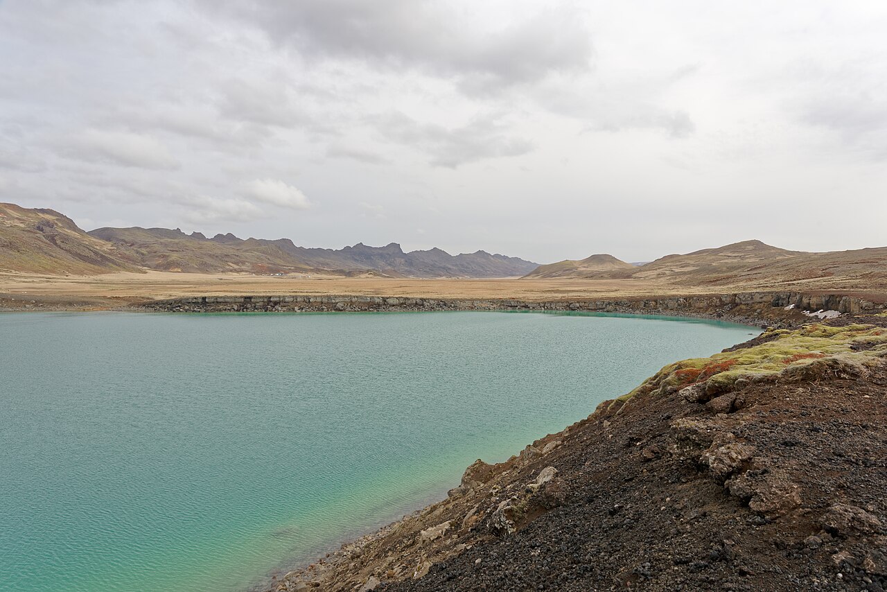 👀Viewpoint
Grænavatn Green Lake
GrænavatnThe vivid emerald color of Grænavatn stops most people in their tracks — it reads almost artificially green, the result of heat-loving algae and dissolved minerals in a lake that sits inside a maar-type explosion crater formed when rising magma hit groundwater over 6,000 years ago. The lake reaches around 46 meters deep, and the color shifts from bright lime near the shallower edges to a richer hue toward the center. A second smaller lake sits just to the north in a neighboring maar crater. The pull-off is right along road 428, a short drive from the Seltún geothermal area. A walking trail loops the crater rim in roughly 20 minutes; views are best from the eastern side. The site is free and accessible year-round. Plan to combine Grænavatn with Seltún on the same stop, since the steaming vents and boiling mud pools are only a few hundred meters away. The whole Krýsuvík area is about 40 minutes from Reykjavík via Route 42 on paved road. Color intensity varies considerably with cloud cover, so bright-green photos you see online often reflect ideal direct sunlight.
Read details →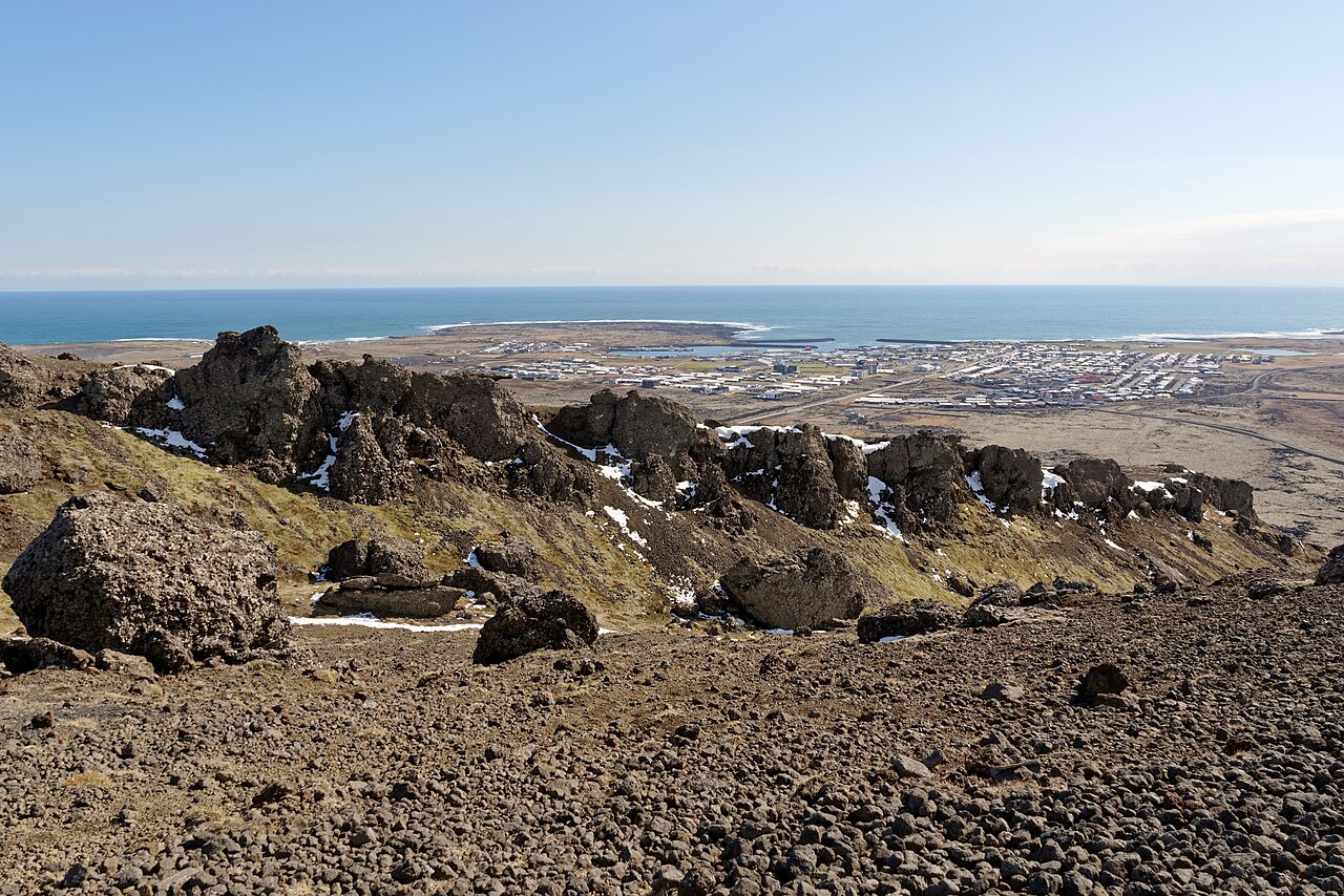 🏘️Town
Grindavík
Grindavík was evacuated in late 2023 when volcanic fissures opened across the Reykjanes Peninsula; the town remains largely uninhabited. Since November 2024 the area is open to visitors, but over 90% of homes have been bought out, and lava from the January 2024 eruption destroyed houses in the northern part of town. As of mid-2026, scientists consider another eruption in the area highly likely. Check safetravel.is before visiting and stay on marked paths — ground fissures are present. What you find is genuinely striking: a fishing town abandoned mid-life, lava barriers built to protect streets, new lava fields reaching the edges of neighborhoods. Guided tours access restricted zones and give the best context for the scale of what happened. The Saltfish Museum in the cultural center Kvikan, which covered the town's fishing heritage, has been subject to closures — verify current status before the visit. The Blue Lagoon is about 6.5 kilometers away and commonly paired with a Reykjanes day trip. Grindavík is roughly 50 kilometers southwest of Reykjavík via Route 43.
Read details → 💨Geyser
Gunnuhver Hot Springs
GunnuhverThe main mud pool at Gunnuhver is around 20 metres across, boiling continuously and churning grey-brown clay with a sound somewhere between a roar and a splatter. Iceland's largest mud pool, it is flanked by steam vents you hear before you see. Unusually, the hydrothermal fluids here are seawater rather than freshwater — ocean water percolates through porous lava and is superheated underground. The site sits directly above the Mid-Atlantic Ridge. Boardwalks thread through the active zone and the warning signs are not decorative. In 2014 a rise in mud-geyser activity forced a temporary closure. The Reykjanes Peninsula has experienced heightened volcanic unrest in recent years, so check current access before visiting — straying off the boardwalk can be fatal. The name comes from a legend: a ghost named Gunna was said to have been trapped here by a priest around 400 years ago. Gunnuhver is about 20 minutes from Keflavík Airport — a convenient first or last stop. The nearby Reykjanesviti lighthouse is a short walk away. Entry is free, the road is paved, and it is open year-round.
Read details →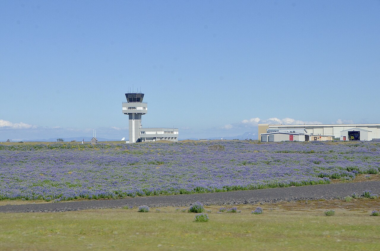 🏘️Town
Keflavík
Most travelers pass through Keflavík without stopping, which is a mistake. The town traces its roots to a 16th-century fishing settlement, and its working harbor still lands cod and haddock today. The seafront is walkable, lined with colorful houses and a handful of decent restaurants serving the catch more honestly than most places in Reykjavík. The strongest reason to linger is Víkingaheimar, the Viking World museum just outside the town center. Its centerpiece is the Íslendingur, a full-scale replica of a 9th-century Gokstad ship that sailed from Iceland to New York in 2000 to mark the thousandth anniversary of Norse settlement in North America. The ship is enormous up close and the exhibitions on the sagas are genuinely engaging — allow at least two hours. Keflavík also carries a more recent layer of history: American forces were stationed at a NATO base here from 1951 until 2006. The Blue Lagoon is a short drive east along the peninsula, and Reykjavík is roughly 50 km away on Route 41 — making Keflavík a practical overnight base for the first or last night of any trip.
Read details → ✈️Airport
Keflavík International Airport
KeflavíkurflugvöllurKeflavík International Airport (KEF) handled 8.3 million passengers in 2024, making it one of the busiest airports in northern Europe relative to its country's population. It sits about 50 km southwest of Reykjavík on the flat lava fields of the Reykjanes Peninsula — the drive in gives an immediate sense of Iceland's raw, treeless landscape before you've even reached the city. The terminal is a single building, expanded with a new East Wing in 2024, and navigation is straightforward. Duty-free shopping is available on both arrival and departure. Car rental desks sit in the arrivals hall, and the Flybus connects to central Reykjavík in around 45 minutes. Icelandair and Play both use KEF as a hub. If you have a long layover, the Blue Lagoon is roughly 20 minutes by car from the terminal — several operators run direct transfers. Hotels in Keflavík town, five minutes away, are considerably cheaper than Reykjavík equivalents and perfectly convenient for early departures.
Read details →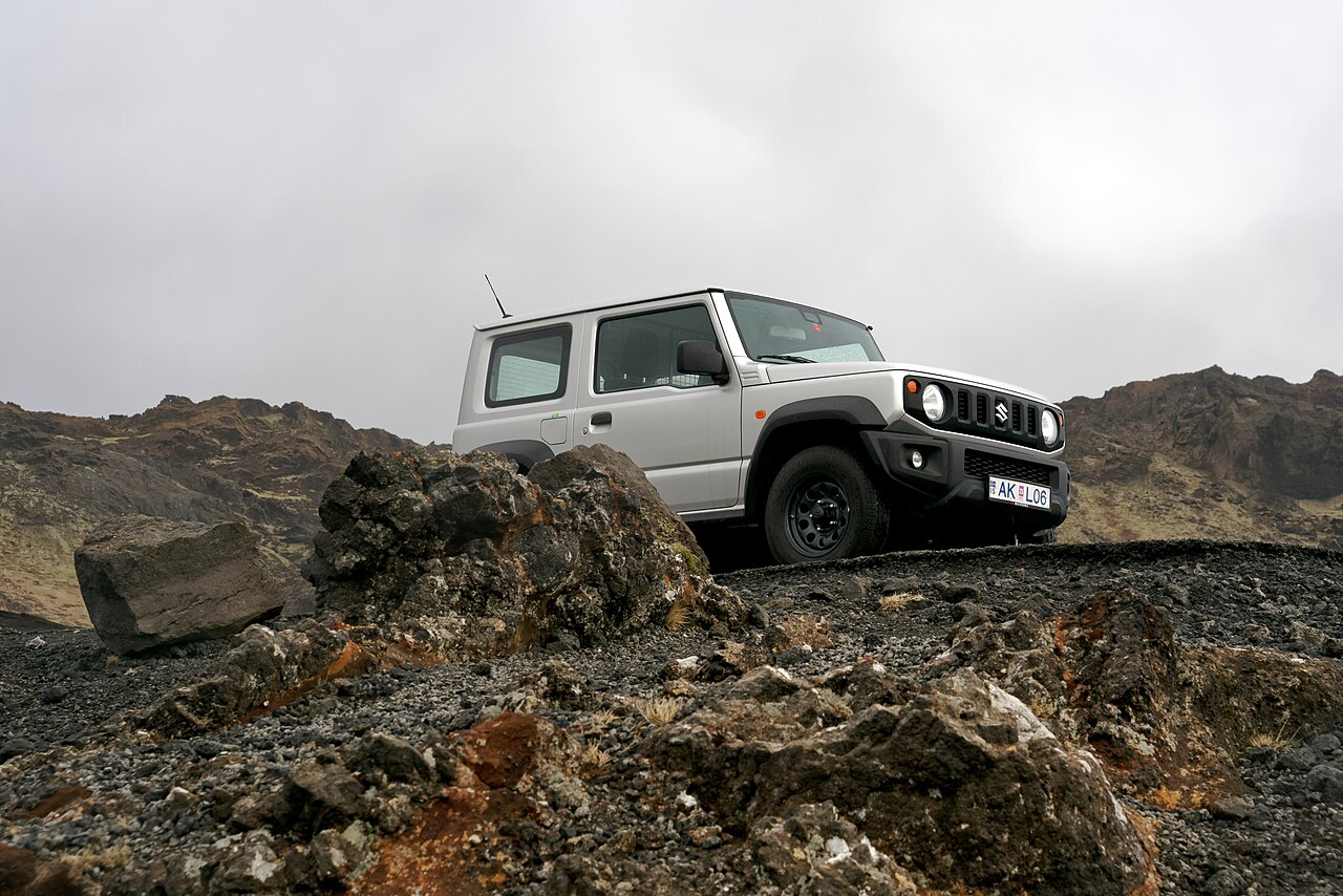 👀Viewpoint
Kleifarvatn Lake
KleifarvatnKleifarvatn is the largest lake on the Reykjanes Peninsula, sitting in a volcanic landscape of black lava and bare hillsides about an hour from Reykjavík. At up to 97 metres deep historically, it ranks among Iceland's deepest lakes — seismic activity after a 2000 earthquake opened a fissure at the bottom and drained roughly 20 percent of the water. The lake has no visible inlet or outlet; water seeps in and out through porous lava below. The paved road to Krýsuvík passes right alongside, and the drive itself is part of the experience: dark scree slopes, steam drifting from vents on the hillsides, and the lake surface shifting colour with the sky. The nearby Seltún geothermal area adds bubbling mud pools and sulphur-stained ground a short detour away. There are no fees and no facilities, so bring what you need. Allow 30 to 45 minutes to stop and walk the shoreline or pull out at viewpoints. The road is paved and accessible year-round, though wind off the lake is common in winter. Stay on marked paths near Seltún — the volcanic ground around active vents is fragile.
Read details →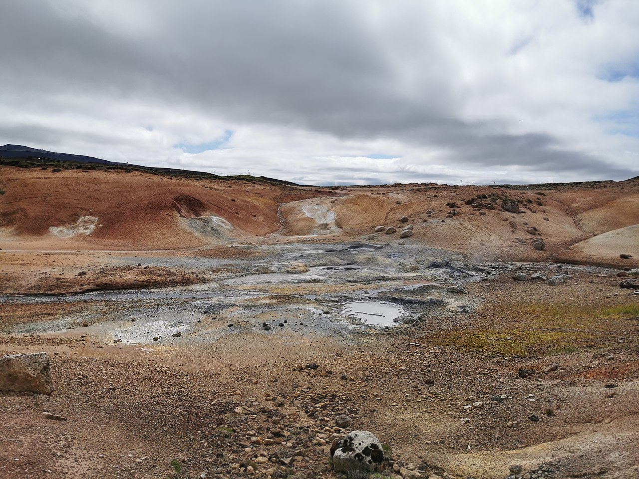 💨Geyser
Krýsuvík Geothermal Area
KrýsuvíkThe ground at Krýsuvík genuinely moves. Mud pools bubble and hiss, steam vents push sulfurous clouds across the path, and the hillsides are stained vivid yellow, orange, and rust from sulfur reacting with iron in the soil. The main geothermal section, Seltún, sits on the Mid-Atlantic Ridge where the Eurasian and North American plates are actively pulling apart, and the heat below is close enough that spring water can approach boiling point. A well-maintained boardwalk loops through the active area with informational signs. Stay on it — the crust between vents can be thin and temperatures reach 80 to 100°C. The loop is short and flat, but the full area rewards an hour rather than a quick pass. Nearby, the crater lake Grænavatn sits in striking emerald green from dissolved geothermal minerals. Krýsuvík is about 30 to 45 minutes from Reykjavík via Routes 41, 43, and 42 — an easy addition to a Reykjanes Peninsula day. It's free and open year-round, though windy winter days make the exposed landscape uncomfortable. There are no facilities on site.
Read details → 🕳️Cave
Raufarhólshellir Lava Tunnel
RaufarhólshellirRaufarhólshellir stretches 1,360 metres under the Reykjanes Peninsula — the fourth-longest lava tube in Iceland — formed around 5,600 years ago when lava from the Leitahraun eruption drained away and left a hollow conduit. Ceilings reach at least ten metres, and the widest sections open to around thirty metres. Mineral striations colour the walls, and several skylights let in daylight; in winter, snow piles up under them and freezes into ice formations near the entrance. Standard tours follow a lit walkway through the main chamber and run about an hour. Adventure tours push into unlit sections and require helmets and headlamps. Both run year-round. Dress warmly: the temperature inside stays close to freezing whatever the season. The cave is roughly thirty minutes from central Reykjavík on Route 39. Tickets cost around 6,990 ISK for adults, tours run throughout the day, and no independent access is permitted.
Read details →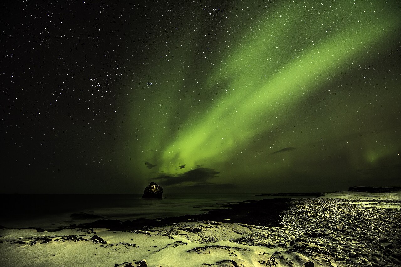 👀Viewpoint
Reykjanes Geopark
Jarðvangur ReykjanesThe Reykjanes Peninsula is the only place on Earth where the Mid-Atlantic Ridge sits above sea level — the North American and Eurasian plates diverge here at around 2.5 centimeters per year, and the ground shows it. UNESCO designated the peninsula a Global Geopark in 2015, covering 55 geosites from boiling mud fields to sea cliffs. Since 2021 the area has experienced repeated eruptions at Fagradalsfjall and the Sundhnúkur crater row, adding new lava fields that hikers can reach on marked trails. The geopark is a collection of sites, not one place. Gunnuhver near the southwest tip is a vigorous mud pool and steam field where the largest pool spans around 20 meters. The Bridge Between Continents straddles the rift fissure on the north shore. Kleifarvatn, the peninsula's largest lake, has actually shrunk following earthquakes along the rift. Most sites are under an hour from Reykjavík and close to Keflavík airport — convenient for arrivals or departures. Always check current volcanic and gas-hazard conditions at visitreykjanes.is before hiking near active lava areas.
Read details → 👀Viewpoint
Reykjanes Lighthouse
ReykjanesvitiIceland's oldest lighthouse has stood on the Reykjanes Peninsula since 1878, though the original structure on Valahnúkur was badly damaged by earthquake within a decade. The current concrete tower — built 1907-1908 and first lit in 1929 — stands roughly 26 to 31 metres tall, with its focal plane around 70 metres above sea level. It still functions as a working landfall light for ships entering Reykjavík and Keflavík. Geothermal steam venting nearby drifts across the tower in photographs, a reminder that this peninsula sits on active volcanic ground. Gunnuhver, one of Iceland's largest hot spring areas, is a short walk away. The old sea cliffs at Valahnúkur offer views of the Atlantic crashing against dark basalt. On clear days, Eldey island is visible on the horizon — the remote volcanic stack where the last known great auks were killed in 1844. About 15 minutes by car from Keflavík Airport, it makes a practical first or last stop on an Iceland trip. The grounds are exposed and wind can be fierce even in summer; layers are worth having. Parking is free and the site is accessible year-round.
Read details →Capital Region
13 placesGreater Reykjavík, combining urban culture, museums, and historical landmarks with beautiful coastal walks.
 🏛️Museum
Árbær Open Air
Árbæjarsafn preserves around 30 historic buildings relocated from across Reykjavík and reassembled into a functioning open-air village on the city's eastern edge. The collection spans the 19th and early 20th centuries — turf-roofed farmhouses, a timber church, a blacksmith's forge, a WWII-era barracks, and residential dwellings fitted out with period furnishings showing how Reykjavík families lived through rapid urbanization. It is less a curated display than a place to wander through at your own pace. Free English-language guided tours run daily at 1 pm in summer — worth taking for the context, since many buildings are harder to read without knowing their story. The grounds also host farm animals, periodic craft demonstrations, and a sweet shop stocking traditional Icelandic treats. The museum is at Kistuhylur 4, about 8 km from central Reykjavík — fifteen minutes by car or reachable on bus lines 5, 6, 15, and 18. Hours are 10 am–5 pm daily in summer (June–August), 1 pm–5 pm the rest of the year. Adults pay around 2,350–2,500 ISK; children under 17 and seniors over 67 enter free.
Read details → 🥾Hiking Trail
Esja Capital Peak
Esja's flat-topped ridge defines Reykjavík's northern skyline and sits only about 10 kilometers from the city center — close enough that locals run its trails after work. The mountain tops out at 914 meters, but the most popular goal is Þverfellshorn at 780 meters, where a large boulder called Steinn marks a natural turnaround point. From there the views sweep across Faxaflói bay and the capital. Continuing to the actual summit involves rougher scrambling terrain. The trailhead at Esjustofa has a café, toilets, and free parking. Multiple routes head uphill from there, ranging from a well-graded family-friendly path to steeper direct lines. Round trip to Þverfellshorn takes roughly two to three hours at a steady pace. Esja is technically open year-round, but the upper trails can be icy enough in winter to require crampons. Weather on the ridge changes fast regardless of season — a windproof layer is worth bringing even on a warm summer day in Reykjavík. The mountain is free to hike.
Read details → 🏛️Museum
FlyOver Iceland
FlyOver Iceland is a motion-based flying theatre at Fiskislóð 43 in Reykjavík's Grandi harbour district, opened in September 2019. Visitors sit suspended in a harness with feet dangling in front of a 20-metre spherical screen, then ride through an 8.5-minute film soaring over glaciers, volcanoes, fjords, and remote highland terrain — accompanied by wind, mist, and scent effects synced to the footage. It was the first FlyOver installation outside North America and remains the only flying theatre of its kind in Europe. The total visit runs about 35 to 45 minutes, starting with two pre-show experiences: The Longhouse, a Viking-hall storytelling chamber, and a pre-flight briefing area. These preshows are included with admission and run back-to-back before guests board the ride itself, which departs roughly every 15 to 20 minutes. Online tickets cost 5,690 ISK for adults (14+) and 3,690 ISK for children 13 and under; buying at the door adds roughly 260 ISK. A Tuesday discount of 2,000 ISK per ticket is regularly offered. The Grandi district is easily reached on foot from the city centre, by bus, or by car — free parking is available on site. The address is directly accessible on paved roads with no 4WD requirement. The attraction operates daily from 9:00 AM to 6:30 PM with no seasonal closure. Image: FlyOver Iceland / flyovericeland.com
Read details → ♨️Hot Spring
Laugardalslaug Main
Laugardalslaug is the largest swimming complex in Reykjavík — a good introduction to how Icelanders actually use their pools, less as exercise venues and more as daily social infrastructure. The facility has a 50-meter outdoor heated pool, a 50-meter indoor pool, a 25-meter children's pool, several hot pots at varying temperatures, a sauna, and an 84-meter water slide. The hot pots are the real draw for most visitors: communal tubs where conversations start without much prompting. Admission runs 1,500 ISK for adults; children under ten get in free. The pre-swim shower (undressed, with soap) is mandatory and standard at every Icelandic pool — follow the signs in the changing rooms. Towels and swimsuits are available to rent. The complex sits in the Laugardalur park area, about 15 minutes from downtown Reykjavík on foot, by bike, or city bus. Hours are 6:30am–10pm weekdays and 8am–9pm weekends. The pool closes roughly a week in late August for maintenance. Weekday mornings are noticeably quieter than weekend afternoons.
Read details → 🏛️Museum
Lava Show
HraunsýningThe Lava Show is the only venue in the world where visitors watch real molten lava poured live in front of them indoors. Located at Fiskislóð 73 in Reykjavík's Grandi harbour district, the experience runs about 50–55 minutes. Basaltic lava from the 1918 Katla eruption is reheated to approximately 1,100°C and channelled down a steel chute into the showroom, close enough that front-row guests can feel the intense radiant heat on their skin and hear minerals crackling as the rock cools. Safety goggles are issued to anyone seated up front. Tickets start at 6,590 ISK for the standard adult admission (around 45–50 USD at typical exchange rates). A premium tier at 9,990 ISK adds balcony seating, a backstage furnace tour, a welcome drink, and a cooled lava keepsake. A second, smaller venue operates in the village of Vík on the South Coast (Víkurbraut 5), focused specifically on the Katla volcano; that location offers the standard show only. Both are fully indoors and weatherproof, making this a practical option on rainy or stormy days. The attraction was founded by Júlíus and Ragnhildur after they witnessed a lavafall during the 2010 Fimmvörðuháls eruption that preceded Eyjafjallajökull. The Reykjavík location is accessible by city bus (routes 3 and 14) and has free on-site parking. The Vík location sits on paved Route 1 through the village. Both venues hold Tripadvisor Best of the Best recognition and the 2025 Viator Experience Award. Image: Lava Show / lavashow.com
Read details → 🐧Puffin Colony
Lundey Puffins
Puffins nest on the small islands of Lundey and Akurey in Faxaflói Bay, just fifteen minutes by boat from Reykjavík's Old Harbour. Boats circle the islands without landing (the colonies are protected), but approach close enough for good photographs of puffins on the grassy clifftops. Guillemots, fulmars, and Arctic terns are also regularly seen. An English-speaking guide on board describes the birds and the bay. Tours run from around late April through mid-August; outside those months there are no birds. Departure is from the Old Harbour, a short walk from the city centre — no rental car needed. Tours last about an hour. Several operators run departures throughout the day in summer, with evening slots offering softer light. Booking ahead is wise in late June and July. If your itinerary is centred on Reykjavík and you want puffins without committing a full day, this is the practical option. The birds are the same Atlantic puffins found at remote colonies, just far more conveniently placed.
Read details → 🏛️Museum
National Museum Iceland
The carved Valþjófsstaður church door stops most visitors in their tracks — it dates from around the 13th century and depicts a knight slaying a dragon to free a lion, rendered in intricate Romanesque style. It is the kind of object that could anchor a major European museum, and here it sits among some 2,000 artifacts tracing Icelandic history from the settlement era to the present. The permanent exhibition "Making of a Nation" runs chronologically from the Viking age through Christianisation, the Reformation, and Iceland's push for independence, using original objects and multimedia throughout. The museum is at Suðurgata 41, walkable from the University of Iceland and served by several city bus lines. Free parking is available. Admission for adults is 3,300 ISK; under-18s enter free. Audioguides come in 10 languages; the building is fully wheelchair accessible. Plan at least 90 minutes for the permanent collection. The museum opens daily 10:00–17:00 but closes on Mondays from September through May — worth checking in the off-season.
Read details → 👀Viewpoint
Old Harbor Whale
Reykjavík's Old Harbour is the departure point for the capital's whale watching tours. Several operators run trips into Faxaflói bay, where minke whales and humpbacks are most common; dolphins and harbor porpoises turn up regularly too. Tours run around three hours year-round, though summer brings the best odds — operators report success on more than 90% of summer departures. Midnight sun tours sell out, so book ahead. Between tours the harbor area offers a full afternoon. The Reykjavik Maritime Museum is right on the dock. A short walk into the Grandi district brings you to the Whales of Iceland exhibition and the Saga Museum. Working fishing boats moored among the tour vessels keep the area grittier than downtown, and a stretch of seafood restaurants lines the waterfront. Puffin island cruises to Akurey and Lundey also leave from here in summer, roughly May through August. The harbor looks across Faxaflói toward Mount Esja, and on clear days the ice cap of Snæfellsjökull is visible across the bay. Harpa concert hall is a five-minute walk east along the shore.
Read details → 🏛️Museum
Saga Wax Museum
Seventeen lifelike silicone figures in dramatically lit tableaux walk you through Icelandic history from the first settler Ingólfur Arnarson through the Reformation. Each figure was made by hand by the museum's founder using traditional techniques for the clothing, weapons, and props — the craftsmanship is genuinely unsettling in the best way. Scenes cover the establishment of the Althing, the Sturlung Age feuds, the arrival of Christianity, the Black Death, and more. An audio guide in seven languages narrates each one; the self-guided tour runs around 30–40 minutes. The museum sits in the Grandi harbour district near the Maritime Museum — not near Perlan, which was its former location. The space is compact but well-paced, and families tend to enjoy the replica weapons and costumes available to try at the end. If you have never encountered the sagas, this is a solid and absorbing primer before visiting actual saga sites around the country. Worth the hour, especially on a rainy afternoon.
Read details → 🏛️Historic Site
Viðey Island
ViðeyViðey is a 1.6-square-kilometre island reached by a five-minute ferry from Skarfabakki harbour near Reykjavík's cruise terminal. The return ferry ticket costs 2,500 ISK for adults (free with the Reykjavík City Card); there is no additional entry fee. Settlement here dates to around 900 AD, and an Augustinian monastery operated on the island from 1225 until the Reformation in 1539. The 1755 stone house Viðeyjarstofa — one of Iceland's oldest stone buildings, designed by Danish architect Nicolai Eigtved — now serves as a café and event space. The island holds two major works of contemporary art. American sculptor Richard Serra installed Áfangar in 1990, a series of nine pairs of basalt columns placed around the western perimeter of the island; their heights follow the natural contour of the land and frame views toward Reykjavík and Mount Esja. Yoko Ono dedicated the Imagine Peace Tower in 2007 as a memorial to John Lennon: a wishing well inscribed with "imagine peace" in 24 languages projects a beam of white light skyward each year between October 9 and December 8. Walking trails cross the island through meadows with over 150 wildflower species, and around 30 bird species nest here including eider ducks and Arctic terns. Summer ferries also depart from the Old Harbour, making a 20-minute crossing. A full visit covering the walking trails and main sites takes roughly two to three hours. Photo: Joe deSousa / Wikimedia Commons (CC0)
Read details → 🏛️Museum
Víkin Maritime
The centrepiece of the Reykjavík Maritime Museum is the Óðinn, a 900-tonne coast guard vessel moored at the Grandi harbour that visitors can board and explore — bridge, engine room, crew quarters. The Óðinn became a national symbol during the Cod Wars of the 1970s, when Iceland confronted the Royal Navy over fishing limits and effectively won. Guided ship tours run daily at 13:00, 14:00, and 15:00 from March through October and carry a separate fee on top of museum entry (around 1,700 ISK for the museum, 1,300 ISK for the ship tour). The indoor galleries cover fishing techniques, boat construction, and maritime accidents, with interactive exhibits that hold children's attention well. The building is a converted fish-freezing plant on Grandagarður, part of the same harbour strip as the Whales of Iceland exhibition and several good restaurants. Budget around 90 minutes if you want the ship tour alongside the galleries. Children under 18 and seniors get free museum admission. The Grandi area is an easy walk or cycle from central Reykjavík.
Read details → 🏛️Museum
Whales of Iceland Exhibit
Twenty-three life-size whale models hang in a vast darkened hall near Reykjavík's Old Harbour, each cast and hand-painted after a specific individual animal documented in Icelandic waters. The centerpiece is a 25-meter blue whale — standing beneath it at full scale is a different experience than any photograph conveys. Orca, sperm whale, the critically endangered North Atlantic right whale, and smaller dolphins fill out the collection. This is Europe's largest whale exhibition. Audio guides in multiple languages cover biology, behavior, and conservation for each species. Interactive stations play whale calls and map migration routes. The exhibition addresses whaling history and current population pressures directly, without softening either subject. The museum is at Fiskislóð 23–25 in the Grandi harbor district, open daily year-round 10:00–17:00. It pairs well with a whale-watching boat tour from the Old Harbour — the exhibit gives you identification and context that makes time on the water more meaningful. Tickets run around 4,000 ISK for adults; budget about an hour inside.
Read details → 🌋Volcano
Þríhnjúkagígur Tour
The only place on Earth where you can ride an open cable lift into an actual magma chamber, Þríhnjúkagígur sits in the Bláfjöll mountains about 30 minutes south of Reykjavík. The volcano last erupted around 4,000 years ago; its magma drained away rather than solidifying inside, leaving a hollow cathedral roughly 120 meters deep with a floor area of over 3,000 square meters. The walls show layers of red, orange, yellow, purple, and green from mineral deposits; the scale only becomes apparent once you are standing inside. Getting there involves a 3 km hike across a lava field, then a 7-minute cable lift descent. Tours run from early May to late October and last 5 to 6 hours including transport. Daily capacity is limited, and summer dates sell out weeks ahead. Minimum age is 8; moderate fitness is needed for the hike. Dress in warm, waterproof layers — it is significantly colder underground than at the surface. Drivers can park at the Blue Mountain meeting point rather than joining the Reykjavík pickup.
Read details →Reykjavík
7 placesThe vibrant northernmost capital, filled with colorful streets, exceptional restaurants, galleries, and Hallgrímskirkja.
 🛒Supermarket
Bónus Laugavegur
Bónus is the cheapest grocery chain in one of Europe's most expensive countries, and the Laugavegur 59 location puts it right on Reykjavík's main shopping street — convenient for visitors staying in the city center. The pink pig logo is something of a national institution, and the format is pure discount: minimal décor, a focused product range, own-brand staples, and prices that make a noticeable difference if you're self-catering for even a few days. Skyr, bread, cheese, cold cuts, fresh produce, and pantry basics are all well-stocked. Hours at this location run approximately 10am to 8pm daily, though specific times can vary — check bonus.is or the door before planning a late arrival. Individual stores across Iceland keep their own schedules, and hours at smaller regional branches may be shorter. Note that Bónus does not sell alcohol; wine, beer, and spirits are available only at the government-run Vínbúðin stores. Hot prepared food isn't sold here either, so it's a shop for raw ingredients and packaged goods rather than ready-to-eat meals. With 33 locations across Iceland, Bónus is a practical stop beyond Reykjavík too — there are branches in many towns along the Ring Road, making it a useful resupply point on longer drives. For self-catering travelers, stocking up here versus eating out or shopping at convenience stores can meaningfully cut daily costs.
Read details → 🏛️Historic Site
Hallgrímskirkja
The 75-meter tower of Hallgrímskirkja is visible from almost anywhere in Reykjavík. Architect Guðjón Samúelsson modeled the church's stepped concrete wings on Iceland's columnar basalt formations — the same rock shapes you see at Svartifoss. Construction ran from 1945 to 1986, and Samúelsson died before it was finished. The result divides people, though it has become the city's defining silhouette. An elevator runs to the observation deck near the top, giving a genuine panorama over Reykjavík toward the harbor and mountains — on a clear day Snæfellsjökull is visible to the northwest. The tower charges a separate admission fee (around 1,400 ISK for adults). The church itself is free: spare white interior, minimal ornament, and a large pipe organ with more than 5,000 pipes installed in the 1990s. Organ recitals run regularly and are worth catching if one lines up. Out front stands a statue of Leif Erikson, a gift from the United States in 1930. The church sits at the top of Skólavörðustígur, a ten-minute uphill walk from the main shopping street.
Read details → 🏛️Museum
Harpa Concert Hall
HarpaHarpa opened in May 2011 after construction stalled during Iceland's financial crisis — a pause that made its eventual completion feel like a statement. The building sits on the old harbor's edge, designed by Henning Larsen Architects with Danish artist Olafur Eliasson responsible for the facade. He clad it in geometric glass panels using a modular hexagonal form; the panels shift color and transparency with the light and weather, most striking at night when the embedded LEDs are running. The main hall, Eldborg, seats 1,600 to 1,800 people and hosts the Iceland Symphony Orchestra, the Icelandic Opera, and visiting performers. The lower public floors are free to walk through, and the harbor-facing café has some of the best waterfront views in the city. Harpa won the EU Prize for Contemporary Architecture (Mies van der Rohe Award) in 2013. The building anchors the eastern end of the waterfront, a short walk from the Sun Voyager sculpture and the working harbor. Admission to public spaces is free; performance tickets vary by event.
Read details →Krónan - Reykjavík
Krónan sits in the middle of Iceland's grocery market — not as relentlessly cheap as Bónus, not as upscale as Hagkaup, but consistently well-stocked and open at hours that suit travelers. Most locations open between 8 and 9 AM and close around 8 or 9 PM. The chain runs around 26 stores across Iceland since founding in 2000, with several in the capital. The selection leans toward everyday Icelandic shopping rather than tourist-oriented retail. You'll find good fresh produce, meat, dairy, bakery items, and a solid range of organic and eco-certified products. For self-catering visitors looking to cut costs without hunting for a Bónus, Krónan hits a practical sweet spot. It's also worth browsing for Icelandic foods to take home — dried fish, local chocolates, and Icelandic licorice tend to be well-represented. One caveat that applies to all Icelandic supermarkets: alcohol is not sold here. Beer, wine, and spirits are only available through the state-run Vínbúðin stores, which keep shorter hours. Plan accordingly if you're stocking up for the week.
Read details → 🏛️Museum
Perlan
Perlan sits on Öskjuhlíð hill in Reykjavík, its glass dome resting on six cylindrical hot-water storage tanks that still supply the city. It has been converted into a nature museum called Wonders of Iceland, and the centrepiece is a roughly hundred-metre-long artificial ice cave built from snow gathered in Icelandic mountains — genuinely cold and dark, and a worthwhile stand-in if a glacier walk is not on your schedule. The Áróra planetarium runs an immersive 8K film about the northern lights, and the other galleries cover volcanoes (with footage from the 2021 Geldingadalir eruption), glaciers, birdlife, and the water cycle. A free 360-degree observation deck wraps around the outside of the dome and gives a clean view over Reykjavík, the bay, and the mountains — worth going up even without a museum ticket. A café and restaurant are also on site. Budget around two hours for the full museum. Perlan is about fifteen minutes from the city centre by car or taxi, with buses nearby. Open year-round, but tour groups fill it mid-morning — arriving at opening or late afternoon is easier.
Read details → ♨️Hot Spring
Sky Lagoon
An infinity edge runs the full length of Sky Lagoon's geothermal pool, set so the water appears to dissolve into the North Atlantic beyond. The lagoon sits at Kársnes Harbour in Kópavogur — technically a separate municipality, though it is about a 15-minute drive from central Reykjavík — and opened in 2021. The water holds steady at 38–40°C year-round. The main draw beyond the soak is the seven-step Skjól ritual, included with entry: you move from the lagoon to a cold plunge, a sauna with ocean views, a cold mist shower, a body scrub, a steam room, and finally a crowberry elixir. The sequence takes around an hour. Two ticket tiers are available — Saman (standard, shared facilities) and Sér (premium, private changing room). Current prices are higher than the entry on this page reflects; check the website before booking. The bar in the lagoon lets you order a drink without getting out of the water. Sunsets over the ocean from the pool are particularly good in autumn and winter. Book in advance; same-day entry is often unavailable on busy days.
Read details → 👀Viewpoint
Sun Voyager
SólfariðPerched on the Sæbraut coastal road, the Sun Voyager is a polished stainless-steel sculpture that reads as a boat — a dream boat, not the Viking longship most visitors assume. Artist Jón Gunnar Árnason designed it as an ode to the sun and a symbol of hope, progress, and undiscovered territory. He died in 1989 before its completion; the work was unveiled in August 1990 for Reykjavík's 200th anniversary. It faces north over Faxaflói bay toward Mount Esja, which fills the background on clear days. The waterfront here is part of Reykjavík's Sculpture and Shore Walk, linking the Old Harbour to the Harpa concert hall past several other public works. On a bright evening the light bounces off the polished steel while bay and mountain fill the frame. In June the sky stays bright past midnight; in winter there is at least a chance of northern lights over the water. Access is free at any hour. Paid parking lines the road nearby and at Harpa a short walk east. Budget about 15 minutes here, though most people end up walking further along the waterfront.
Read details →East Iceland
5 placesExplore the incredible sights and unique geological wonders of this region in Iceland.
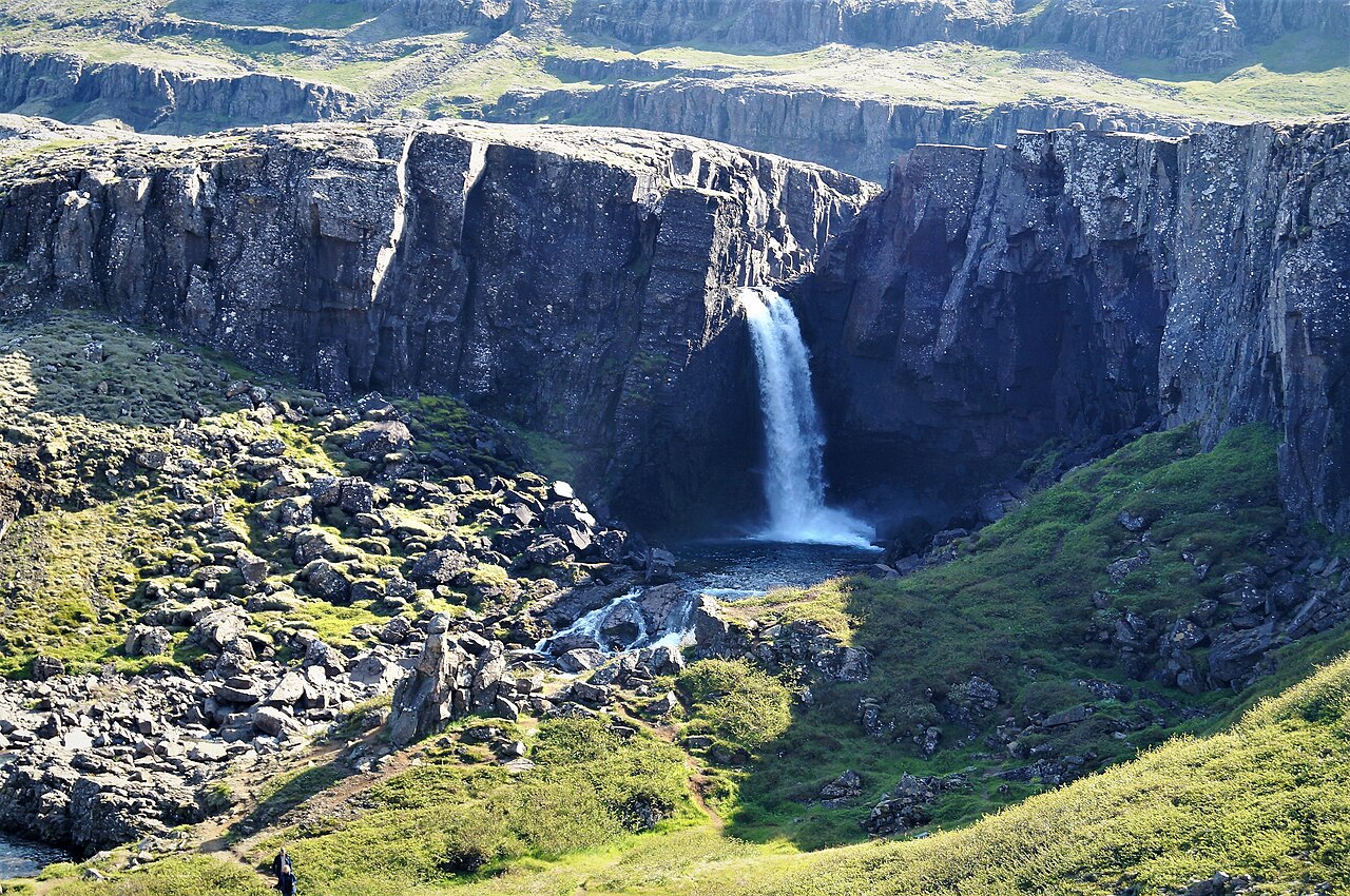 💧Waterfall
Folaldafoss
Folaldafoss sits along Road 939, the Öxi Pass, a steep gravel mountain road that cuts through eastern Iceland between the Ring Road and the valley above Berufjörður. The falls drop around 20 meters where the Berufjarðará river squeezes through a narrow gap and tumbles into a rocky bowl, with a clear pool forming at the base. It's one of the lower waterfalls along a river that produces many falls in quick succession heading up the same valley. The Öxi Pass is an unpaved road and quite steep in places — a regular 2WD car can manage it in dry summer conditions, but the road tends to be rough or muddy outside of June through August, and it's worth checking road.is before turning off the Ring Road. The waterfall is visible and easily reached from the roadside, with a short walk of just a few minutes on flat ground. East Iceland sees a fraction of the tourist traffic of the south, so this is a peaceful stop. Djúpivogur, the nearest town, is about 24 km south along the coast. Spring snowmelt brings the highest flow.
Read details →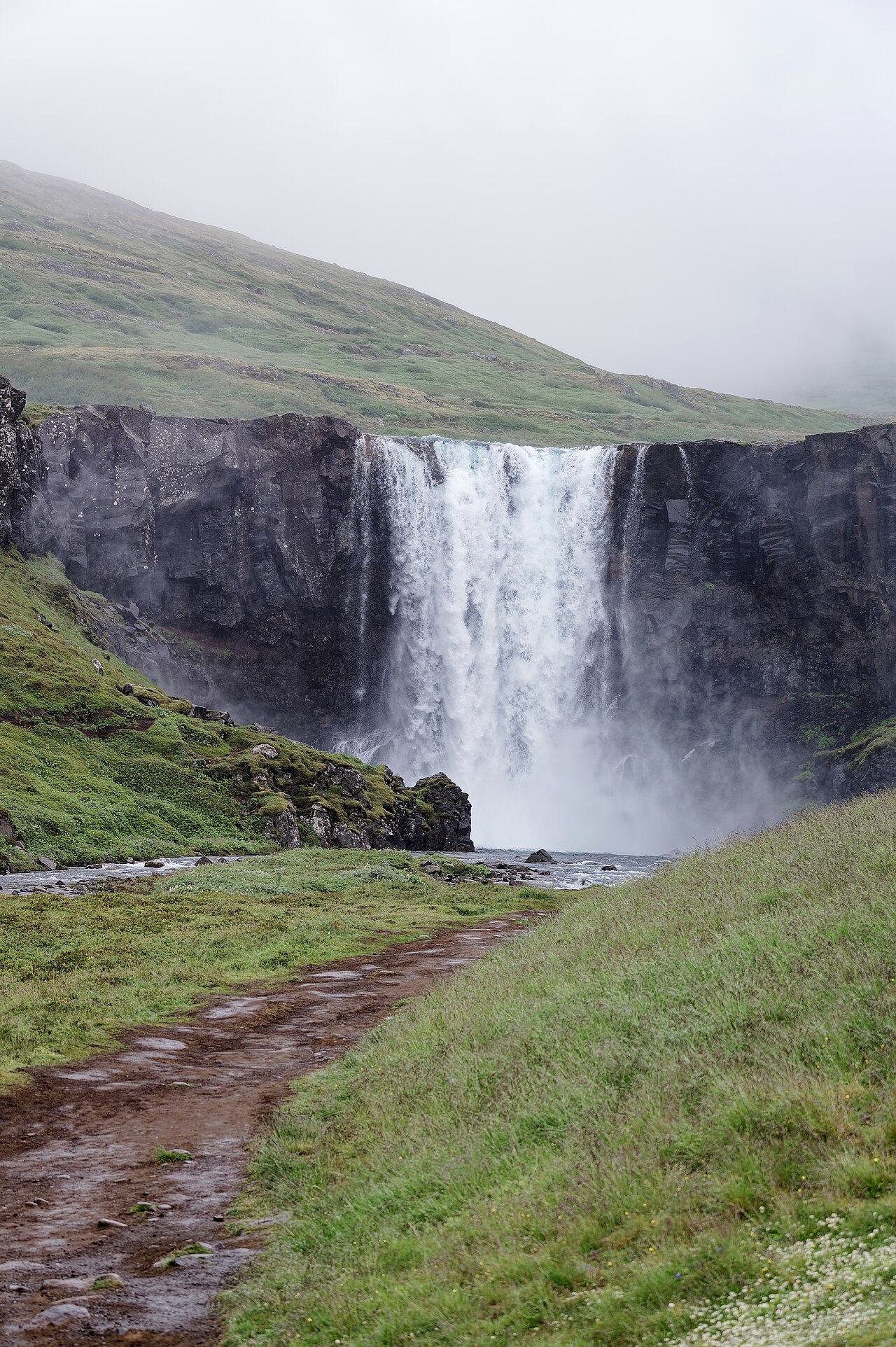 💧Waterfall
Gufufoss
Gufufoss drops around 27 metres into a narrow rocky gorge just off Route 93, the mountain road between Egilsstaðir and Seyðisfjörður. The falls are single-tiered, and the volume of snowmelt-fed water generates a persistent mist that gives the place its name: "steam falls." On a calm morning, the spray hangs in the light well — the east-facing cliff catches direct sun early in the day. There is no formal car park; you pull off on the verge where the road comes closest to the gorge, roughly 8 kilometres before Seyðisfjörður. A short gravel path drops to the riverbank, from where you can walk upstream to face the falls directly. The ground near the water is slippery after rain, so sturdy footwear is worth it. The visit takes around 20 minutes, and most people fold it into a trip to Seyðisfjörður itself — a village of colourful timber buildings just a few minutes further on. Gufufoss is free and open year-round. Route 93 crosses a mountain pass and can close in severe winter weather, so check road conditions before making the drive in the colder months.
Read details →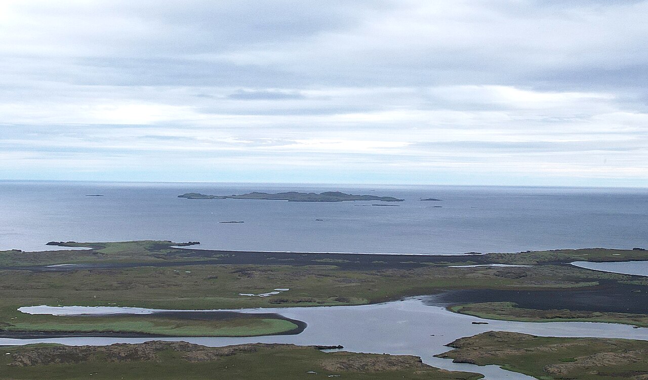 🐧Puffin Colony
Papey Island
PapeyPapey sits roughly 6 kilometers off the East Iceland coast and draws visitors for two reasons: one of the region's largest Atlantic puffin colonies, and the oldest wooden church in Iceland, built in 1807. The island covers about 2 square kilometers and rises to 59 meters at its highest point. Its name is Celtic — "friar's island" — reflecting accounts of Irish monks who may have preceded Norse settlers, though archaeological evidence is still uncertain. The last permanent residents left in 1966. Boat tours depart from Djúpivogur on the mainland. The crossing takes around 45 minutes to an hour, and guided walks on the island last about two hours. Seals haul out on skerries nearby and are often visible from the boat. The tour season runs June through August; departures are weather-dependent, so confirm conditions before heading to the dock. Djúpivogur lies on Route 1 in the East Fjords, about 70 kilometers south of Egilsstaðir. For Ring Road travelers passing through East Iceland in summer, the Papey trip is a practical half-day detour with close, unhurried puffin access.
Read details →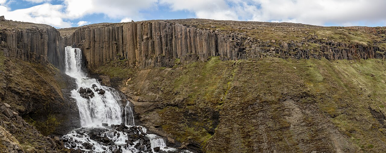 💧Waterfall
Stuðlafoss
Stuðlafoss drops over a face of hexagonal basalt columns in East Iceland's Jökuldalur valley, the columns stepping back at varying heights to form a tiered shape behind the falls. The waterfall is modest in scale, but the geometry of the surrounding stone is the draw — the same columnar jointing found at Stuðlagil canyon nearby, at a more approachable scale. From the Ring Road near Skjöldustaðir, Route 923 (gravel) runs roughly 14 kilometres to a bridge over the Jökla at the farm Klaustursel, where there is parking. A 2-kilometre walk reaches the falls. Stuðlafoss does not appear on all maps, so coordinates or an Iceland-specific trail app are useful. The road is passable without 4WD in dry conditions; check after rain. Most visitors pair this with Stuðlagil canyon nearby, where the same basalt geology lines the Jökla at a larger scale — revealed after the Kárahnjúkar dam lowered river levels. Together they make a half-day excursion from Egilsstaðir, about 70 kilometres east. June through September is the practical window.
Read details → 🏘️Town
Vopnafjörður
Vopnafjörður sits at the inner end of a wide northeast Iceland fjord, flanked by headlands opening onto Bakkaflói and Héraðsflói bays. The name traces to a Viking-age settler called Eyvindur Vopni — "vopni" meaning weapon — and the area served as a major emigration departure point in the late 1800s. The Kaupvangur Museum documents that story. Around 700 people live here now, mostly in fishing and agriculture. The most-visited nearby site is Bustarfell, a turf-farm museum about 20 km outside town. The farm has been in the same family since the 16th century, making it one of Iceland's oldest continuously occupied sites. Three kitchens from different centuries are preserved side by side, giving a concrete sense of how life changed across generations. It opens seasonally in summer. Vopnafjörður sits on the Arctic Coast Way scenic route, with salmon rivers, the Gljúfurárfoss waterfall, and uncrowded black sand beaches nearby. Services are limited — fill up on fuel and supplies before heading further northeast. The drive in from the Ring Road via Route 85 is scenic and quiet.
Read details →Highland
3 placesExplore the incredible sights and unique geological wonders of this region in Iceland.
 ♨️Hot Spring
Hveravellir Highland
The Kjölur highland road (F35) cuts between the Langjökull and Hofsjökull glaciers, and roughly halfway along it sits Hveravellir — a geothermal field where turquoise pools steam against a backdrop of black sand and distant ice caps. The centrepiece is a blue bathing pool at a comfortable temperature, surrounded by hot springs, fumaroles, and silica formations. A small fee applies to use the pool; the geothermal area is free to walk through. The place has been a waystation since the saga age. Fjalla-Eyvindur, an 18th-century outlaw, survived several highland winters here using the geothermal warmth, and the ruins of his shelter are still visible among the springs. A Touring Association hut provides basic bunk accommodation and meals in summer. F35 is an F-road, open only in summer — typically from around mid-June — and requires appropriate clearance; check road.is before departing. The drive from Reykjavík is roughly four to five hours. Budget at least an hour on site, longer if you plan to soak; the landscape between two glaciers tends to hold you longer than planned.
Read details → 🌋Volcano
Lakagígar Craters
On June 8, 1783, the ground cracked open along a 27-kilometre fissure in Iceland's southern highlands and kept erupting for eight months. Fluorine in the ashfall poisoned livestock and pastures, triggering a famine that killed an estimated 9,000–10,000 people — roughly a fifth of the population. A sulphur dioxide haze spread across Europe that summer and the Northern Hemisphere cooled for years. Today the surrounding lava field, Eldhraun, is carpeted in thick green moss — one of the largest such fields on Earth. Around 130 craters line up in an eerily regular row. A marked trail climbs 1.8 kilometres to the summit of Mount Laki at 818 metres, where the full crater row stretches to both horizons. Information boards explain the eruption's consequences. Access is via road F206, a rough highland track about 40 kilometres from the Ring Road with river crossings; allow two hours each way. The road typically opens late June and closes in early September, and a capable 4x4 is essential — a standard car will not get through. Guided super-jeep tours from towns in South Iceland are a practical alternative if you would rather not drive the F206 yourself.
Read details → 🌋Volcano
Víti Askja Lake
Víti — "Hell" in Icelandic — is an explosion crater on the rim of the Askja caldera in the Central Highlands, holding a geothermal lake of milky-blue water warm enough to swim in. The crater formed in the catastrophic 1875 eruption that blanketed northeast Iceland in ash and drove thousands of Icelanders to emigrate to North America. A steep sandy path descends inside, and in good conditions visitors wade into roughly 25°C water, though the sulphurous smell and murky bottom are part of the deal. Swimming is sometimes restricted by rangers depending on water acidity or landslide risk — check at Dreki mountain hut before counting on a swim. Right beside Víti, separated by a low ridge, is Öskjuvatn — the vast, deep, cobalt-blue caldera lake formed in the same eruption. The contrast between the two bodies of water, one cloudy and warm, one clear and cold, is striking. Getting here requires a 4x4 on F-roads, with river crossings en route. The road is passable only from late June to early September. Many visitors join a super-jeep tour from Lake Mývatn, which handles the navigation on the rougher highland tracks.
Read details →North Iceland
11 placesExplore the incredible sights and unique geological wonders of this region in Iceland.
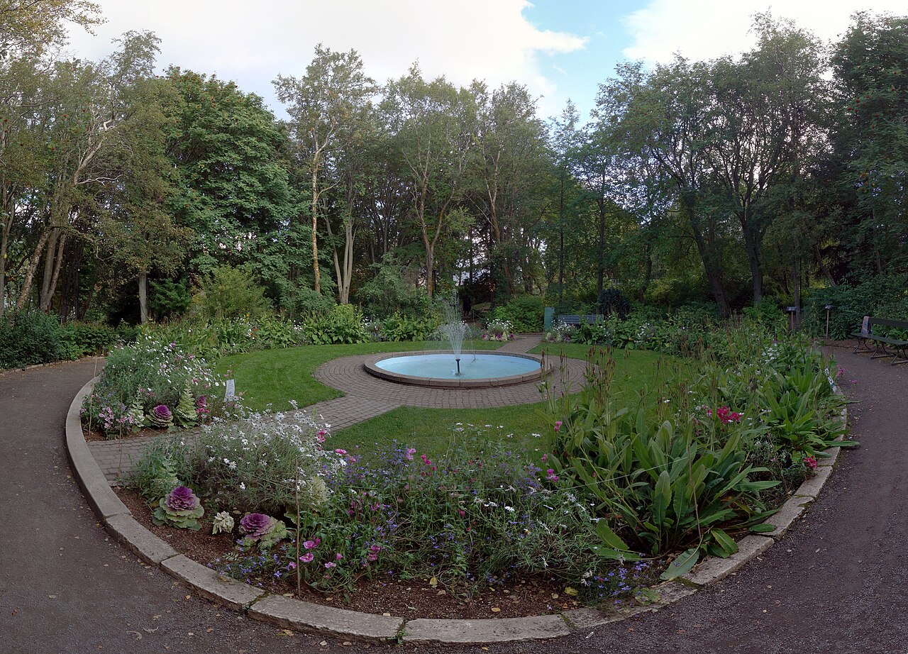 👀Viewpoint
Akureyri Botanical Garden
Lystigarður AkureyrarAbout 85 km south of the Arctic Circle, the Akureyri Botanical Garden is one of the world's northernmost botanical gardens — and the fact that it needs no greenhouse for most of its plants reflects Akureyri's unusually mild microclimate. Its origins go back to 1910, when local women founded a Park Association and secured land from the city; it opened in 1912. Today it covers around 3.6 hectares with over 7,000 plant species, including native Icelandic flora, alpine plants, an arboretum, and what is claimed to be the northernmost rose collection in the world. Entry is free, and the garden is a genuine local favorite on warm afternoons. Winding paths connect the themed sections, benches are scattered throughout, and a small café operates in summer. The best season is June through September when the garden is in full bloom; outside those months it is open but quieter and the café is closed. From central Akureyri it is a short drive or an uphill walk. An hour covers it comfortably — more if you linger in the rose section. A natural stop before heading further into north Iceland.
Read details →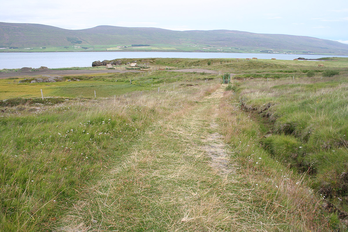 🏛️Historic Site
Gásir Medieval Trading Post
GásirFor several centuries in the Middle Ages, Gásir was northern Iceland's most important trading hub — a seasonal harbour on Eyjafjörður where merchants from across Europe arrived each summer. Excavations from 2001 to 2006 found trading booth remains and evidence of high-value exports: gyrfalcons, walrus ivory, and sulphur alongside bulk goods like dried fish. The site appears in several Old Icelandic sagas and was active from around the 11th century until trade shifted south to Akureyri in the 16th century. Today Gásir is a quiet, flat stretch of land on the fjord about 11 kilometres north of Akureyri, reached by a short gravel road. There is no reconstruction — just the open ground, the fjord view, and interpretive signs explaining the excavations. Every July the Akureyri Museum runs a medieval festival here with period costumes, crafts, and food; if the timing works, it is worth combining with a visit. Access is free, the gravel road does not require a 4WD, and the site is open year-round. The most comfortable visiting window is May through September.
Read details →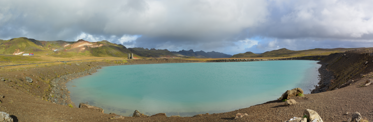 👀Viewpoint
Grænavatn (Mývatn)
GrænavatnSouthwest of Lake Mývatn, a small lake called Grænavatn takes on a distinctly green cast from the algae and minerals fed in by thermal springs — the name means simply "Green Lake," and the color, which shifts from olive to murky jade depending on the light, is the point of the stop. A stream, Grænilækur, drains the lake toward Mývatn itself. The surrounding area takes its name from Grænavatn farm, a historic settlement occupied since the Viking Age; the turf farmhouse from 1913 is held by Iceland's National Museum. The lake lies off Route 1 between the Skútustaðir pseudocraters and the Dimmuborgir lava formations. It is a brief, low-key stop — budget around 20 minutes — but it adds texture when working through the area's volcanic geography. The access passes through private farmland, so stay on the path. Námaskarð geothermal field, Hverfjall crater, and Grjótagjá cave are all within a short drive, making Grænavatn a natural add-on rather than a destination in itself. Year-round access, no entry fee.
Read details →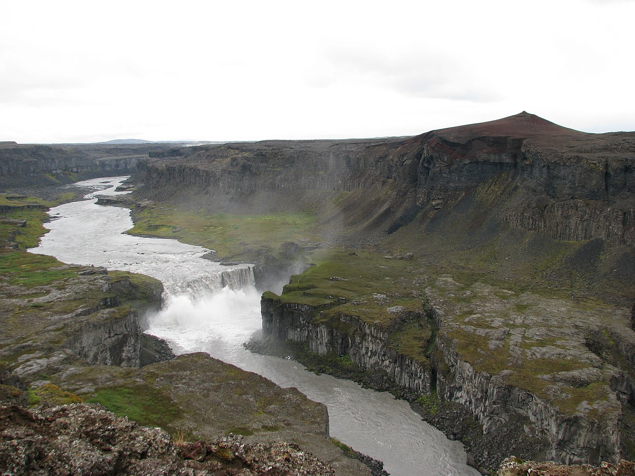 💧Waterfall
Hafragilsfoss
Downstream from Dettifoss, the Jökulsá á Fjöllum continues through the Jökulsárgljúfur canyon before dropping over Hafragilsfoss — around 27–30 meters into a gorge flanked by dark basalt columns. The falls are far less visited than their upstream neighbor, which means genuine solitude and the canyon's full scale to yourself. The east bank approach via Route 864 gives the best views. The parking area near Sjónnípa hill sits on the canyon rim with sight lines both south toward Dettifoss and north toward the Hólmatungur wetlands. Hafragilsfoss lies about 2.5 kilometers south of Dettifoss; most visitors combine both in a single walk along the rim trail. The path is well-marked but expect uneven ground and mud after rain — allow an hour for the return walk plus time at the viewpoint. Route 864 is gravel but manageable without 4x4 in dry summer conditions. The west bank road (Route 862) closes in winter, making the east bank the reliable year-round option. No facilities at the falls, so bring water and layers — the canyon rim is exposed and wind can be sharp even in summer.
Read details →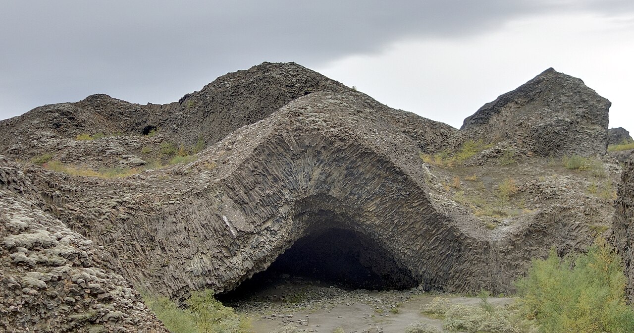 👀Viewpoint
Hljóðaklettar Echo Rocks
HljóðaklettarMost basalt in Iceland stands in tidy vertical columns. Hljóðaklettar is different: the lava here cooled inside ancient volcanic conduits around 8,000 to 9,000 years ago, so the columns run vertical, horizontal, and radial — sometimes all within a few meters of each other. The result is a maze of honeycomb walls, arched caves, and twisted formations with no obvious parallel elsewhere on the island. Several clusters have been named: Kirkjan (the Church), Kastalinn (the Castle), and Tröllið (the Troll) among them. The site sits along the Jökulsá á Fjöllum river in Jökulsárgljúfur canyon, part of Vatnajökull National Park, roughly between Dettifoss and Ásbyrgi. Marked trails range from a 30-minute loop to two hours including the Rauðhólar crater row. Birch scrub fills parts of the valley, and the river runs alongside. The canyon road (Route 862) is gravel, no 4x4 needed, open generally June through September. Camping at the nearby Vesturdalur campsite makes this a good overnight base for the whole canyon.
Read details →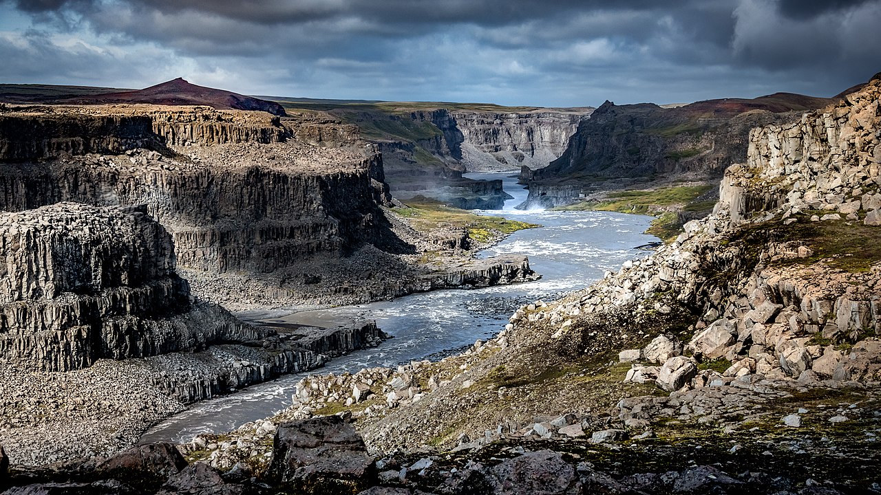 👀Viewpoint
Hólmatungur
Spring-fed streams emerge from the canyon walls at Hólmatungur, fanning across the valley in clear channels and small waterfalls before joining the cloudy glacial Jökulsá á Fjöllum. The contrast between crystal springs and the silty main river is striking. Lush vegetation — angelica, wildflowers, low trees — clings to the cliffsides, giving this stretch of Jökulsárgljúfur an unusually green character for Iceland. The main loop (trail H1) covers about 4.5 km in one to two hours, following the Hólmá river west to Hólmárfossar waterfalls and returning along the Jökulsá. A harder extension, trail H2, branches to Katlar where the river narrows into a gorge with dramatic whirlpools. Hólmatungur sits midway along the canyon between Dettifoss to the south and Ásbyrgi to the north — a natural stop on the multi-day canyon trail. Access is via Road 862 north from the Ring Road, then east on Road 887 to the gravel car park at Ytra-Þórunnarfjall — no 4x4 required. Entry is free inside Vatnajökull National Park. Trails are reliably open June through September only; camping is not permitted here.
Read details →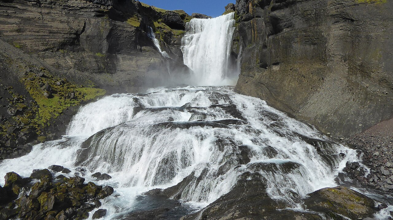 💧Waterfall
Hrafnabjargafoss
Upstream from the famous Goðafoss, the Skjálfandafljót river carves through a lava field roughly 9,000 years old and then drops over Hrafnabjargafoss — a two-chute waterfall split by a large central rock island, falling into a broad bowl-shaped gorge. The name translates to Raven Rocks' Waterfall, a reference to the dark basalt formations framing it. At around 5 meters tall it is not imposing by Icelandic standards, but the wide spread of the drop and the remote highland setting give it a character quite different from roadside waterfalls on the tourist circuit. Getting here takes effort. From the Ring Road east of Akureyri, the route runs south on gravel before joining Highland Road F26 (Sprengisandur), which is only open in summer. From the Aldeyjarfoss parking area, a rough track leads another kilometer to the riverbank where the falls appear. Plan two to three hours from Akureyri at minimum — the road is slow going. Visitor numbers are low even in peak season; carry extra water and let someone know your route, as the area has no services.
Read details →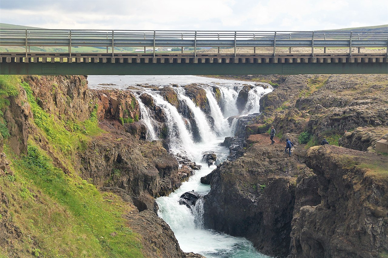 💧Waterfall
Kolufoss
Kolugljúfur is a narrow gorge cut by the Víðidalsá river in northwest Iceland, about 15 minutes off the Ring Road on Road 715. The canyon runs roughly a kilometre, reaches around 40 metres deep, and holds a series of waterfalls called Kolufoss that drop into the tight slot from multiple angles — more enclosed and dramatic than a single-drop fall. A bridge at the parking area gives an immediate overview, and a short path follows the rim to several vantage points. The local legend holds that a giantess named Kola lived here, catching salmon from the river and cooking them in nearby hot springs. The canyon and falls are named after her. The Víðidalsá is still a salmon river today. Road 715 is gravel and connects back to Route 1 after a short drive. A standard 2WD car handles it fine in summer; check road.is before coming in winter. The whole stop takes well under 30 minutes. No fees, no facilities at the site.
Read details →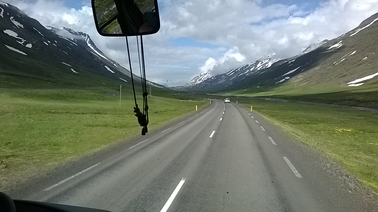 👀Viewpoint
Öxnadalur Valley
ÖxnadalurDriving west from Akureyri on Route 1, Öxnadalur opens with knife-edged peaks on either side, old farms on the valley floor, and the jagged silhouette of Hraundrangi dominating the skyline. That peak — its name means "Steeple Rock" — rises to around 1,075 meters; its shape was sharpened by glacial erosion and the collapse of the mountain's flank at the end of the last Ice Age, and it looks unlike anything else along this stretch of the ring road. The valley has literary weight. The farm Hraun, visible below the mountain, was the birthplace of Jónas Hallgrímsson, the 19th-century poet and naturalist central to Iceland's national identity. His poem "Ferðalok" is partly an ode to this landscape, and a small museum at the farm marks his memory. There are no fees; you pull off Route 1 at a viewpoint and spend about 45 minutes taking it in. The mountain pass Öxnadalsheiði can close during severe winter storms — check road.is before traveling in January or February. The rest of the year the drive is straightforward on paved road.
Read details → 🏘️Town
Sauðárkrókur
Sitting on the southwestern shore of Skagafjörður Fjord, Sauðárkrókur is the largest town in Northwest Iceland and the main service hub for one of the country's most important horse-breeding regions. The surrounding Skagafjörður valley has been famous for Icelandic horses for centuries, and several nearby farms offer riding tours. The town has a swimming pool, restaurants, accommodation, and a secondary school serving the wider northwest — it functions as a genuine regional center. Nearby Glaumbær preserves one of Iceland's best examples of traditional turf farmhouses and is worth a short detour. Boat tours to Drangey, the dramatic rock island associated with outlaw Grettir's saga, leave from the local marina. Borgarsandur, a black sand beach stretching nearly four kilometres east, is a quieter coastal walk. From Akureyri, Sauðárkrókur is reached by turning onto Route 75 through the valley — a scenic drive in its own right. It makes a practical overnight base for exploring Skagafjörður and the Troll Peninsula.
Read details → 💧Waterfall
Selfoss
Wide, shallow, and horseshoe-shaped, Selfoss sits about one kilometer upstream from Dettifoss on the Jökulsá á Fjöllum river in northeast Iceland. At 11 meters tall it lacks the raw vertical drama of its neighbor, but it compensates with breadth — the water spreads across roughly 100 meters of dark basalt ledges, splitting into dozens of smaller cascades. The effect is more intricate than Dettifoss, and many visitors find it the more photogenic of the two. Both falls share the same parking areas. From the west bank, take the paved Route 862 (open year-round); the gravel Route 864 on the east bank is seasonal. A marked trail runs north along the canyon rim from the Dettifoss viewpoint to Selfoss — about a 15-minute walk. The path can be wet and rocky. Because Dettifoss draws most of the crowds, Selfoss often feels noticeably quieter even in peak season. Flow peaks in summer with glacial melt but the falls run year-round. Bring waterproofs when water is high. The entire area sits within Vatnajökull National Park.
Read details →Northeast
3 placesExplore the incredible sights and unique geological wonders of this region in Iceland.
 💧Waterfall
Dettifoss
The Jökulsá á Fjöllum river delivers an average of around 193 cubic meters of glacial water per second over Dettifoss — a 44-meter drop across a face about 100 meters wide. Glacial sediment turns the water grey-brown, and the force is physical: the ground trembles at the viewing platforms, and spray hangs permanently over the canyon. This is where Ridley Scott opened Prometheus. Two roads reach the falls from opposite banks. Route 862 on the west is paved and open year-round; most visitors use it. The path from the car park to the falls is well-worn but gets muddy because most of the spray falls on the west side. Route 864 on the east is older gravel road, usually passable only in summer, with a slightly different viewing angle and less spray. Worth the extra walk: Selfoss is about a kilometer upstream, broader and quieter than Dettifoss, and most day-trippers skip it entirely. Hafragilsfoss sits downstream in the gorge. A waterproof layer is worth having on the west bank regardless of the forecast.
Read details →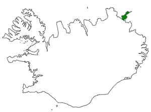 👀Viewpoint
Langanes Peninsula
LanganesLanganes is a 45-kilometre finger of land pointing northeast from Iceland's coast, and the further you drive the less it feels like anywhere else. Sealed road gives way to gravel, gravel thins to a rough track, and at Fontur — the very tip — the Langanesviti lighthouse (first built in 1910) stands with open ocean in three directions. No entry fees, no crowds, poor mobile coverage: bring fuel, food, and water from Þórshöfn. The main summer draw is birdlife. Skoruvíkurbjarg cliffs hold one of the world's largest gannet colonies, centred on Stóri Karl, a rock column offshore. A purpose-built clifftop platform gives a direct sightline to the nesting birds. Puffins, guillemots, and kittiwakes pack the same cliffs from May through June. The interior holds ruins of abandoned settlements, including Skálar, a fishing community that supported over a hundred people in the early 1900s before being abandoned by 1946. Road 869 is gravel throughout, passable by a regular car in dry summer conditions, though rougher sections near Fontur suit a 4x4. Allow four hours for the round trip.
Read details →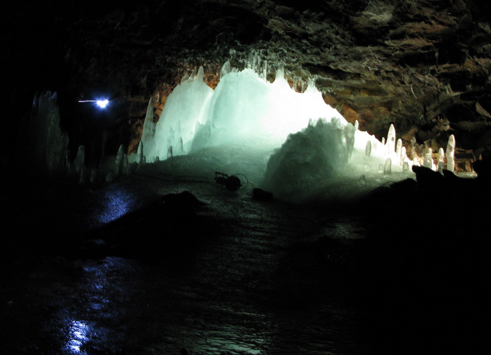 🕳️Cave
Lofthellir Lava Cave
LofthellirLofthellir is a 370-metre lava tube formed roughly 3,500 years ago in the Laxárdalshraun lava field, a few kilometres east of Lake Mývatn. What sets it apart from other Icelandic lava caves is a permanent accumulation of ice: groundwater seeps through the porous basalt ceiling, freezes on contact with the sub-zero air inside, and has built up over centuries into towers and columns of clear ice that grow incrementally each winter. The cave holds the largest known natural ice formations inside an Icelandic lava cave. Access is by guided tour only — the cave sits on private farmland and entry without a licensed guide is not permitted. Tours depart from the Mývatn area in a modified super jeep, crossing rough volcanic tracks past the Hverfjall tephra crater and Lúdentarborgir crater row before parking near Mount Hvannfell. From there, a 20–30 minute walk across uneven lava leads to the cave entrance, which requires crawling on hands and knees through a narrow passage before opening into larger chambers. Guides provide helmets, headlamps, and studded boots. The total outing runs approximately 4–5 hours. Interior temperatures stay at or below 0°C year-round, so warm layered clothing is essential regardless of season. The tour is not suitable for people with acute claustrophobia, significant mobility limitations, or children under 8. Prices start around 42,900 ISK per adult with local operators based in the Mývatn area. Photo: Jon Stefansson / Flickr (CC BY 2.0)
Read details →Northwest
4 placesExplore the incredible sights and unique geological wonders of this region in Iceland.
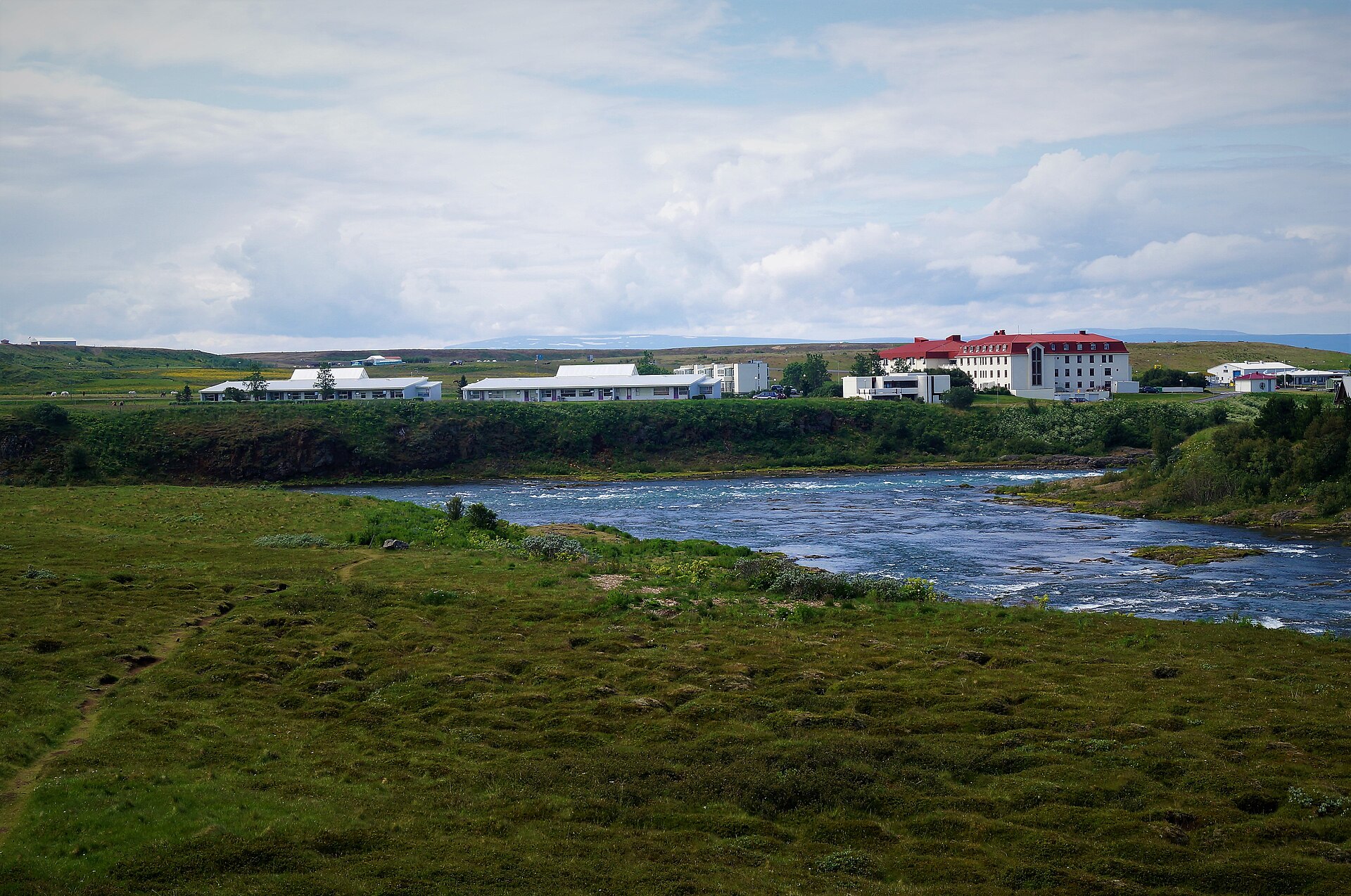 🏘️Town
Blönduós
Blönduós is the largest service town on Húnaflói Bay, where the Blanda river meets the sea in northwest Iceland. With roughly 880 residents it's a practical Ring Road stop — supermarket, fuel, accommodation, pool. The modern church has an unusual crater-inspired form. The Icelandic Textile Centre covers the country's weaving traditions, and the Sea Ice Exhibition documents the polar ice that drifts down with the East Greenland Current and has historically disrupted fishing on this coast. Most travelers use the town as a base for the Vatnsnes Peninsula, about 30 minutes away. Hundreds of harbour seals haul out on the rocks at Illugastaðir on the peninsula's west coast; there's a small car park and you can walk to close range. The best window is two hours either side of low tide. The basalt sea stack Hvítserkur, about 15 metres tall, sits just north and is easily combined in the same outing. Blönduós falls roughly halfway between Reykjavík and Akureyri, making it a natural break. Allow an hour for the town, and add half a day if you plan to loop the Vatnsnes Peninsula.
Read details → 🏛️Museum
Hvammstangi Seals
The Icelandic Seal Center sits on the harbor in Hvammstangi, a small town just off Route 1 on the Vatnsnes Peninsula. A non-profit museum and research facility operating since 2005, it focuses on Iceland's two resident seal species — harbor seals and grey seals — plus the coastal wildlife found along these shores. Exhibits cover biology, behavior, the history of seal hunting, and conservation. The center also serves as the local tourist information office, and staff can advise on where seals are hauling out on any given day — Illugastaðir and Ósar are the main viewing spots on the peninsula. The museum is small; most visitors move through in 20–30 minutes. The real value is the practical intelligence it offers before you head out: where to park, how close to get, how to watch without disturbing the animals. Opening hours shift seasonally — longer hours from May through September, shorter weekday-only hours in winter. The center sits about 6 km off the Ring Road, roughly halfway between Reykjavík and Akureyri, and makes an easy stop on any ring-road itinerary.
Read details → 👀Viewpoint
Hvítserkur
Hvítserkur is a 15-metre basalt pillar in Húnafjörður bay on the east side of the Vatnsnes peninsula, its silhouette compared to a drinking dragon or elephant depending on the angle. The name means "white shirt" — a reference to the bird guano covering its dark flanks, where fulmars and gulls nest. The rock is thought to be an ancient magma dike left standing after softer surrounding rock eroded away. Concrete reinforcements at the base slow the erosion. The viewpoint sits above a short, steep path to a black sand beach. At low tide you can walk close to the base; at high tide the water rises around the stack and the scene changes considerably. The beach offers better angles than the clifftop, especially near sunset. The drive along Vatnsnes is gravel but manageable without a 4x4, and the peninsula has reliable seal-watching spots at Illugastaðir and Ósar. Hvítserkur is roughly 30 km off the Ring Road — far enough to keep crowds lighter than Ring Road stops, though summer afternoons have grown busier. Allow about 30 minutes, longer if you time a low-tide beach visit.
Read details → 👀Viewpoint
Vatnsnes Seals
The Vatnsnes Peninsula holds Iceland's most reliable seal-watching, with both harbor seals and grey seals hauling out on rocky beaches year-round. The main viewing site at Illugastaðir has an 800-meter wheelchair-accessible path to a covered shelter with binoculars. Seals rest on the rocks during the two hours either side of low tide; at high tide you may see nothing. June and July are the best months — harbor seal pupping season brings the most animals ashore. Start in Hvammstangi, a small town at the base of the peninsula where the Icelandic Seal Centre covers seal biology and current viewing conditions. The circuit around the peninsula also passes Hvítserkur, a basalt sea stack worth the short detour. There is a small parking fee at Illugastaðir farm, which also has restrooms and a campsite. Vatnsnes is around 2.5 hours from Reykjavík — a long day trip, more comfortable as an overnight. The structured field is marked free, though the Illugastaðir parking fee applies on-site. Stay well back from the seals; binoculars or a telephoto lens serve you better than trying to close the distance.
Read details →Reykjavik Area
4 placesExplore the incredible sights and unique geological wonders of this region in Iceland.
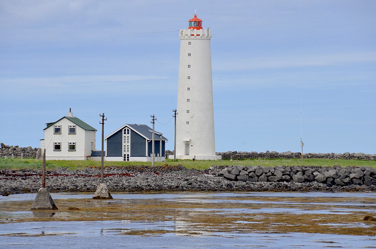 ✨Northern Lights
Grótta Lighthouse
GróttuverGrótta sits at the tip of the Seltjarnarnes peninsula, less than 20 minutes from central Reykjavík, and it's probably the easiest place in the capital region to feel away from the city. The lighthouse — first built in 1897, rebuilt in 1947 — stands on a small tidal islet accessible across a sandy causeway at low tide. The crossing window is only a few hours, so check tide tables before going. From September through April, dark skies and unobstructed ocean views make Grótta one of the better aurora spots reachable from Reykjavík. The area also holds Kvika, a small geothermally heated seawater foot pool on the coast at around 39°C — warming your feet while watching for lights is a legitimate use of a winter evening. Parking is free and the site is open at any hour. Between May 1 and July 15, the islet itself is closed during the bird nesting season — Arctic terns, eiders, and other seabirds breed here. You can still walk the coastal path on the peninsula during this period. The rest of the year it is a calm, uncrowded spot that most visitors to Reykjavík never find.
Read details →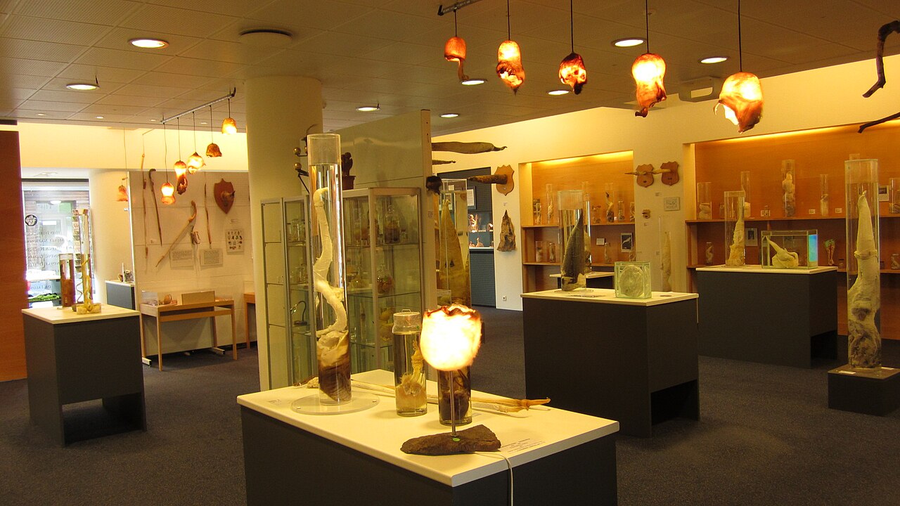 🏛️Museum
Icelandic Phallological Museum
Hið Íslenzka ReðasafnThe world's only museum dedicated entirely to phallic specimens sits at Hafnartorg Square in central Reykjavík, and it takes itself seriously in the most deadpan Icelandic way. Founded in 1997 by historian Sigurður Hjartarson, the collection has grown to over 300 specimens from more than 100 mammal species — ranging from a tiny hamster to a full sperm whale — alongside folklore exhibits covering supernatural creatures from Icelandic tradition. The museum is compact; most visitors spend around an hour. The approach is genuinely scientific, with each specimen labeled by species, provenance, and preparation method. The gift shop leans hard into the theme. Admission is around 2750 ISK for adults; children under 13 enter free. Open daily 10am–7pm year-round, and walkable from most Reykjavík accommodation. Whatever your reaction going in, the museum earns its reputation less through shock value than through sheer commitment — decades of collecting from one obsessive archivist.
Read details →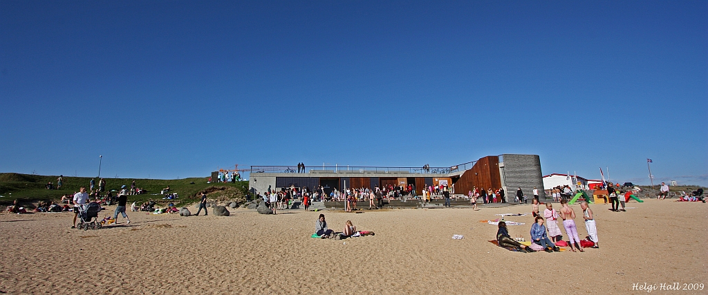 🏖️Beach
Nauthólsvík Geothermal Beach
NauthólsvíkGeothermal hot water is pumped into a sheltered bay here, raising the lagoon temperature from the ocean's natural 4–6°C to around 15–19°C in summer. A large hot tub maintained at roughly 38°C sits in front of the service building for those who want a proper soak. The beach is a genuine local hangout — on a warm afternoon you will find Reykjavík residents sunbathing and grilling alongside children in the shallow water. The beach opened in 2000 and features imported light-coloured sand, changing rooms, showers, and a small café. Admission is 1,500 ISK for adults and 400 ISK for children aged 10–17; younger children enter free. The full beach season with the heated lagoon runs roughly mid-May through mid-August, though facilities including the hot tub operate year-round. To get there, drive south along the coast from the city centre — the beach sits below Perlan and is signposted off Nauthólsvegur, facing Faxaflói bay with views toward Mount Esja. The hot tub draws regulars even in January.
Read details →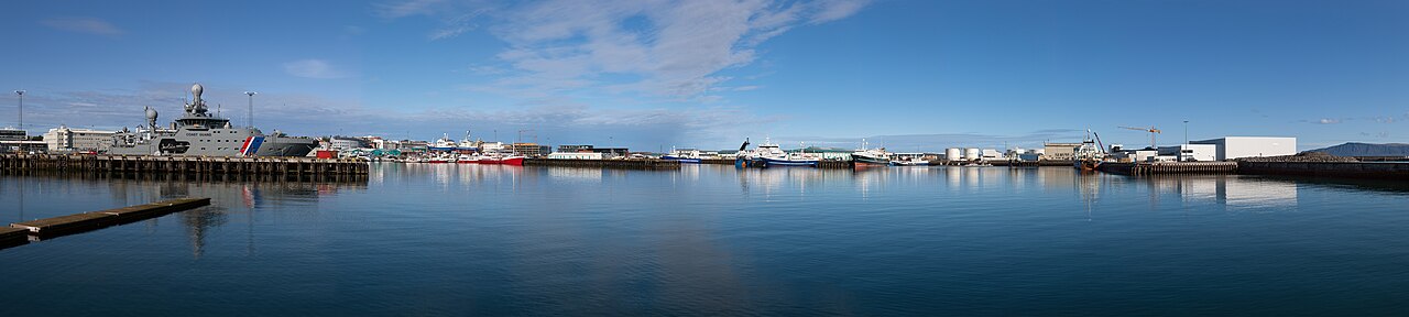 🏘️Town
Reykjavík
The world's northernmost capital of a sovereign state sits on Faxaflói bay in southwest Iceland, home to around 139,000 people in the city proper and roughly 253,000 in the wider capital region — about 64% of Iceland's entire population in one compact, walkable city. The old core runs along Laugavegur, the main shopping street, whose name recalls the route Reykjavík women once walked to do laundry in geothermal springs up the valley. Hallgrímskirkja church dominates the skyline; its tower lift gives views over the city and bay. On the waterfront, Harpa concert hall — opened in 2011 with a geometric glass facade by Olafur Eliasson and Henning Larsen — hosts the Iceland Symphony Orchestra year-round. Geothermal swimming pools are where locals actually spend leisure time. Summer brings the midnight sun and major music and culture festivals; winter brings northern lights visible from the outskirts. The Golden Circle — Þingvellir, Geysir, Gullfoss — is under two hours by car, making Reykjavík a practical base for day trips across the country.
Read details →South
34 placesExplore the incredible sights and unique geological wonders of this region in Iceland.
 👀Viewpoint
Bridge Between Continents
A short footbridge spanning a ragged lava fissure on the Reykjanes Peninsula marks one of the few places on Earth where the Mid-Atlantic Ridge rises above sea level, making the boundary between the North American and Eurasian tectonic plates physically walkable. The bridge was built in 2002 as a symbolic crossing; the rift is real, the product of two plates pulling apart at around 2.5 centimeters per year. The surrounding landscape confirms this — fractured lava fields, sparse vegetation, rock that looks newly made because much of it is. Standing at the bridge and looking along the rift gives a clearer sense of the geology than any exhibit. The fissure is wide enough to straddle, though the actual plate boundary is a broad zone rather than a single line. Certificates marking the crossing are available at the Reykjanes Information Center nearby. The site is free and open at any hour. It sits about 50 kilometers from Reykjavík and 23 kilometers from Keflavík Airport — easy to work into an arrival or departure day. Parking is on-site; sturdy shoes help on the uneven lava surface.
Read details → 👀Viewpoint
Dyrhólaey
Dyrhólaey is a 120-metre volcanic promontory named for the enormous rock arch at its tip — "door-hole island" — wide enough that small boats and even a small aircraft have passed through it. What was once a true island is now connected to the mainland, though from the upper viewpoint the geology still reads clearly: a solid plug of volcanic rock dropping sheer to the surf. Two parking areas serve the site. The lower lot sits near the cliffs; the upper lot, by the white lighthouse, is the better viewpoint. A 15 to 20-minute walk covers the main overlooks, with views east toward Reynisfjara black beach, the Reynisdrangar sea stacks, and Mýrdalsjökull glacier to the north. Atlantic puffins nest on the clifftops from late April through August. The upper area closes overnight during nesting season — roughly 7 PM to 9 AM — to protect the colonies, so plan arrival accordingly. Dyrhólaey has been a nature reserve since 1978. The clifftop is exposed and unguarded in places; keep clear of edges in wind. It sits just off Route 1, about 20 kilometres west of Vík, and pairs naturally with Reynisfjara beach.
Read details → 🌋Volcano
Eldfell Warm
At 1:55 in the morning on January 23, 1973, a fissure tore open on the eastern edge of Heimaey — about a kilometre from the town centre — and within hours had grown to over two kilometres long, shooting lava fountains 150 metres into the sky. Nearly all of the island's 5,300 residents were evacuated by boat within six hours. By the time the eruption ended in July, around 400 buildings had been destroyed and the island had gained significant new land. Eldfell, the cone that built itself from nothing during those five months, now stands about 200 metres above sea level. The hike to the summit takes around 45 minutes at an easy pace, passing through vivid bands of rust-red and orange ash that give the mountain its distinctive colouring. Ground warmth is still detectable in places — the earth close to the surface retains enough heat that warm spots are scattered across the upper slopes, a tangible reminder of how recently this rock was moving. From the top, views take in the rebuilt town directly below, the steep cliffs around Heimaey, the other Westman Islands scattered to the south, and open Atlantic on all sides. The Eldheimar museum in town, built around an excavated house still half-buried in ash, tells the 1973 story with considerable depth and is worth an hour of its own. Getting to Heimaey requires either a 30-minute ferry from Landeyjahöfn on the South Coast or a short flight; the island is small enough to explore on foot or by bicycle. Eldfell itself has no entry fee and no set path — you simply walk up.
Read details → 🏛️Museum
Eldheimar 1973
At around 2 AM on January 23, 1973, a volcanic fissure opened less than 200 meters from the edge of Heimaey town. Within hours, the entire population of roughly 5,300 people had evacuated to the mainland. The eruption lasted five months, burying around 400 buildings under lava and ash. Eldheimar was built around one of those houses — left exactly as archaeologists found it, volcanic debris still filling the rooms, a domestic interior frozen at the moment of evacuation. The museum pairs this preserved house with exhibits, survivor testimonies, film footage, and documentation of the decision to pump cold seawater onto the advancing lava to save the harbor. That improvised operation is examined in satisfying detail; without the harbor, the island had no economic future. Plan about an hour. Getting to the Westman Islands requires a 35-minute ferry from Landeyjahöfn on the South Coast or a short flight from Reykjavík. The ferry can be rough in bad weather, so leave room in your schedule.
Read details → ❄️Glacier
Eyjafjallajökull Volcano
In April 2010, Eyjafjallajökull shut down European airspace for six days — not because of a massive eruption, but because the volcano sits beneath a glacier, and meltwater meeting magma blasted fine ash to altitudes aircraft cannot safely fly through. The stratovolcano reaches 1,651 meters; its summit ice cap spans roughly 66 square kilometers and is up to 200 meters thick. Gígjökull, the main outlet glacier on the northern flank, was torn apart by the meltwater flood that poured down into the Markarfljót river system, and the volcanic system beneath the ice remains active. The glacier is visible from much of the South Coast, between Seljalandsfoss and Skógafoss on Route 1. Guided super-jeep tours and glacier walks operate from nearby farms; the summit itself requires technical mountaineering gear. The Þórsmörk valley on the eastern flank, sheltered by the massif, makes a good base for multi-day hiking. The Eyjafjallajökull Visitor Center at Þorvaldseyri farm, just off Route 1, tells the eruption story through farming families who lived through ash falls, evacuations, and watched the mountain erupt from their own fields. It is one of the more human-scale visitor centers in Iceland, worth a stop even without going onto the glacier.
Read details → 🥾Hiking Trail
Fimmvörðuháls Epic
The Fimmvörðuháls pass trail runs roughly 25 kilometers from Skógar on the south coast to the highland valley of Þórsmörk, threading the gap between two glaciers — Eyjafjallajökull to the west and Mýrdalsjökull to the east. The first section climbs alongside the Skógá river, passing around 26 waterfalls before the landscape turns entirely volcanic: a black plateau of ash and lava from the 2010 Eyjafjallajökull eruption, with two craters, Magni and Módi, visible right off the path. The pass itself sits at around 1,000 meters elevation. The full hike takes 8 to 10 hours at a steady pace; total elevation gain is roughly 1,000 meters, so fitness and proper footwear are not optional. Snow often lingers on the high sections into June, and weather near the glaciers can shift fast. The trail is in reliable condition from mid-June through September. The route is one-way, so most hikers arrange a bus back from Þórsmörk or continue onto the Laugavegur trail. The trailhead at Skógar sits right beside Route 1, about two hours from Reykjavík, with free parking at the Skógafoss car park.
Read details → ❄️Glacier
Fjallsárlón Icebergs
Fjallsárlón sits about 10 kilometers west of Jökulsárlón on the Ring Road, and while it draws far fewer visitors, the glacier views are more immediate: the lagoon lies right at the foot of Fjallsjökull, an outlet of Vatnajökull, so the snout looms close and icebergs are freshly calved just in front of you. The lagoon falls inside Vatnajökull National Park, a UNESCO World Heritage site. Zodiac boat tours run from April through October, lasting around 30 to 40 minutes among the ice. Getting close to a several-meter block of glacial ice from a small inflatable is a different experience from watching from the bank — you can see dark tephra bands running through it. Outside of tour season the view from shore is free and rarely crowded. On-site there is parking, a café, and a restaurant. The drive from Reykjavík is around four to five hours east on Route 1. No admission fee applies to the lagoon itself, and the proximity to the glacier face makes it a worthwhile stop even if you plan to visit Jökulsárlón the same day.
Read details → 💧Waterfall
Foss a Sidu
The waterfall at Foss farm drops roughly 80 meters down a basalt cliff directly beside the Ring Road, about 10 kilometers east of Kirkjubæjarklaustur. It's fed not by a river but by a small lake, Þórutjörn, at the top of the cliffs — which explains why the flow is relatively slender despite the long drop. The farm below takes its name from the falls, and it sits in the working agricultural landscape of the Síða district. On windy days, that slender column of water gets caught by updrafts against the cliff face and is pushed sideways or entirely backwards — the falls appear to run uphill. It only happens in genuinely strong wind, but the South Coast is windy enough that your chances are reasonable outside midsummer calm spells. No hike is required: the falls are visible from the road and you can pull over beside the farm. It's a quick stop rather than a destination — 10 to 15 minutes unless you're waiting for wind. Driving east from Reykjavík on Route 1, it appears roughly 260 km out, past Vík.
Read details →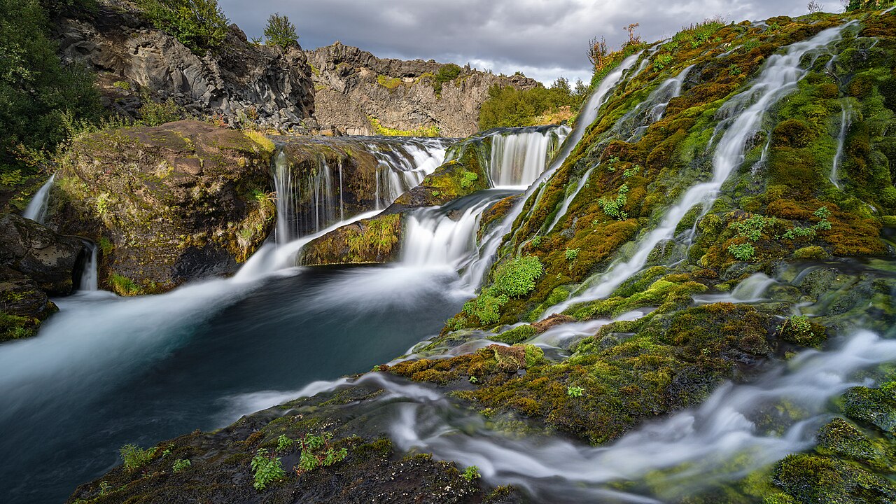 💧Waterfall
Gjain Oasis
The Rauðá river enters a narrow lava gorge in Þjórsárdalur and fans into dozens of small streams that spill over dark basalt ledges into clear pools, creating a dense network of cascades that looks nothing like the open highland landscape a few minutes' walk away. The gorge is carpeted in moss and low flowering plants, and the valley sides block the wind — giving it an unusually sheltered, lush quality for this part of Iceland's interior. Getting there requires a 4x4. From Route 32, turn onto the gravel Road 327, which can be rough and deeply rutted after rain. The walk into the gorge from the parking area is easy and flat; allow an hour to explore the canyon channels properly. The nearby Stöng archaeological site — a Viking-era longhouse buried by a volcanic eruption around 1104 — makes a logical pairing on the same trip. Gjáin is about two hours from Reykjavík via Routes 30 and 32, and Háifoss, one of Iceland's tallest waterfalls, lies close enough to combine in a day. Summer is the best time to visit: vegetation peaks from June through August and the access road is most reliably passable. There is no entrance fee.
Read details → 💧Waterfall
Haifoss
At 122 meters, Háifoss is one of Iceland's tallest waterfalls, and standing at the canyon rim looking straight down at the Fossá river's unbroken drop gives an immediate sense of just how tall that is. Right beside it, Granni — "the Neighbor" — falls into the same canyon from a separate channel; the two together make one of the more dramatic viewpoints in the Icelandic highlands. Getting there takes effort. Road 332 branches off Route 32 in the Þjórsárdalur valley and runs about seven kilometers of rough, potholed gravel to the parking area. It demands patience and a high-clearance vehicle; a 4x4 is the safe call, especially after wet weather. Once parked, the viewpoint is a short walk to the canyon edge. There are no toilets, café, or any services here — arrive prepared. The falls are most powerful in early summer when snowmelt swells the Fossá. Háifoss pairs well with a stop at Gjáin — a small volcanic gorge with lava formations — about ten minutes back down the valley. From Reykjavík the drive is roughly two hours.
Read details → 🌋Volcano
Hekla Climb
Hekla has erupted more than twenty times since Iceland was settled, often with very little warning — the 2000 eruption, the most recent, began with only about 80 minutes of detectable tremor. Icelandic authorities do not officially recommend the climb, and anyone heading up should register at safetravel.is. The summit stands at around 1,491 meters, and the ascent gains roughly 1,000 meters over lava fields and snow. The trail — unmarked but reasonably well-worn since 2000 — takes three to four hours each way from the trailhead near Route 26, ascending the northwest flank along the elongated ridge. Snow fields are likely even in summer, so crampons and trekking poles are worth bringing. Clear days give views across the southern highlands to distant glaciers. Hekla sits about 1.5–2 hours from Reykjavík on paved roads. The Hekla Center museum at Leirubakki farm offers solid context before or instead of the climb. Guided ascents are available through several South Iceland operators; July and August give the best chance of snow-free passage on the upper slopes.
Read details → 🏘️Town
Hella
About 94 kilometres east of Reykjavík on the Ring Road, Hella sits beside the Ytri-Rangá river with a direct view toward Hekla's ridgeline on clear days. With around 865 residents, it's a working town useful for fuel, a supermarket, accommodation at several price points, a geothermally heated pool, and a pharmacy. It sits between Selfoss and Hvolsvöllur, making it a natural overnight base for day-tripping in multiple directions. The Ytri-Rangá is one of Iceland's premier Atlantic salmon rivers; lodges nearby cater to fly-fishing clients who book years in advance. Highland bus connections run in summer toward Þórsmörk and Landmannalaugar — useful for anyone without a 4WD wanting interior access. Hekla, Seljalandsfoss, and Skógafoss are all within an hour's drive. Hella covers practical needs efficiently and costs less than accommodation in better-known towns nearby. The geothermally heated swimming pool — open to visitors — is the kind of quiet local spot where you'll share lanes with farmers rather than tour groups.
Read details → 💧Waterfall
Hjalparfoss
Two streams drop roughly 20 meters side by side at Hjálparfoss, leaning toward each other as they fall before merging in a wide pool below. The surrounding basalt is notably contorted rather than the clean hexagonal columns found elsewhere in Iceland — the lava cooled in more chaotic conditions, producing twisted formations that crowd the pool's edge. The name means "Help Falls." Travelers heading into the interior historically stopped here because the Fossá River kept the surrounding land well-watered and grassy enough to rest horses. That context matters: Þjórsárdalur holds several historical sites nearby, including the Viking-age farm ruins at Stöng, the reconstructed longhouse at Þjóðveldisbærinn, and the dramatic Háifoss a few kilometers up the road. Hjálparfoss is off Route 32, about 120 km from Reykjavík. The parking area is well-signed; a five-minute flat walk reaches the main viewpoint, with a slightly steeper path to the water's edge. The whole stop takes 30 minutes, so it works best as part of a longer Þjórsárdalur loop rather than a standalone trip.
Read details → 🏛️Historic Site
Hjörleifshöfði Viking
A solitary 221-meter headland rising from the black sands of Mýrdalssandur, Hjörleifshöfði is where Iceland's saga history becomes tangible. Hjörleifur Hróðmarsson, foster brother of Iceland's first settler Ingólfur Arnarson, arrived in 874 AD and was killed here by his Irish thralls the following year. The thralls fled to the offshore islands — known ever since as Vestmannaeyjar — where Ingólfur later hunted them down. A burial mound near the summit, Hjörleifshaugur, is believed to hold his remains. The hike to the top and back runs roughly seven kilometers and takes two to three hours. The western face is the gentler approach. From the summit, views stretch over the black desert to glaciers and the sea. At the eastern base sits Gígjagjá — better known as Yoda Cave — a lava formation whose shape has made it a popular photo stop. Turn off Route 1 onto the gravel track signed for the headland. A parking fee applies (around 1,000 ISK). The hike itself is free and open year-round, though the access track can be soft after rain.
Read details → 🏛️Historic Site
Hofskirkja Turf
Built between 1883 and 1885 by carpenter Páll Pálsson, Hofskirkja is the last turf church constructed in Iceland in the traditional style — a working building that closes a chapter of vernacular architecture stretching back to the Viking Age. The structure is small (under ten meters long): timber framing, stone side walls, and thick turf piled over the roof so it looks like it grew from the ground. Records of a church on this site go back to 1343, and it still functions as the parish church of Öræfi under the care of the National Museum of Iceland. The church sits in the Öræfi district of southeast Iceland, roughly between Skaftafell and Höfn, easily reached off the Ring Road. The surrounding graveyard holds old headstones, and on a clear day the Vatnajökull glacier tongues fill the background behind the grass-roofed building. Entry is free. The interior is open when services are not in progress: plain wooden pews, minimal decoration — exactly what a small rural congregation that needed a warm, durable winter building would have built. The whole stop takes about an hour.
Read details → 🏘️Town
Hvolsvöllur LAVA
About 105 km east of Reykjavík on Route 1, Hvolsvöllur is a small South Coast town with two museums that reward a stop. The main draw is the LAVA Centre, an interactive exhibition opened in 2017 on Iceland's volcanoes and earthquakes. Visitors move through rooms on the Mid-Atlantic Ridge and Iceland's volcanic systems, with real-time seismic monitoring and an earthquake simulator. Admission is charged (around 5,200 ISK for adults). It is a useful primer before driving toward Eyjafjallajökull, Katla, or Hekla. The Saga Centre nearby is dedicated to Njáls saga, one of the great Icelandic family sagas, much of whose action unfolds in this region. Exhibits include a 90-metre tapestry depicting saga scenes, a replica Viking longhouse, and a model of Þingvellir as it looked around the year 1000. Practically, Hvolsvöllur has fuel, a supermarket, accommodation, and restaurants — useful given how sparse services get further east. The town is also a departure point for highland routes to Þórsmörk and the Fimmvörðuháls trail.
Read details → 🏘️Town
Klaustur Historic
Kirkjubæjarklaustur — shortened to "Klaustur" by everyone — sits beside the Ring Road in South Iceland on land thought to have been occupied by Irish monks before Norse settlement. A Benedictine convent operated here from 1186 until the Reformation closed it around 1550. The village's most dramatic moment came during the 1783 Lakagígar eruption, the largest lava flow in recorded history, when lava advanced toward the settlement. Pastor Jón Steingrímsson delivered his famous Fire Sermon that July, and the flow halted. A memorial chapel marks the site. Today Klaustur is primarily a service stop. Between Vík and Höfn there are few alternatives on the Ring Road — fuel, a supermarket, accommodation, a restaurant, and a pool are all here. The surroundings are worth a short walk. Kirkjugólf — a natural basalt pavement worn flat by glaciation — sits at the village's edge and looks like a tiled floor. Systrafoss waterfall drops behind the village, Fjaðrárgljúfur canyon is a short drive west, and the turn-off to the Lakagígar crater row is nearby when summer F-roads are open.
Read details → 💧Waterfall
Kvernufoss
Kvernufoss drops roughly 30 to 40 meters into a narrow black basalt canyon a short walk from the Skógar Museum — the same car park that serves the far more visited Skógafoss. The falls draw meltwater from Eyjafjallajökull via the Kvernuhólsá river. When conditions allow (generally late spring through autumn), you can walk behind the curtain of water and look down the Kvernugil canyon — a close, wet experience that demands waterproof gear and sturdy shoes. The walk from the museum car park takes 15 to 20 minutes along a path that rises gradually through the gorge. The trail is easy to start but narrows and gets muddy near the base, and the spray soaks anything in range. On sunny days a rainbow often forms in the mist. Budget around 45 minutes total for the round trip with time at the falls. Because Kvernufoss shares parking with Skógafoss, the detour costs nothing extra in logistics. But most visitors park, head straight for Skógafoss, and miss the sign pointing the other way. Come early or late in the day if you want the canyon to yourself.
Read details → 🏛️Museum
LAVA Volcano Experience
The LAVA Centre opened in Hvolsvöllur in 2017, positioned between some of Iceland's most active volcanic systems — Eyjafjallajökull and Katla to the east, Hekla to the north. Interactive displays cover the tectonic mechanics of the Mid-Atlantic Ridge, an earthquake simulator recreates historic Icelandic tremors, and a 12-meter structure models the mantle plume beneath Iceland. A cinema shows volcanic history films, and a rooftop observation deck offers 360-degree views toward the surrounding volcanoes. The balance between depth and accessibility works well — enough detail for genuine geology interest without losing casual visitors. Plan at least an hour; 90 minutes is more realistic if you use the interactive stations. A restaurant is attached for a meal stop on the South Coast. The centre sits on Route 1 in Hvolsvöllur, roughly 80 minutes east of Reykjavík and a similar distance west of Vík — a natural mid-point stop. Summer hours run 8:30 AM to 7:00 PM; winter hours are 8:30 AM to 5:00 PM. The current adult ticket is around 5,200 ISK; check the website for family pricing.
Read details → ⛽Fuel Station
N1 - Hveragerði
Sitting just off Route 1 about 45 km southeast of Reykjavík, the N1 in Hveragerði is often the first proper service stop when heading toward the South Coast. It covers the basics reliably: fuel, a convenience store, hot food, coffee, toilets, and an ATM. Hours run roughly 7:30 to 19:30 on weekdays and 9:00 to 19:30 on weekends, though these can shift seasonally. Hveragerði sits directly above a geothermal field — hot springs bubble up in greenhouses and the central park — and the trailhead for the Reykjadalur hot-river hike starts at the edge of town. That trail is about 3 km each way to a natural bathing river, making a round trip of two to three hours; the walk is free, with a small parking fee at the trailhead. For travellers on the Ring Road, this station marks the point where services begin to thin. It is the last reliable stop before the longer stretch toward Selfoss and Hella, and worth a top-up if you are pushing straight toward the black-sand coast.
Read details → 💧Waterfall
Oxararfoss
The Öxará river was diverted — most likely after the Alþingi was established in 930 AD — to flow over the lava cliffs at Almannagjá, creating Öxarárfoss and providing fresh water for the assembly gatherings. The falls drop around 13 meters and are modest in scale, but the setting inside the rift canyon is what earns a visit: dark basalt walls on both sides and the knowledge that you are standing on the boundary between the North American and Eurasian tectonic plates. In winter the cascade frequently freezes into ice columns. The walk from the Þingvellir visitor center parking area is easy and takes about 15 to 20 minutes each way, running along the edge of Almannagjá before descending into the canyon. The valley gets busy at midday with Golden Circle tour coaches; arriving early or in the evening means quieter trails. Þingvellir is roughly 45 minutes from Reykjavík on Route 36. Entry to the national park is free, though parking carries a fee. Most visitors fold Öxarárfoss into a broader walk combining it with views over Þingvallavatn and the historic parliament site below.
Read details → ♨️Hot Spring
Reykjadalur Hot Spring River
ReykjadalurAbout 45 kilometers southeast of Reykjavík, on the edge of Hveragerði, a trail climbs into a geothermally active valley where a warm river runs between grassy banks — open to anyone, free to bathe. The round trip to the bathing area is roughly six to seven kilometers with around 300 meters of elevation gain, taking most people 45 to 75 minutes to reach the top. Along the way, steaming vents and a small waterfall (Djúpagilsfoss) drop into a canyon on the left side of the valley. The hot river is fed by upstream springs and diluted by cold mountain water; move up or downstream to find the temperature that suits you. Wooden privacy screens line the bathing area — enough for modesty but not enclosed. Bring a swimsuit and towel in a waterproof bag. The trail gets muddy after rain and icy in winter. Parking at the trailhead north of Hveragerði charges a fee via app (around 1,000 ISK for five hours). The bath itself is free. Weekday mornings are quieter; weekend afternoons draw crowds.
Read details →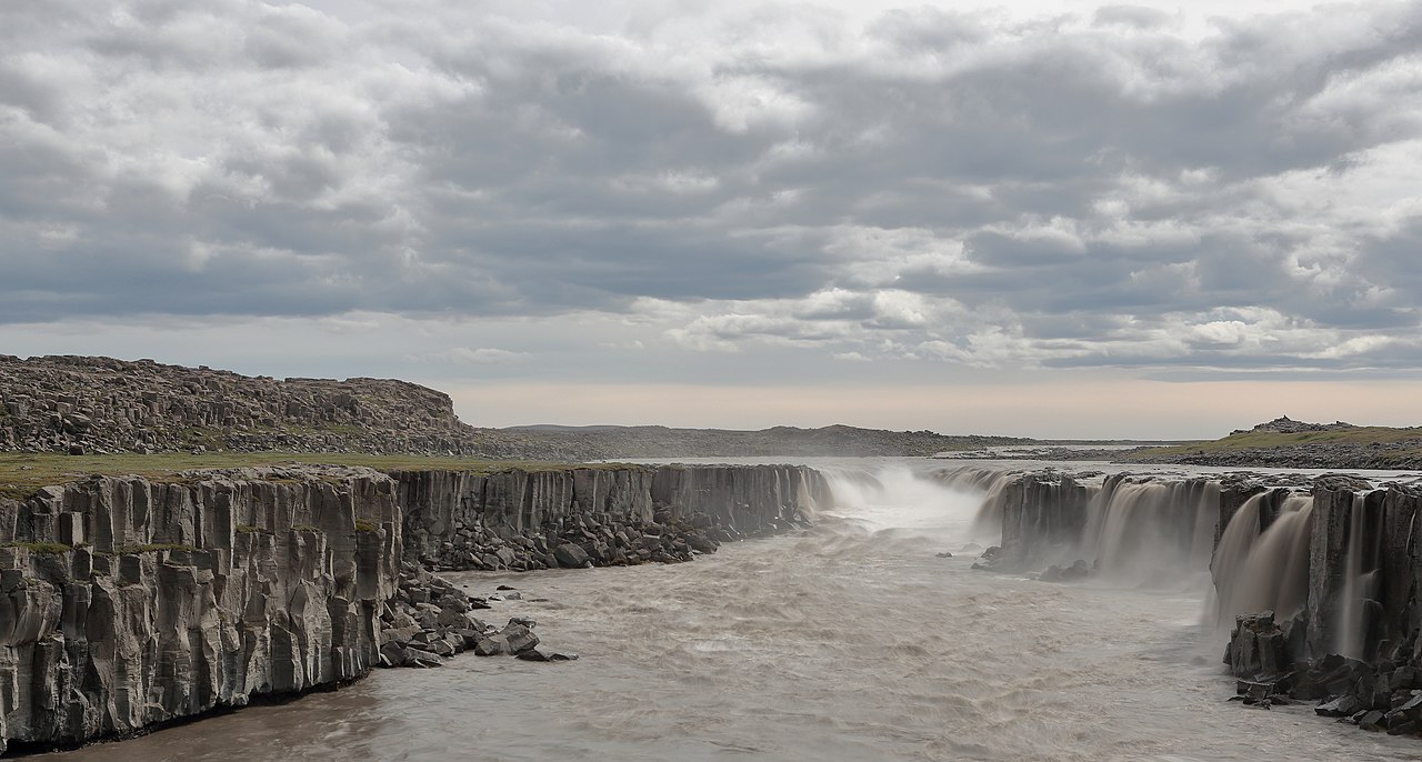 🏘️Town
Selfoss Service Hub
Selfoss is the commercial backbone of South Iceland — a real town of around 8,000–9,000 people rather than a curated tourist stop. At the junction of Route 1 and Route 35, about 50 kilometers southeast of Reykjavík, it makes a practical overnight base at prices noticeably lower than the capital. Supermarkets (Krónan, Bónus), fuel stations, a hospital, a cinema, and a well-equipped swimming pool all sit within a compact center. The Bobby Fischer Center on Austurvegur 21 holds original scoresheets and memorabilia from the 1972 World Chess Championship, open afternoons from May to October. Fischer died in Iceland in 2008 and is buried at the Laugardælir church just outside town. The Ölfusá riverbank offers easy walking, and the old town area near Tryggvaskáli has historical flood markers from three major twentieth-century floods. Day trips cover Þingvellir, Geysir, Gullfoss, and the South Coast waterfalls comfortably. The Westman Islands ferry at Landeyjahöfn is about 45 minutes away. Everything is on paved roads and fully operational year-round.
Read details → 👀Viewpoint
Seltún Mud Pots
Seltún sits on a high-temperature geothermal field within the Krýsuvík volcanic system, where the ground hisses, gurgles, and stains the earth in yellows, reds, and whites from sulfur and mineral deposits. Mud pots heave and plop at the surface, fumaroles vent steam continuously, and the hot springs run above 80°C. Wooden boardwalks thread through the most active sections — the warning signs about fragile ground and scalding water are serious, not decorative. The boardwalk loop takes about 30 minutes, though most people linger. Lake Kleifarvatn, a dark, deep lake filling a volcanic fissure, is a short drive north and worth pairing with the visit. The Reykjanes Peninsula has seen heightened volcanic activity since 2020, and Seltún feels very much part of a living system. From central Reykjavík the drive is about 40 minutes via paved roads. Entry and parking are both free. Combine with Gunnuhver and the Reykjanes Lighthouse for a solid half-day peninsula loop. Cool or overcast days make the steam dramatically more visible.
Read details → 👀Viewpoint
Silfra Snorkel
Silfra is a submerged fissure in Þingvellir National Park where the North American and Eurasian tectonic plates meet, and the water here is clear enough to see more than 100 metres. Glacial meltwater from Langjökull filters through porous lava for decades before reaching the fissure, which is why it arrives essentially pure. Temperature stays at 2–4°C year-round. Dry suits are required and provided by tour operators. The fissure runs through four sections — Big Crack, Hall, Cathedral, and a shallow Lagoon at the end. Hall and Cathedral produce the blue-green tones that make photographs from here immediately recognisable. The Lagoon, wide and open, is where the scale of the visibility becomes most apparent. Snorkeling needs no certification; diving requires Open Water certification plus documented dry-suit experience. Tours depart from a parking area inside Þingvellir, about 45 minutes from Reykjavík via Route 36, and run year-round. Winter visits are quieter. The 17,000 ISK price is for a guided snorkel tour; diving costs more. Book ahead — summer slots fill fast.
Read details → ❄️Glacier
Sólheimajökull Walk
Sólheimajökull is an outlet glacier of the Mýrdalsjökull ice cap, and a short paved road (Route 221) branches off the Ring Road between Skógafoss and Vík, leading directly to a large parking area. The glacier tongue is a 10 to 15 minute walk along a flat, marked path from the lot. The ice is dramatically streaked with bands of black volcanic ash from Katla, the active volcano beneath Mýrdalsjökull, and retreat markers along the approach show how far the glacier has pulled back in recent decades — the change is considerable and immediately obvious. Stepping onto the ice requires a guided tour; several operators run year-round hikes of two to three hours, providing crampons, helmet, ice axe, and harness. Ice climbing and blue ice cave tours also run in suitable conditions. Book in advance in summer. There is a parking fee of around 750 ISK payable via the Parka app. Plan at least an hour here even if you only view from the edge. The site is about 98 miles from Reykjavík and slots neatly into a South Coast day trip between Skógafoss and Vík.
Read details → 🏛️Historic Site
Stöng Viking
When Hekla erupted in 1104, it buried at least 22 farms in the Þjórsárdalur valley under volcanic ash. One of them, Stöng, stayed hidden for over 800 years until archaeologists excavated it in 1939 — the first professionally conducted dig on Icelandic ruins. What they uncovered was a well-preserved longhouse floor plan belonging to a prosperous Commonwealth-era farm. The original ruins, now protected under a shelter building about 4 kilometers away, can be viewed via a raised walkway; the central hearth and sleeping platforms are clearly legible in the foundations. The reconstruction, Þjóðveldisbærinn, was built between 1974 and 1977 to mark the 1,100th anniversary of Icelandic settlement. It recreates the longhouse, outbuildings, and a turf church using traditional materials and methods. Inside, visitors can handle period tools, try on historical clothing, and use a weaving loom. The atmosphere is hands-on in a way that museum display cases rarely manage. A separate replica church was added and consecrated in 2000. Þjóðveldisbærinn is open daily from May 1 to October 15, 10:00–17:30; adult admission is 2,500 ISK. The site is roughly 120 kilometers east of Reykjavík, and the surrounding Þjórsárdalur valley rewards the drive — Gjáin's mossy gorge and Háifoss waterfall are both within a short distance.
Read details → 💨Geyser
Strokkur Geyser View
Every six to ten minutes, Strokkur's pool swells into a glassy blue dome and fires boiling water 15 to 20 metres into the air — occasionally higher. The buildup is part of the show: the surface lifts visibly before the eruption, giving just enough warning to raise a camera. The event lasts a few seconds, then the pool refills. Most visitors catch three or four eruptions in the time they spend here. Strokkur sits in the Haukadalur geothermal valley alongside the original Geysir, which gave its name to the English word but now erupts only after earthquakes. The surrounding field has colourful hot spring pools, fumaroles, and mud pots worth a slow circuit. Stay on the marked paths; the crust over hot ground is thinner than it looks, and spray can reach bystanders when the eruption leans downwind. No entrance fee, but this is a core Golden Circle stop with heavy daily traffic. Arriving before 9 am or after 6 pm cuts crowds. The site sits about 100 kilometres east of Reykjavík on Route 35, roughly 90 minutes' drive.
Read details → ❄️Glacier
Svínafellsjökull Views
Few glaciers in Iceland are this accessible and this dramatic to stand next to. Svínafellsjökull is an outlet tongue of the Vatnajökull ice cap that presses between dark ridgelines into a heavily crevassed snout — fractured blue and white ice with dirt bands running through it. The free viewpoint is a short walk from a parking area off the Ring Road near Skaftafell; guided glacier walks depart from close by. The glacier has appeared in several major productions: Christopher Nolan used it as the alien ice planet in Interstellar (2014), and both Game of Thrones and Batman Begins filmed here too. The ice does look otherworldly in person, which explains the pattern. Svínafellsjökull is retreating measurably each year, and even decade-old photos show how far the snout has pulled back. No fee for the viewpoint; the access road is paved. If you want to walk on the ice, book a licensed guide in advance — solo travel onto the glacier is prohibited and the crevasses are genuinely hazardous. May through September is the most practical window.
Read details → 💧Waterfall
Systrafoss
Two parallel streams drop around 25 meters down a hillside directly behind the village of Kirkjubæjarklaustur, falling into a small lake called Systravatn. The name — Sisters' Falls — commemorates a Benedictine convent that stood here from around 1186 until the mid-sixteenth century. Both the lake and the falls take their name from those nuns, and the slopes above hold further reminders: Systrastapi, a rocky outcrop a short walk above the falls, is where the sisters were said to have prayed, offering views back over the village and the wide lava fields beyond. From the village centre the walk is short and easy — just a few minutes along a marked trail to the base of the falls, with a path continuing upward to Systrastapi. The trail can be slippery when wet, so grip footwear helps. Parking is available in the village with the trail clearly signed off Route 1. Systrafoss makes a good 20- to 30-minute stop when driving the South Coast, and Kirkjubæjarklaustur — shortened to Klaustur by almost everyone — sits about 260 km east of Reykjavík, making it a natural midpoint for fuel and food.
Read details → 💧Waterfall
Urridafoss
Urriðafoss carries more water than any other waterfall in Iceland — around 360 cubic meters per second on average — yet drops only about 6 meters, making it one of the widest and most powerful low-drop falls in the country. The Þjórsá, Iceland's longest river, feeds it year-round with glacial meltwater from Vatnajökull and other ice caps. A proposed hydroelectric plant at Urriðafoss itself could reduce the falls dramatically; local opposition has so far kept it from being built. The falls sit about 1.5 km off Route 1, signed from the road near the Þjórsá bridge — a short, easy detour. There is no fee. The wide, braided character of the falls rewards a few minutes of wandering along the bank rather than stopping at the first overlook. The name comes from the Icelandic word for trout, and Atlantic salmon still run this stretch of river in summer. Year-round accessibility and easy access make Urriðafoss a low-commitment stop on a south coast drive. The falls are most dramatic in spring when snowmelt pushes the river above its average flow.
Read details → 🏖️Beach
Vík Safer Beach
The black sand beach behind Vík village — locally called Víkurfjara — sits right behind the Krónan supermarket on the eastern edge of town, a short walk from the petrol station and guesthouses. It delivers the same volcanic scenery as the famous Reynisfjara: ink-dark sand, basalt cliffs, and the silhouette of the Reynisdrangar sea stacks offshore. The Reynisfjall ridge rises to the west, and the church on the hill above Vík gives the scene a distinctive backdrop. In summer, seabirds including puffins nest on the cliffs above. The beach is considerably quieter than Reynisfjara, which draws tour buses from morning onwards. That said, the Atlantic here is no tamer — sneaker waves are a real hazard, the water is cold and strong, and the sea is unpredictable regardless of how calm it looks. Stay well back from the surf and never turn your back on it. Being steps from Vík's services makes this the more practical stop if you want to browse the shops or get food. Route 1 runs right past it and the beach is accessible year-round with no special vehicle required.
Read details → 🐧Puffin Colony
Westman Islands
VestmannaeyjarAround 830,000 breeding pairs of Atlantic puffins — roughly 20 percent of the world population — arrive in the Westman Islands each spring and crowd into clifftop burrows until August or September. Boat tours around the main island, Heimaey, pass directly below those cliffs where thousands of birds wheel and land. In late August, locals rescue pufflings: fledglings disoriented by streetlights that land in town instead of heading out to sea. Heimaey also carries the story of the 1973 eruption, which began overnight and buried part of the town before everyone evacuated. The volcano it created, Eldfell, takes about half an hour to climb from town and still radiates faint warmth. The Eldheimar museum, built around an excavated house buried in the lava, is one of the better small museums in Iceland. The car ferry from Landeyjahöfn takes about 35 minutes to Heimaey and runs several times daily, though it cancels in rough weather — check before driving out. Flights from Reykjavík are the backup. Plan a full day; an overnight stay lets you walk the cliffs in the evening when puffins are most active.
Read details → 🥾Hiking Trail
Þórsmörk
Tucked between three glaciers — Eyjafjallajökull, Mýrdalsjökull, and Tindfjallajökull — Þórsmörk is a highland valley that feels unlike anywhere else in Iceland. Where most of the country is open and wind-scoured, the ridges here trap warm air: the slopes are thick with birch scrub, wildflowers, and moss in summer, while glacial rivers wind across the valley floor below the ice-capped peaks. The name means Thor's Forest, and the vegetation earns it by Icelandic standards. Two of Iceland's most-walked multi-day routes converge here. The Laugavegur trail (roughly 55 km from Landmannalaugar) ends in the valley, and the Fimmvörðuháls trail connects south to Skógafoss. Day-hikes from the huts reach ridges with wide views of ice and volcanic terrain. Mountain huts at Húsadalur, Básar, and Langidalur serve both trail-finishers and day visitors. Access requires crossing glacial rivers on F-roads; private vehicles must be high-clearance 4x4. Scheduled highland buses from Reykjavík and Hvolsvöllur ford the rivers and are the practical choice for most visitors. The valley opens roughly late May or June and closes in September.
Read details →West
30 placesExplore the incredible sights and unique geological wonders of this region in Iceland.
 👀Viewpoint
Arnarstapi Arch
GatkletturGatklettur, the basalt arch just outside Arnarstapi, is best seen from the coastal path rather than the road — at sea level the scale of the arch against open Atlantic water becomes clear in a way no roadside view conveys. Waves carved it by eroding weaker rock in the cliff face over centuries. Seabirds work the cliffs in summer, including puffins, fulmars, and Arctic terns, while eider ducks shelter in the harbor below a statue of the half-human, half-troll figure Bárður Snæfellsás. The marked coastal path linking Arnarstapi to Hellnar runs past the arch and takes 1.5 to 2.5 hours at a comfortable pace, passing sea stacks and blowholes. At Hellnar, a small café sits at the path's end with ocean views. The track is mostly flat but footing near cliff edges can be uneven in wet weather. Arnarstapi is about two and a half hours from Reykjavík via Route 54. Parking is available at the village. Entry is free and the site is open year-round, though midsummer gives the best wildlife activity and the most daylight to appreciate the Snæfellsjökull glacier visible to the west.
Read details → 💧Waterfall
Barnafoss
Barnafoss — "Children's Falls" — is not a single waterfall but a violent series of rapids where the Hvítá river, fed by Langjökull glacier, forces itself through a narrow lava channel. The water churns a deep blue-grey with the kind of force that makes the viewing platform feel like exactly the right place to stand. The name comes from a folk tale: two boys crossed a natural stone arch over the falls, lost their footing, and drowned. Their mother had the arch demolished so no one else could cross. Barnafoss sits right beside Hraunfossar, where water seeps through the edge of an ancient lava field in dozens of thin parallel streams. The contrast is striking — Hraunfossar is quiet and broad, Barnafoss narrow and relentless — and seeing both takes only 30 minutes from the shared car park. Winter adds ice formations along the lava edges that change the character of the place entirely. The site is about 90 minutes from Reykjavík and pairs well with stops at Reykholt or Deildartunguhver hot spring. Parking is free, pathways are paved and accessible, and the site is open year-round.
Read details → 👀Viewpoint
Berserker Lava Field
BerserkjahraunBerserkjahraun is a lava field on the Snæfellsnes peninsula formed by four scoria craters that erupted around 4,000 years ago. The rock has since accumulated a dense covering of moss — deep green in wet weather, almost luminous in low light — that softens the jagged surface into rolling mounds and narrow corridors. Walking through it gives a real sense of scale that a drive-by on Route 54 does not. The name comes from Eyrbyggja saga: two Swedish berserkers agreed to clear a path through the lava field in exchange for a farmer's daughter. They completed the task; the farmer had them killed and buried in the field. The cut path — the Berserkjagata — is still walkable, and the burial mounds are marked. Recent archaeological work reportedly found skeletal remains of two large individuals near the site, lending the old story an unexpected credibility. The marked path starts from a pull-off on Route 54 between Stykkishólmur and Grundarfjörður. The walk to the burial mounds takes around an hour there and back. Free, open year-round, and within 20 minutes of Kirkjufell and Stykkishólmur.
Read details → 🏘️Town
Borgarnes
Borgarnes is about 75 km north of Reykjavík — roughly an hour via the Ring Road — and its Settlement Centre is one of the more worthwhile museums anywhere on the Ring Road circuit. Two exhibitions, each with an audio guide in 15 languages, cover Iceland's settlement period and the saga of Egill Skallagrímsson, whose family farm stood just outside town at Borg á Mýrum. The farms, rivers, and mountains named in Egils saga are visible from the town, giving the exhibits a concrete backdrop. The museum has a good café; allow 60–90 minutes for both exhibitions. Practical services are solid: fuel, a large supermarket, and several accommodation options. The town works well as a base for the region. Within an hour's drive you can reach Deildartunguhver hot spring, Hraunfossar and Barnafoss waterfalls, Reykholt (associated with medieval scholar Snorri Sturluson), the Krauma geothermal baths, and the start of the Snæfellsnes Peninsula road. For a day trip from Reykjavík, Borgarnes plus two or three of the surrounding sites makes a full and varied day without overextending.
Read details → 👀Viewpoint
Búðir Black Church
BúðakirkjaBúðakirkja stands alone on a lava field on the south coast of Snæfellsnes, a small black wooden church with Snæfellsjökull glacier rising behind it and the Atlantic stretching out in front. The current building dates from 1848, though the site's ecclesiastical history goes back to 1703, when a local merchant built the first chapel here. By then Búðir had already been a trading post for centuries — busy enough in its time, then gradually abandoned until only this church and its graveyard remained. Steinunn Sveinsdóttir, a merchant's widow, campaigned to have the church rebuilt in 1848 despite official opposition, which is why it still stands today. The interior is simple: wooden pews, a modest altar, nothing elaborate. The church remains consecrated and is used for weddings, occasional services, and community events. It's open to visitors when not in use for a ceremony — the door is generally unlocked during daylight hours, but there are no set visiting hours, so you may find it locked on any given visit. A small cemetery adjoins the church, with headstones facing the bay. The pull here is the composition: black paint, green grass, dark lava rock, white glacier. On overcast days the scene turns almost monochromatic; in clear weather the glacier dominates the frame. The nearby Hotel Búðir sits just far enough away not to crowd the picture. Búðakirkja is easy to reach on paved road, roughly midway along the Snæfellsnes south coast circuit, about two hours from Reykjavík.
Read details → ♨️Hot Spring
Deildartunguhver
At around 97°C and pumping out roughly 180 liters per second, Deildartunguhver is the highest-flow hot spring in Europe — steam from it is visible from the road long before you arrive. Most of the water doesn't stay local: pipes carry it 34 km to Borgarnes and 64 km to Akranes for district heating, and nearby greenhouses use the surplus warmth to grow produce year-round. Visiting is free. A boardwalk and observation platforms let you get close to the spring, but stay on the marked path — there is no barrier between boardwalk and boiling ground. The main pool roils and churns; smaller vents hiss along the banks. A rare endemic fern (Struthiopteris fallax, found nowhere else in the world) grows in the steam zone at the edge. The Krauma geothermal spa, about 10 minutes away, uses Deildartunguhver water cooled with glacial water for bathing. Pairing the spring with Reykholt (historic home of saga-writer Snorri Sturluson) and the waterfalls Hraunfossar and Barnafoss makes for a strong West Iceland half-day. All roads are paved.
Read details → 🏖️Beach
Djúpalónssandur
Four basalt boulders on a black pebble cove on the Snæfellsnes peninsula once decided who made the crew. The lifting stones of Djúpalónssandur tested aspiring fishermen: Amlóði (Useless) at 23 kg, Hálfdrættingur (Weakling) at 54 kg, Hálfsterkur (Half-Strong) at 100 kg, and Fullsterkur (Full-Strong) at around 154 kg. Only those who could raise Hálfsterkur were considered fit for the boats. The stones still sit on the beach. The cove is dramatic: dark basalt pebbles, lava formations sculpted into arches and fins, and scattered iron from the British trawler Epine GY7, which ran aground in a blizzard on 13 March 1948 with fourteen of her nineteen crew lost. The wreck is left as a memorial. A short path north leads to Dritvík cove, the site of a former fishing station. The car park is a well-marked turn off Route 574 inside Snæfellsjökull National Park; the walk down takes about ten minutes. Sturdy footwear matters on the uneven pebbles. Budget around an hour for the beach and Dritvík; on clear days, the glacier-topped Snæfellsjökull frames the view inland.
Read details → 🏛️Historic Site
Eiríksstaðir Leif
The reconstructed longhouse at Eiríksstaðir stands about 100 metres from where archaeologists uncovered the actual foundations of Erik the Red's farm — a 10th-century homestead in the Haukadalur valley of West Iceland that the sagas identify as the birthplace of Leif Eiríksson. The original ruins are still visible. The reconstruction was built in 1999, using the same materials and techniques available a thousand years ago: turf walls, a timber frame, no nails. It opened in 2000, timed to mark the thousandth anniversary of the Norse landfall in North America. Guided tours run throughout the day during the season, with costumed guides demonstrating crafts, recounting the sagas, and making the cramped interior feel genuinely inhabited rather than merely preserved. The guides are the main draw — the dim longhouse, the central fire pit, and their storytelling make the history concrete in a way a museum case rarely does. Tours are ongoing, so there's no need to time your arrival precisely; just show up during opening hours. The site charges admission (adults around 2,900 ISK; children 12 and under free with an adult). It operates April 1 through October 31 only, 10 am to 5 pm. Getting here requires a deliberate detour — Eiríksstaðir sits in quiet farming country about two hours north of Reykjavík, near the small town of Búðardalur in the Dalir district. That remoteness keeps visitor numbers reasonable. The drive through low green hills and past scattered farms adds to the sense that you're somewhere genuinely off the tourist circuit, which makes the site's historical weight feel all the more unexpected.
Read details → 🌋Volcano
Eldborg Perfect
Eldborg rises 60 metres above the surrounding lava field as a near-perfect spatter cone — a circular ring of dark scoria with a bowl about 200 metres across and 50 metres deep. It's one of the most geometrically satisfying volcanoes in Iceland, and it formed from an eruption roughly 5,000 years ago. The lava field it produced, Eldborgarhraun, covers around 30 square kilometres across the Hnappadalur valley. The trail starts at Snorrastaðir farm, which has a small parking area. From there it's about 2.5 kilometres each way across the lava to the crater, mostly on rough but walkable ground with some shrubby vegetation. Near the top, chains are fixed to the steepest section to help with the final scramble to the rim. Allow around two hours for the round trip if you take it at a relaxed pace. Once on the rim, you can walk the full circumference and look straight down into the bowl — on a clear day, Snæfellsjökull glacier is visible in the distance to the west, and the lava field spreads out below you in all directions. Eldborg sits off Route 54 in Hnappadalur, roughly 30 kilometres north of Borgarnes and accessible on paved roads with no 4x4 required. There's no charge to hike. It works year-round, but snow can make the upper section more demanding in winter. The straightforward access and dramatic payoff make this an easy half-day addition when driving the Snæfellsnes Peninsula.
Read details → 🏛️Historic Site
Flatey Island
FlateyFlatey sits roughly halfway across Breiðafjörður bay in western Iceland, about 2 kilometers long and walkable end to end in under an hour. A monastery was founded here in 1172; the medieval manuscript Flateyjarbók takes its name from the island. Today only five permanent residents live here, and the cluster of 19th-century timber buildings — painted in faded reds and yellows — feels quieter than almost anywhere else in the country. The 1926 church is worth going inside: Spanish artist Baltasar Samper painted murals on the interior walls depicting scenes of island life. No cars are permitted, and in summer puffins nest in the clifftops. A small guesthouse and café are open June through August; outside those months nearly everything closes and ferry sailings are frequently cancelled. Access is via the Baldur ferry from Stykkishólmur on the Snæfellsnes peninsula, which stops at Flatey on the crossing to Brjánslækur in the Westfjords. Day visits are possible on the summer schedule; overnight stays give a better sense of the island once the day-trip passengers have gone.
Read details → 👀Viewpoint
Gerðuberg Wall
A wall of hexagonal basalt columns runs for over a kilometre along the southern edge of the Snæfellsnes Peninsula, straight and uniform enough to look like deliberate stonework. The individual columns stand between 7 and 14 meters tall and up to about 1.5 meters wide — a result of lava from the Ljósufjöll volcanic system cooling slowly and contracting evenly as it solidified. The effect is closer to an organ-pipe facade than the scattered columns at most basalt sites in Iceland. Access is simple: a signed turnoff off Route 54 leads onto a short gravel track to a small free parking area. A flat path runs along the base of the cliff, where you can examine the columns up close. There are no facilities and no entrance fee. The whole walk takes about 20 to 30 minutes, though photographers tend to stay longer. Light catches the geometry best in the low morning or evening sun, which also brings out the colour contrast between dark basalt and the green turf at the base. The site is free, open at any hour, and about 90 minutes to two hours from Reykjavík — an easy stop on the southern loop of the peninsula.
Read details → 💧Waterfall
Glymur
At 198 meters, Glymur was Iceland's tallest waterfall until Morsárfoss was measured in 2011. It remains the highest reachable on foot, and the hike is one of the better half-day walks near Reykjavík. The trailhead sits at the end of Hvalfjörður, about 70 kilometers from the capital. The 7-kilometer loop gains around 425 meters, passing through a small lava cave called Þvottahellir near the start before climbing to narrow cliff-edge sections with chain ropes. Two river crossings are part of the loop. A log with a cable assist spans the Botnsá and is typically in place from June through September. Above the falls, you wade the river itself — cold and knee-deep or less in summer. The best viewpoint is the canyon rim looking straight down 198 meters and back out to the fjord. This trail has genuine exposure and no guardrails. Anyone uncomfortable with heights should reconsider. Wear proper hiking boots — the cliff sections are dangerous when wet. The full loop takes 3–4 hours. Arrive before 9 AM for a quieter canyon.
Read details → 🌋Volcano
Grábrók Walk
Grábrók is the largest of three craters formed by the same fissure eruption roughly 3,400 years ago, and among the easiest volcanic craters to climb in Iceland. From the parking area right off Route 1, a well-maintained trail with several hundred wooden steps reaches the rim in about 15 to 20 minutes. At the top you can walk the full circumference and look into the red-and-black cinder bowl, which has stayed remarkably intact. The other two craters — Grábrókarfell and Litla-Grábrók — are visible nearby. The lava field covers around 7 square kilometers, now softened by birch scrub and thick moss. The crater sits just east of Lake Hreðavatn, near Bifröst University, about 170 km north of Reykjavík — a natural stopping point when driving the Ring Road. On clear days the views from the rim take in the Borgarfjörður valley. The whole area has been a nature reserve since 1962. The climb suits most fitness levels, including families with older children. The path can ice up in winter, so traction devices help from November through March. Parking and access are free.
Read details → 🏘️Town
Grundarfjörður Photo
Kirkjufell dominates every view from Grundarfjörður — the 463-meter peak rises sharply from the water's edge at the western end of town, with the small cascade of Kirkjufellsfoss tumbling in front of it. The mountain-and-waterfall composition has become shorthand for Iceland photography, and the spot drew further attention when Kirkjufell appeared in Seasons 6 and 7 of Game of Thrones as the "arrowhead mountain." Coming from the south, the approach along the north coast of Snæfellsnes gives you the full view as you arrive. Grundarfjörður is a working fishing village of around 900 people. The town has fuel, a supermarket, accommodation, and a swimming pool. It is roughly 174 km from Reykjavík — about two and a half hours — making it a reasonable day trip or an overnight base for western Snæfellsnes. The parking area near Kirkjufellsfoss fills up quickly with tour buses midday. Come early morning or in the evening for calmer conditions and better light. Winter brings the possibility of northern lights above the peak; in summer the mountain stays lit well into the night.
Read details → 🏘️Town
Hellnar Path
The 2.5-kilometre coastal trail between Hellnar and Arnarstapi is the most rewarding short walk on the Snæfellsnes peninsula. The path stays low along the lava shoreline, passing basalt columns, sea arches including the photogenic Gatklettur arch, and blowholes where Atlantic swells surge into fissures. Kittiwakes, fulmars, and Arctic terns nest on the cliffs from June through August. The walk takes 45 to 60 minutes one way on mostly flat, occasionally rocky ground; avoid it in icy conditions. Hellnar is the quieter end to start from. The Fjöruhúsið café — a family-run place above the cove — serves fish soup with homemade bread and operates roughly Easter through late October. The sea cave Baðstofa, reachable at low tide, catches reflected light off the water in shifting colours. Hellnar is reached via a short turn off Road 574 on the south side of the peninsula. Parking is free at both ends, so you can walk one way and double back or arrange a car shuffle. Snæfellsjökull glacier rises to the north and is visible on clear days.
Read details → 💧Waterfall
Hraunfossar
Hraunfossar is not a waterfall in the usual sense — there is no single plunge or dramatic cliff. Instead, hundreds of small springs seep out from beneath a 900-meter stretch of the Hallmundarhraun lava field and trickle directly into the Hvítá river, forming a long, lace-like curtain of clear water over black rock. The lava field formed in a volcanic eruption around the 10th century; glacial meltwater percolates through the porous basalt for years before emerging here, arriving bright and clear while the glacial Hvítá beside it runs grey-green. A boardwalk along the riverbank gives good views of the full cascade, and the site is wheelchair accessible. Barnafoss, a narrow gorge waterfall with a very different personality, is a couple of hundred meters upstream — most visitors see both in one stop. There is a café and toilet facilities on site. Hraunfossar is about 126 kilometers north of Reykjavík, roughly two hours by car via Route 1 then roads 50 and 518. The falls run year-round, and autumn is particularly good when birch trees along the bank turn yellow and rust.
Read details →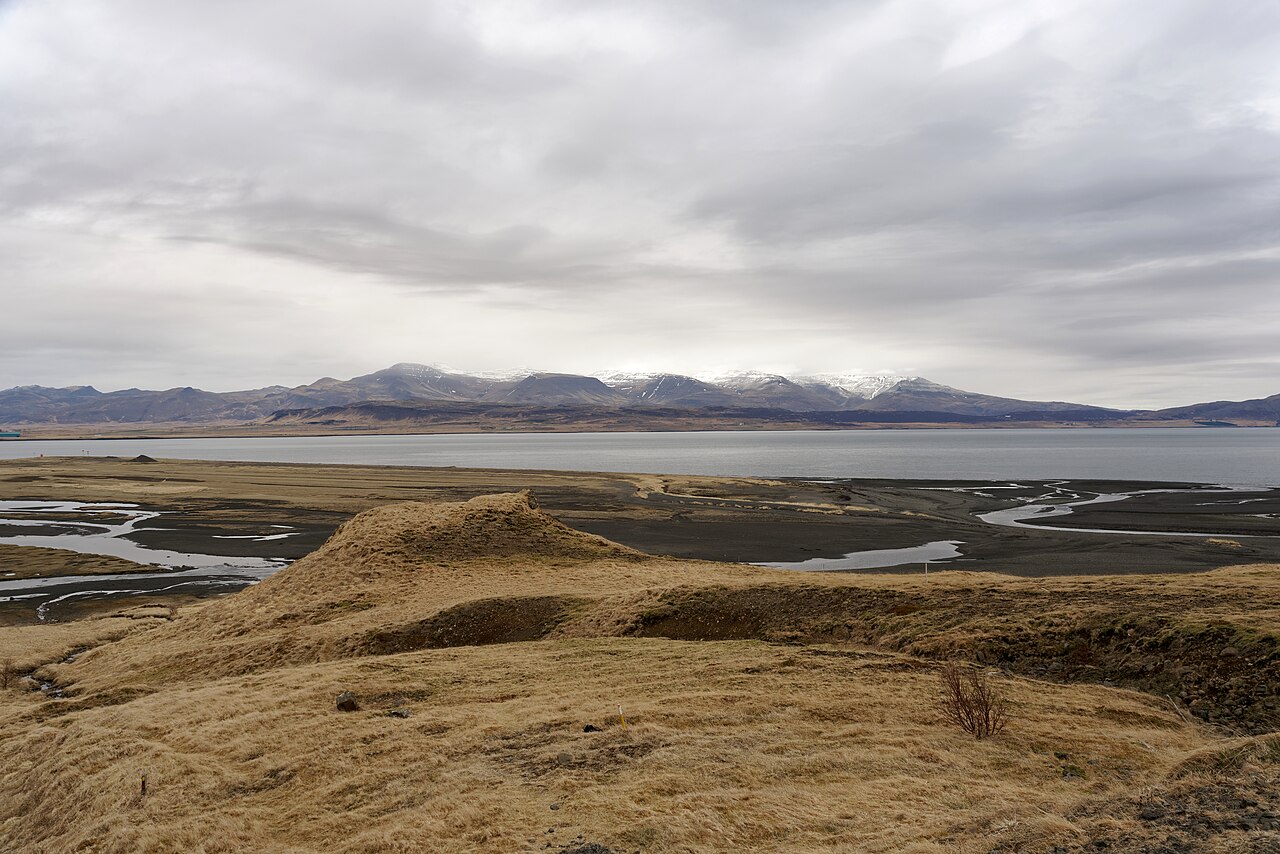 ♨️Hot Spring
Hvammsvik Ocean Pools
Eight geothermal pools are cut into volcanic rock along the shore of Hvalfjörður, about 45 minutes from Reykjavík via Route 47 — bypassing the tunnel and following the fjord road instead. The pools range from cool to genuinely hot, and because they sit close to the waterline, ocean water mingles with the geothermal water at high tide, shifting temperatures across the day. There is also a steam bath and sauna, and in summer you can swim directly in the cold fjord or paddle-board on the inlet. The design keeps things minimal: volcanic rock, wild vegetation, and an unobstructed view down the fjord. Numbers are capped, so the experience stays quiet. Advance booking through the Hvammsvík website is essential — evening slots in summer fill well ahead. Admission is paid (not free) and was running around 7,000 ISK per adult at recent rates; check the official site as prices are updated periodically. The drive is straightforward on paved road, no 4WD required. Budget at least an hour, though most people linger longer once they settle in.
Read details → 💧Waterfall
Kirkjufellsfoss
Kirkjufellsfoss is a series of cascades dropping around 16 meters on the small river at the foot of Kirkjufell mountain on the Snæfellsnes Peninsula. The falls themselves are modest, but the composition — cascades in the foreground, Kirkjufell's distinctive 463-meter peak rising directly behind — has made this one of Iceland's most photographed spots, a status sealed by the mountain's appearance in Game of Thrones. The car park is right off Route 54, a few minutes west of Grundarfjörður, and a short flat path reaches the river in under five minutes. The rocks near the water can be slippery, but the site is otherwise very easy. There is no entry fee. Early morning and winter visits tend to produce the best conditions: fewer people, better light, and in winter a chance of snow on the mountain or Northern Lights overhead. Budget 30–45 minutes for a standard visit. If you're photographing seriously — waiting for the right light, trying different foreground angles — you could easily spend considerably longer.
Read details → ♨️Hot Spring
Krauma
Krauma sits directly beside Deildartunguhver, Europe's most powerful hot spring, which produces around 180 litres of near-boiling water per second. That water is too hot at source, so the facility cools it with cold glacial water and distributes it across six pools — five heated, one cold — ranging from about 6°C to 42°C. No chemicals are added; it is simply natural geothermal water managed for bathing. The design is contemporary, with warm timber and large windows over surrounding lava fields. Two steam rooms and a relaxation room with loungers complete the setup, and an on-site restaurant focuses on locally sourced food. Advance booking is recommended on weekends. Krauma is about 97 kilometres from Reykjavík — roughly 1.5 hours — and sits minutes from the historic medieval site at Reykholt, making a combined stop practical on a West Iceland or Snæfellsnes loop. Adult admission runs around 7,900 ISK. Open year-round.
Read details → 🕳️Cave
Langjökull Tunnel
The world's largest man-made ice tunnel bores roughly 500 meters into Langjökull, Iceland's second-biggest glacier, at a consistent 0°C. At about 3.5 meters wide and 3 meters tall, the passage is easy to walk, and the ice overhead — up to 30 meters of it — glows in natural blue tones where the lighting catches the compressed layers. The glacier holds ice that fell as snow over a thousand years ago. The tunnel opened in 2015 and remains the only year-round accessible ice tunnel of its kind. Tours depart from Húsafell in West Iceland, about two and a half hours from Reykjavík. Specially modified multi-axle glacier trucks carry the group up onto the ice cap — roughly 30 minutes each way in summer, longer in winter. Guided time inside runs about an hour, with stops at chambers and points covering glaciology and climate. Total tour time is three to four hours. Book through intotheglacier.is; prices start around 25,000 ISK per adult. Wear multiple warm layers regardless of season — the tunnel stays at freezing year-round. The tour suits almost any fitness level including children.
Read details → 👀Viewpoint
Lóndrangar Pillars
Two basalt towers rise from the shoreline on the western Snæfellsnes peninsula: volcanic plugs left standing after the softer material of the original crater eroded away over thousands of years. The taller pillar stands 75 metres above the water, the shorter 61 metres. Both have been climbed — the taller first in 1735, the shorter not until 1938. Local folklore holds them to be trolls petrified by sunlight, and on a grey day the silhouettes do suggest frozen figures. The site is within Snæfellsjökull National Park. A short path from the car park leads to clifftop viewpoints framing both pillars against the glacier behind them. Puffins, kittiwakes, and fulmars nest in the rock face, and the surrounding lava coast has sea caves worth exploring. No facilities at the car park; Hellissandur is the nearest town. Lóndrangar fits naturally into a western peninsula loop — Djúpalónssandur beach is a few kilometres away, and the road continues around the tip past the glacier. Route 574 passes the turn-off on paved road. The pillars photograph well year-round; stormy weather adds atmosphere.
Read details → 🏘️Town
Ólafsvík
Ólafsvík earned a royal trading licence from the Danish Crown in 1687, making it one of Iceland's oldest authorized trading posts, and fishing has defined it ever since. Today it's a working town of just over 1,000 people on Snæfellsnes's northern shore, with trawlers in the harbour and a fish-processing plant. The church, designed by Hákon Hertervig and finished in 1967, has one of Iceland's most distinctive silhouettes — angular, reading like a ship's prow from one side. The harbour is the departure point for whale-watching tours into productive feeding grounds offshore. A small maritime museum sits by the waterfront, and the Pakkhús cultural centre occupies an 1844 trading store. The town covers the basics for Snæfellsnes travellers: fuel, supermarket, pool, and accommodation. Snæfellsjökull glacier fills the skyline to the south. Saxhóll crater is a quick stop nearby. Djúpalónssandur beach and the Lóndrangar sea stacks lie within roughly 20 kilometres inside Snæfellsjökull National Park. The road east toward Grundarfjörður passes beneath Kirkjufell.
Read details → 🏔️Canyon
Rauðfeldsgjá Saga
Rauðfeldsgjá is a narrow crack in Botnsfjall mountain on the southern Snæfellsnes Peninsula — wide enough to walk into but tight enough that the walls close in almost immediately. A stream runs along the floor and mossy basalt rises steeply on both sides. The first section of the canyon is manageable without gear; going deeper requires climbing over wet rocks, and the water deepens as you go. Waterproof boots and a headlamp are worth having, and it is not a place to enter when water levels look high. The name comes from the Saga of Bárður Snæfellsás. According to the tale, Rauðfeldur and his brother Sölvi sent Bárður's daughter drifting toward Greenland on an iceberg. Bárður — a half-troll guardian of the peninsula — threw Rauðfeldur into this gorge and hurled his brother off a nearby cliff, Sölvahamar. The landscape here is layered with these kinds of saga associations. The gorge is just off Route 574, a few kilometres from Arnarstapi, about 2.5 hours from Reykjavík. Parking is a short walk from the entrance and entry is free.
Read details → 🏛️Historic Site
Reykholt Snorri
Snorri Sturluson moved to Reykholt in 1206 and spent the rest of his life here — writing the Prose Edda, the Heimskringla histories of Norwegian kings, and likely Egil's Saga, while accumulating political enemies. He was assassinated in the farm cellar in 1241 on the orders of the Norwegian king. The farm is now the Snorrastofa cultural centre, holding exhibitions on Snorri's life and the turbulent Sturlung Age, with material in five languages including English. Behind the church, the circular stone pool Snorralaug is fed by a hot spring at roughly its medieval dimensions — about four meters across. Snorri built a tunnel from the farmhouse to the pool; the entrance is visible beside the spring, though access is restricted. Bathing has been prohibited since 1817, when the pool was designated a heritage site. The stonework is original medieval construction. Reykholt sits in Borgarfjörður, about 90 minutes east of Reykjavík. The Hraunfossar waterfalls and Deildartunguhver hot spring are nearby. Plan about an hour. Snorrastofa charges an entrance fee (adults around ISK 2,000).
Read details →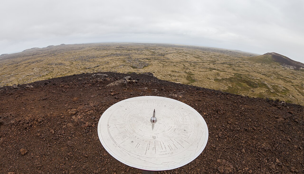 🌋Volcano
Saxhóll Steps
Around 396 metal steps spiral up the flank of Saxhóll, a cinder cone that erupted roughly 3,000 to 4,000 years ago on the western tip of the Snæfellsnes Peninsula. The staircase, which won the Rosa Barba International Landscape Prize in 2018, was built to protect the fragile volcanic surface from foot traffic. It wraps around the cone at a manageable gradient and most people reach the rim in about 10 minutes. From the top, views take in moss-covered lava fields, the glacier cap of Snæfellsjökull to the east, and the North Atlantic to the west. Saxhóll is technically two craters, though one was quarried historically. The intact cone is a classic bowl shape. The car park is at the base of the stairs directly off Route 574 (Útnesvegur); there is no entry fee. Steps can be icy in winter and wet weather. The crater sits within Snæfellsjökull National Park, a few kilometres from Djúpalónssandur beach and Vatnshellir lava tube. For anyone looping the peninsula, Saxhóll is an easy 20–30 minute stop that pays off well above its time cost.
Read details → 🏛️Museum
Settlement Museum
The Settlement Center in Borgarnes occupies two of the town's oldest buildings — a merchant's house from 1877 and a warehouse from 1889 — and runs two exhibitions side by side. The first covers Iceland's settlement era, tracing how Norse migrants arrived in the 9th century and built a society from scratch. The second follows Egil Skalla-Grímsson, the complex poet-warrior at the heart of Egils Saga. Both use audio guides available in 15 languages, and the production quality is high — this is not a dusty display-case museum. The center sits on the Borgarnes waterfront at Brákarbraut, about an hour north of Reykjavík on the Ring Road. Budget 60–90 minutes for both exhibitions. There is a well-regarded restaurant on site for lunch. Borgarnes is often bypassed on the drive to Snæfellsnes or the Westfjords, which makes this a genuinely useful stop: the saga material connects directly to sites along the Snæfellsnes Peninsula. Tickets cover both exhibitions and the audio guide.
Read details → 🕳️Cave
Sönghellir Singing
The oldest confirmed inscription on any Icelandic cave wall — dated to 1483 — sits carved into the hyaloclastite rock of Sönghellir, alongside runic signs, Christian crosses, and the scratched names of 18th-century naturalists Eggert Ólafsson and Bjarni Pálsson. The cave cuts into volcanic tuff on the flank of Stapafell mountain, above the village of Arnarstapi on the Snæfellsnes peninsula. It is an erosion cave, not a lava tube, which partly explains why its rough walls carry sound so unusually well. Speak or sing inside and the resonance is immediate. The cave is shallow enough that it never feels claustrophobic, but a quiet voice fills the space. Getting here takes about ten minutes uphill from a small gravel parking area off Road 574; no equipment is needed, though a headlamp helps for inspecting the carvings. The cave sits within the Snæfellsjökull National Park area, with the glacier visible above and Arnarstapi just minutes away. Entry is free and access is year-round, though winter ice on the approach path warrants care.
Read details → 🏘️Town
Stykkishólmur Colors
Stykkishólmur has been a trading hub on the Snæfellsnes peninsula since at least the early 16th century, and the town still carries the confidence of a place that has always had commercial purpose. It sits on the north side of the peninsula above a natural harbor sheltered by the basalt stack of Súgandisey island, whose lighthouse is a short walk from the center. The Norwegian House — built in 1828 from timber imported from Norway — now holds the local history museum and is among the oldest surviving structures in the region. The Library of Water, installed by American artist Roni Horn in the old library building, fills a hilltop room with floor-to-ceiling glass columns containing water drawn from Iceland's major glaciers. It's an unusual and worthwhile stop, not large, but quietly affecting. The harbor connects to boat tours through Breiðafjörður bay and to the Baldur ferry, which crosses to Flatey island and continues to the Westfjords — a useful route for anyone heading that direction without wanting to drive the long way around. Film enthusiasts will recognize parts of town from "The Secret Life of Walter Mitty," where Stykkishólmur stood in for Nuuk, Greenland. In practical terms the town is the best-equipped base on Snæfellsnes: accommodation at several price points, a geothermal pool, a supermarket, and a handful of good restaurants working with local shellfish. Budget around an hour to walk the harbor area, the hilltop church viewpoint, and the Norwegian House, then more time if you visit the Library of Water or take a bay tour.
Read details → 🕳️Cave
Víðgelmir Cave
VíðgelmirIceland's largest lava tube stretches 1,585 meters beneath the Hallmundarhraun lava field, reaching up to 15.8 meters high and 16.5 meters wide. Víðgelmir formed around 900 AD when a prolonged eruption sent molten lava across the land; as the surface hardened, the liquid interior drained away, leaving this cathedral-sized passage. Viking Age artifacts found inside show early settlers knew the cave long before any modern visitor. Guided tours follow a lit walkway through the most dramatic sections, past lava stalactites, multiple floor levels from successive flows, and vivid mineral colorations on the walls. Ice formations build up deep in the cave through winter. Bring a warm layer — it stays cold underground year-round regardless of conditions above. Tours depart from a visitor center near Húsafell, roughly two hours from Reykjavík. The walkway makes this one of Iceland's more accessible underground experiences with no technical equipment needed. Book ahead in summer. Hraunfossar waterfalls and Langjökull glacier are nearby, making this a good anchor for a full day in the area.
Read details → 🏖️Beach
Ytri Tunga Seals
On the southern shore of the Snæfellsnes Peninsula, Ytri Tunga is one of the few beaches in Iceland where seeing wild seals is a near certainty. Harbor seals haul out on the low rock shelves just offshore, basking in unhurried groups often close enough that binoculars are optional. Grey seals appear occasionally. The beach itself stands out: golden-yellow sand rather than the black volcanic shore that covers most of Iceland's coastline. A short gravel path leads from the small parking area through low dunes to the water's edge. Low tide is when seals gather most visibly on exposed rock. Late spring through midsummer is prime — June and July when mothers nurse pups — and early morning or evening gives you the beach to yourself. The parking area has no facilities; nearest services are in Arnarstapi, about fifteen minutes east. Ytri Tunga sits right off Route 54, roughly two and a quarter hours from Reykjavík. Free, no 4x4 needed. Keep at least 50 metres from the seals and avoid sudden movements — they look placid but will abandon the rocks if disturbed.
Read details →